What Queen West used to look like in Toronto
Queen West seems a natural street to knock off as I continue to fill in some of the more obvious gaps in our collection of historical photo posts. Although Yonge Street is typically considered the most important street in Toronto (and for good reason), it wouldn't be difficult to make the argument that, at least historically speaking, Queen Street deserves consideration for that title.
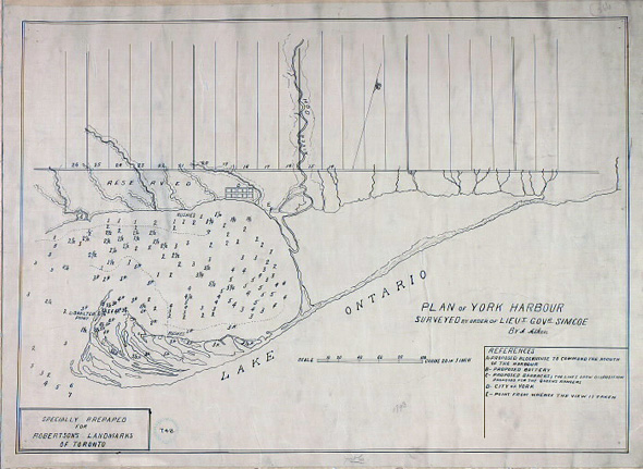
Part of the reason for this, as is explained in the Queen Street West Heritage Conservation District Plan, is that Queen (then known as Lot Street) "was the baseline established by the Royal Engineers, when they laid out the town of York (now Toronto) in 1793." At the behest of Lieutenant-Governor John Graves Simcoe, much of York was divided into 41 lots, the boundary lines of which define our current streetscape.
Here's a cogent explanation of how it all worked, courtesy of Jane E. MacNamara on the site Simcoe's Gentry:
"They had narrow frontages (660 feet) on Lot Street (today's Queen Street), to allow all owners access to the town and harbour. The lots were ten times as deep (6,600 feet) as they were wide and extended north to today's Bloor Street. There were 32 Park Lots running from the Don River, west to about today's Lansdowne Avenue. From there, west to the Humber River, the land was divided into nine "Township" lots, following the pattern of the Park Lots, but double the width. They were 200 acres each, more or less, as the contours of Lake Ontario and the Humber River would allow. The Park Lots closest to the Town of York were the most desirable, and the status of the persons to whom they were granted reflected this."
It's rather remarkable to think that Toronto developed from such lots, and yet there's obvious proof of it all over the place. But Queen Street is important for more than this reason, of course. A vibrant commercial strip throughout the 20th century and beyond, it's also the home to municipal landmarks like Old and New City Hall, one of Toronto's oldest and most majestic buildings in Osgoode Hall, and the site of profound change over the last couple decade or so.
That said, what's also fascinating about Queen Street is just how many of the street's buildings remain from the turn of the century. Many of them have been altered or added to in some way, but if you look closely enough, you'll see that they've been around for the long haul. Toward that end, this photo essay from Urban Toronto is a must-read.
For the purposes of this photo survey, I've included images taken between roughly Bay and Gladstone streets. If it didn't make for an awkward title, I could have referenced West Queen West to underscore that this overview takes us to places like the now-lost Trinity College and John Abell Factory. I've always thought the line between Queen West and West Queen West seemed a bit arbitrary, so I've dispensed with it altogether here. The Queen Street Subway (what we would today call the Dufferin Underpass), on the other hand, more obviously marks one's entrance into Parkdale.
For those interested in the more recent history of this stretch, we're blessed with the work of two local photographers who have documented the changing face of Queen West and West Queen West. To fill in the period post-1970, do check out the work of Patrick Cummins (who just released a book) and, of course, Kevin Steele, whose Portraits of Queen West is always delightful.
PHOTOS
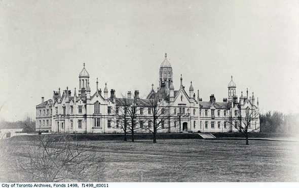
Trinity College, 1856 (sadly demolished in 1950)
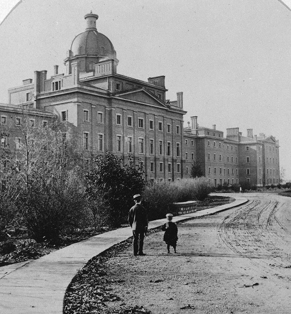
Provincial Lunatic Asylum (also demolished)
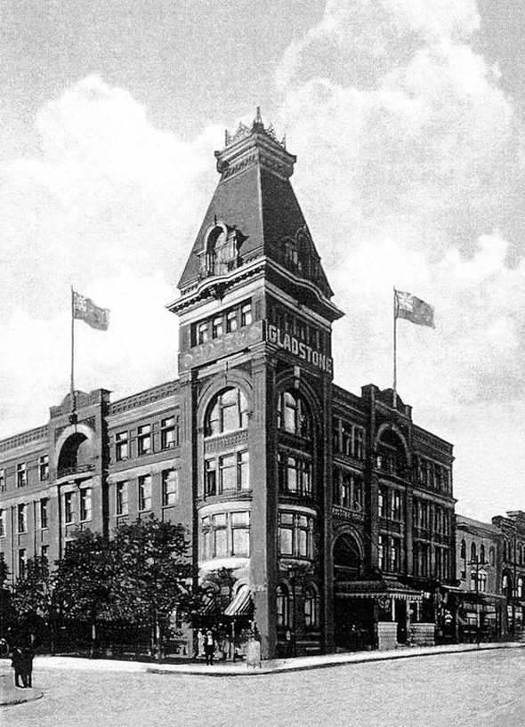
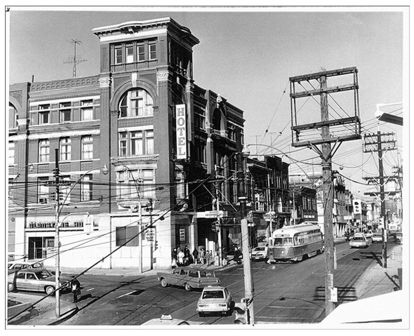
The Gladstone Hotel, Ca. 1900s (via the Gladstone Hotel)
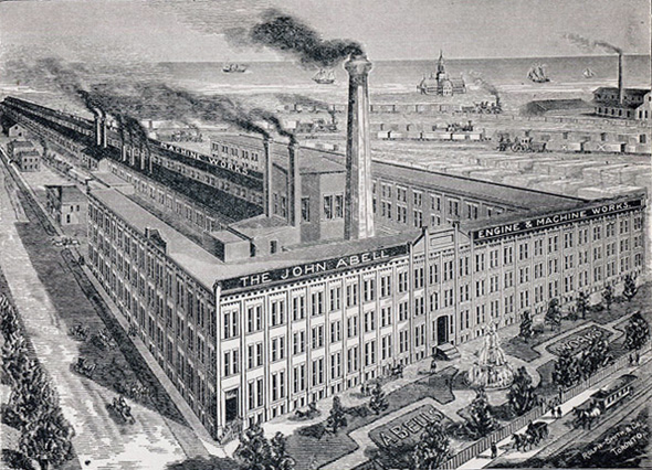
The John Abell Factory (now the condo filled Queen West Triangle)
Queen & Euclid, 1900s
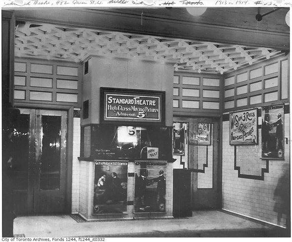
Standard Theatre at 482 Queen West, 1900s
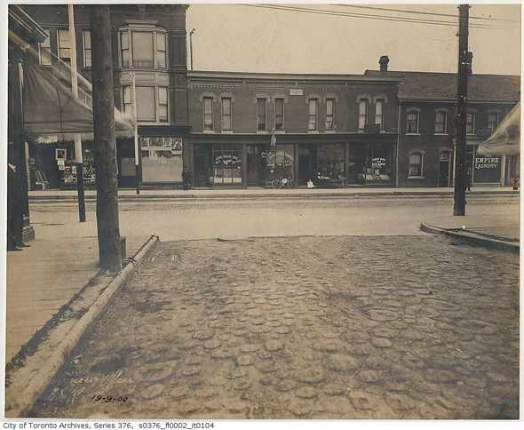
Queen & Manning, 1900
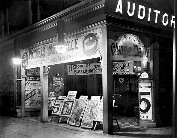
Auditorium Theatre at 382 Queen West, 1910
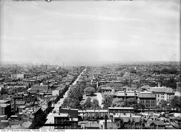
Looking west across Queen from the tower at Old City Hall, 1911
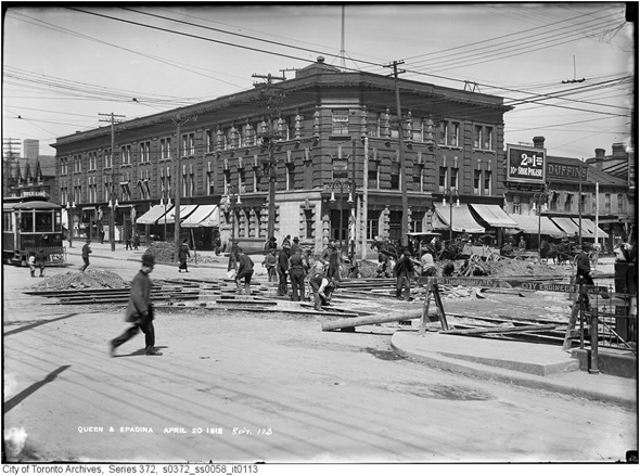
Queen & Spadina, 1912
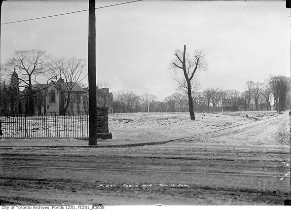
Corner of Queen and Gore Vale, 1914
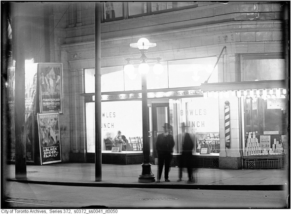
Southeast corner Queen & Bay, 1916
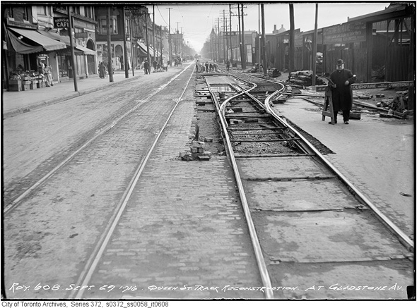
Looking east along Queen from Gladstone, 1916
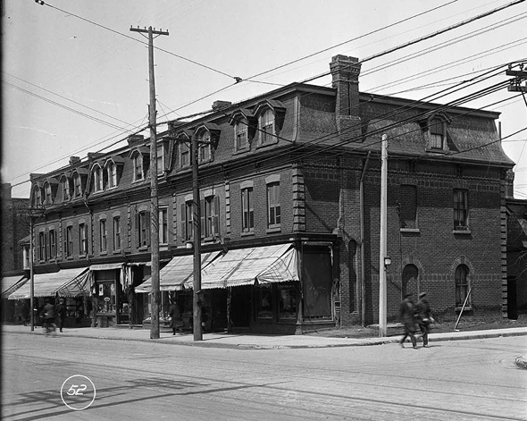
Northwest corner Queen and Lisgar, 1919
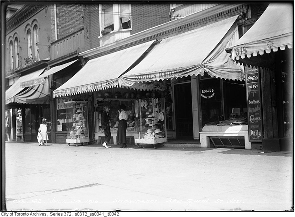
299 Queen West, 1919
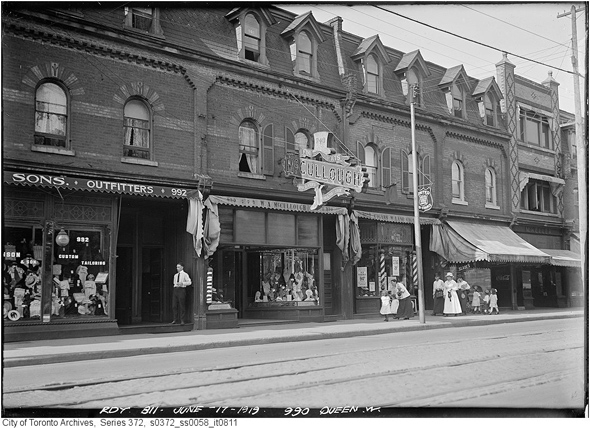
990 Queen West, 1919
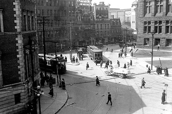
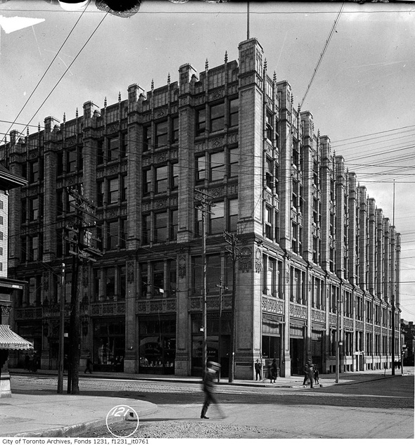
Queen & Bay, 1923
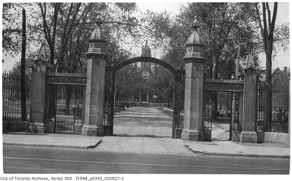
Gates to Trinity College in 1926
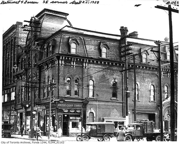
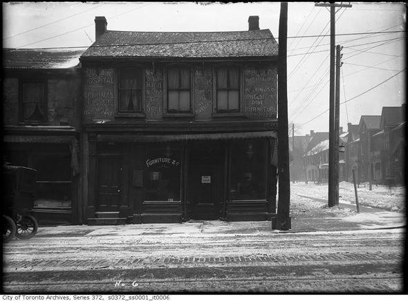
Southeast corner of Queen & Bathurst in 1928 (now a CB2 furniture shop)
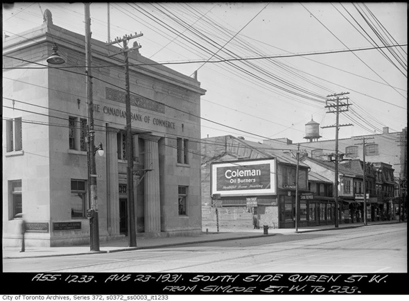
Queen & Simcoe, 1931
322 Queen West, 1940s
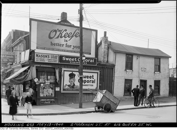
Queen & Markham, 1940
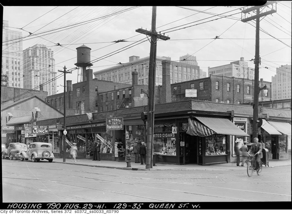
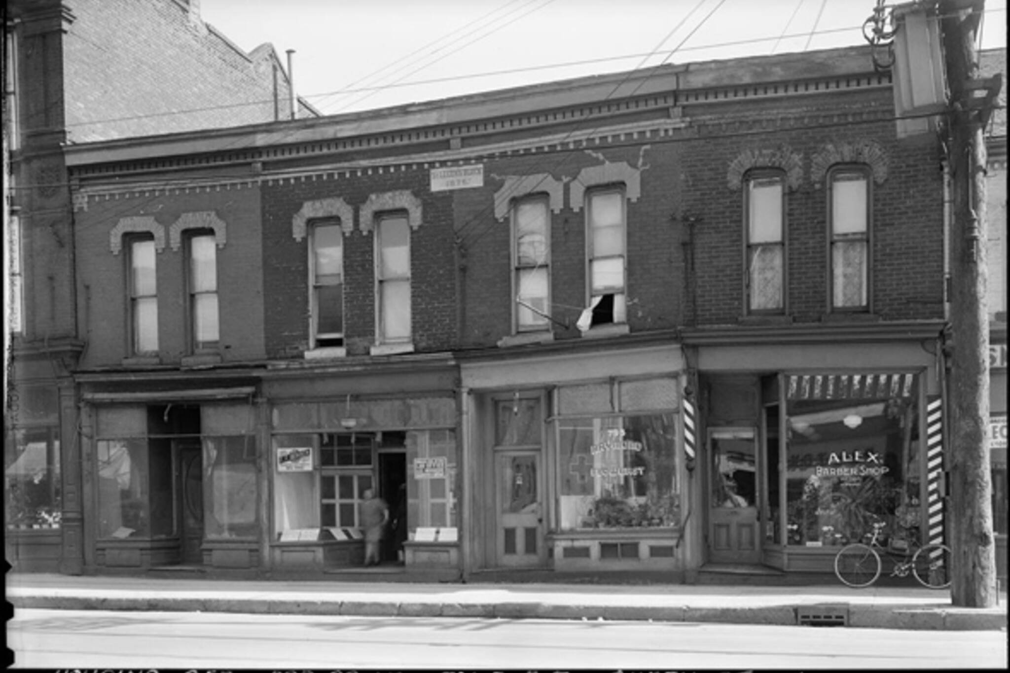
129-135 Queen West, 1941
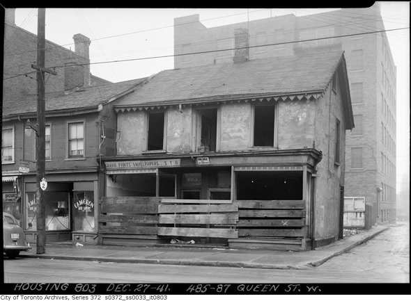
485 Queen West, 1941
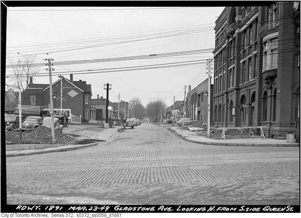
Gladstone north from Queen, 1949
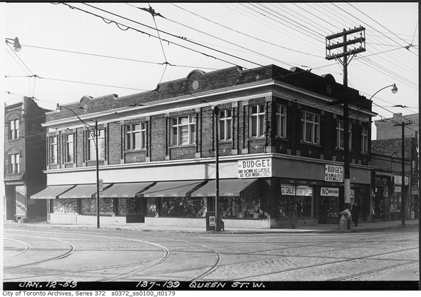
137-39 Queen West, 1953
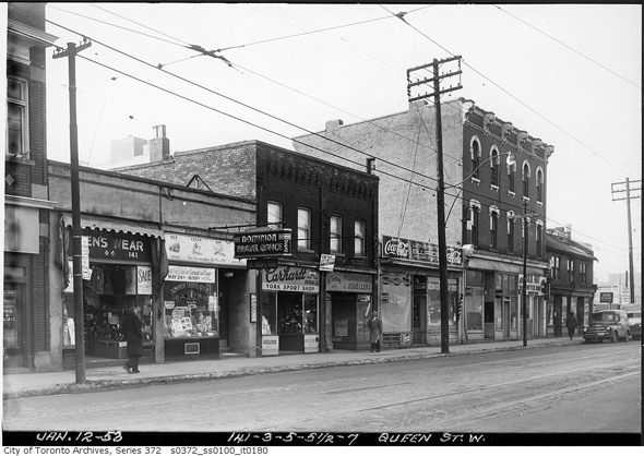
141-47 Queen West, 1953
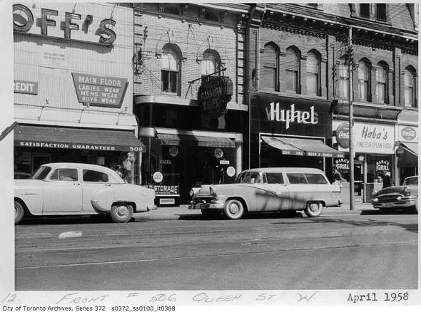
508 Queen West, 1958
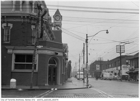
Queen & Ossington, 1958
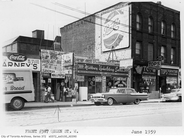
387 Queen West, 1959
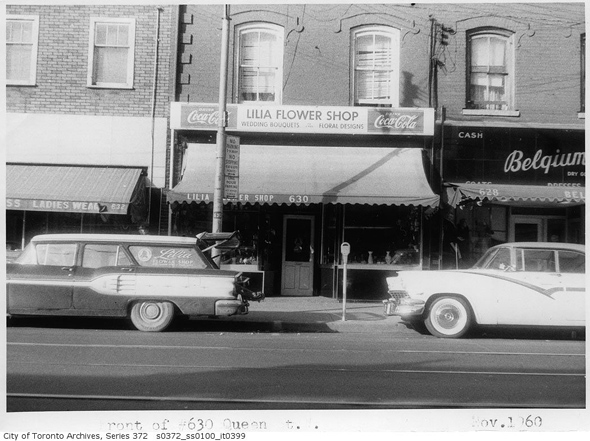
630 Queen West, 1960
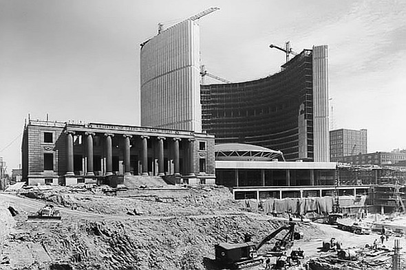
New City Hall under construction (Registry of Deeds and Land Titles Building going down), 1964
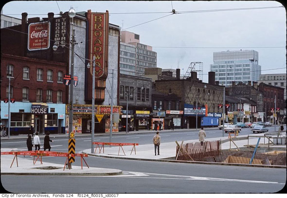
Broadway Theatre, Queen and Bay area late 1960s
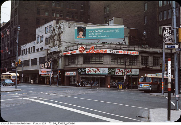
Bay Theatre, late 1960s
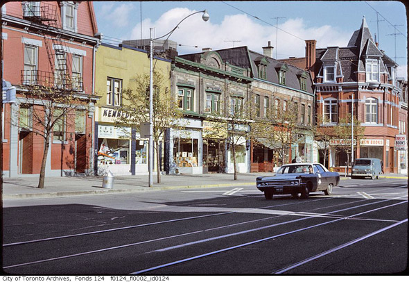
Gladstone & Queen, 1970s (?)
Metro Cab on Queen West (west of Beverley)
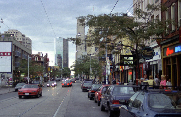
1990s
Photos from the Toronto Archives (unless otherwise noted) / Second image from the Toronto Public Library
Latest Videos
Latest Videos
Join the conversation Load comments