This is what Trinity Bellwoods Park looked like a century ago
The history of Trinity Bellwoods Park has more than one buried treasure under its grassy knolls.
Probably the most famous former inhabitant of the park, and one of the sources for its name, was Trinity College, which stood from 1852 until 1950.
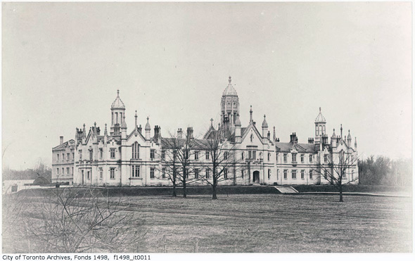
Old Trinity College as it looked in 1856.
The Anglican school was built by Bishop John Strachan (from whom the nearby street also gets its name) and would exist as a private institution until 1904 when it eventually joined with the University of Toronto.
Trinity Bellwoods in the 1890s.
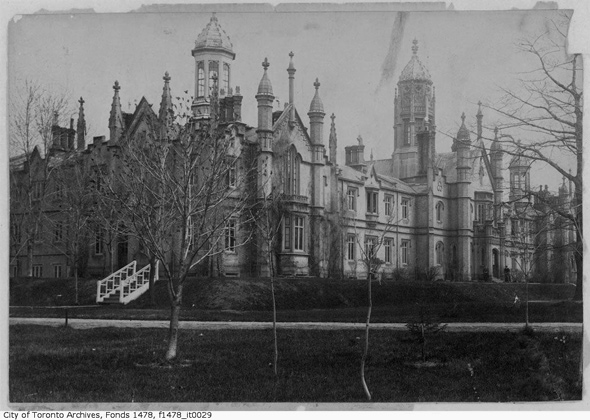
After the completion of a second Trinity College at U of T's central campus (which is something of a copy of the original), the first college was eventually demolished due to the callous short-sightedness of City officials at the time.
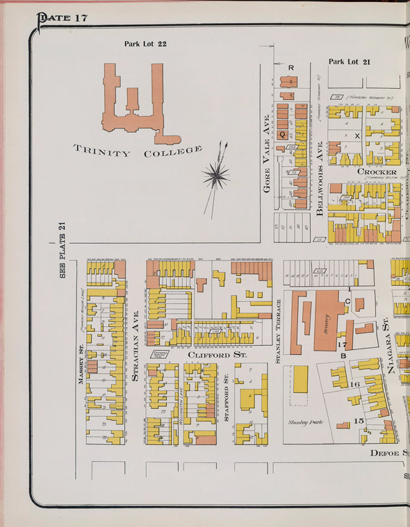
Goad's Atlas, 1910.
Much of the foundation is said to still exist due north of the Queen Street gates, one of two remaining pieces of the school (the other is the former St. Hilda's College residence, which is now a retirement home).
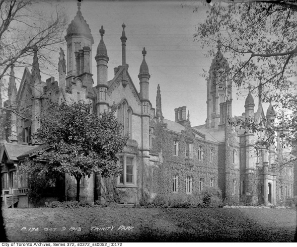
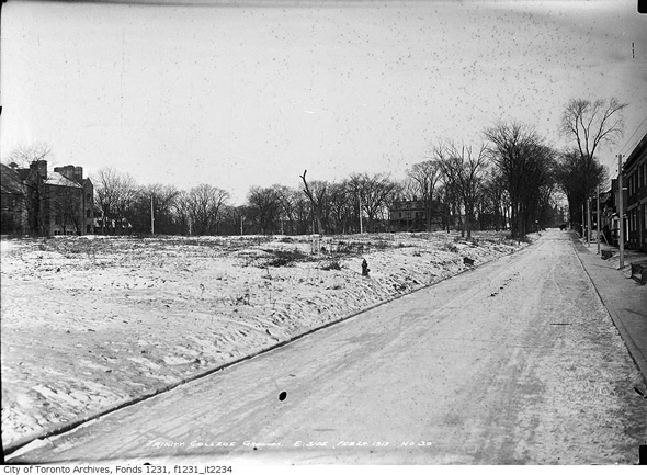
As it looked in 1913.
In addition to what remains of the Trinity College, at the northwest end of the park there is more buried history, namely the former Crawford Street Bridge, which once ran over the Garrison Ravine.
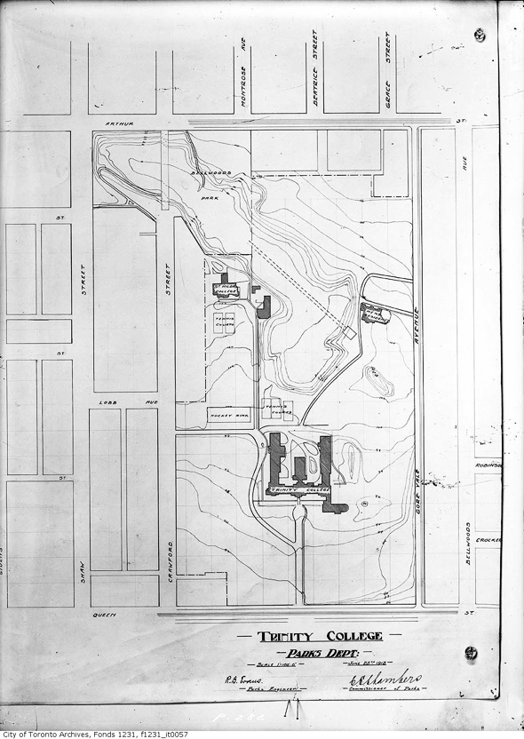
The campus map circa 1913.
Part of the ravine can still be seen in the form of the "dog bowl" that now exists just southeast of the where the bridge has been buried, and flooding is common on the north side of the park in spring.
The original wood bridge in 1912.
When the Bloor-Danforth subway line was built in the 1960s, the fill was used to raise the ravine depression, which is now level with Dundas Street.
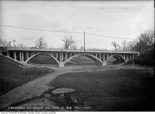
The new bridge in 1915.
Trinity Bellwoods was also once home to a pretty lively amusement park and almost became a baseball stadium.
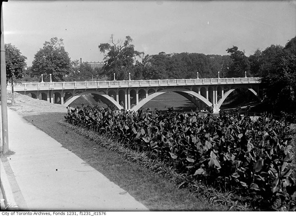
Another angle of the bridge in 1917.
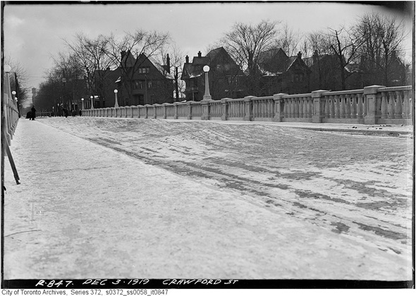
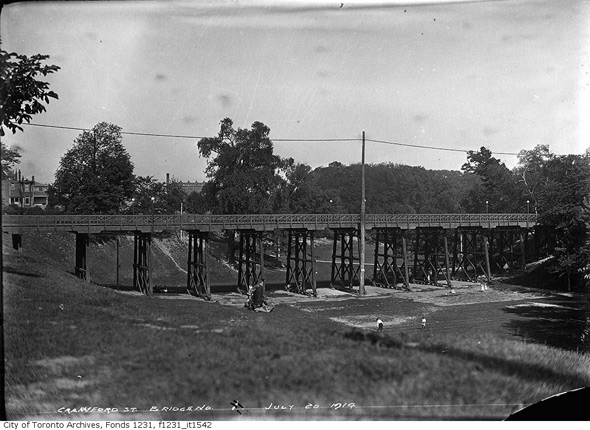
The top of the bridge, 1919.
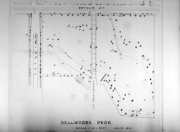
The park plan from 1910.
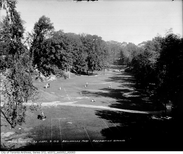
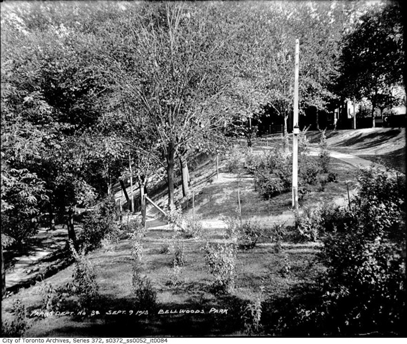
The park as seen in 1913.
The park in 1913.
Gore Vale and the park in 1913.
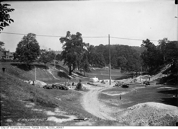
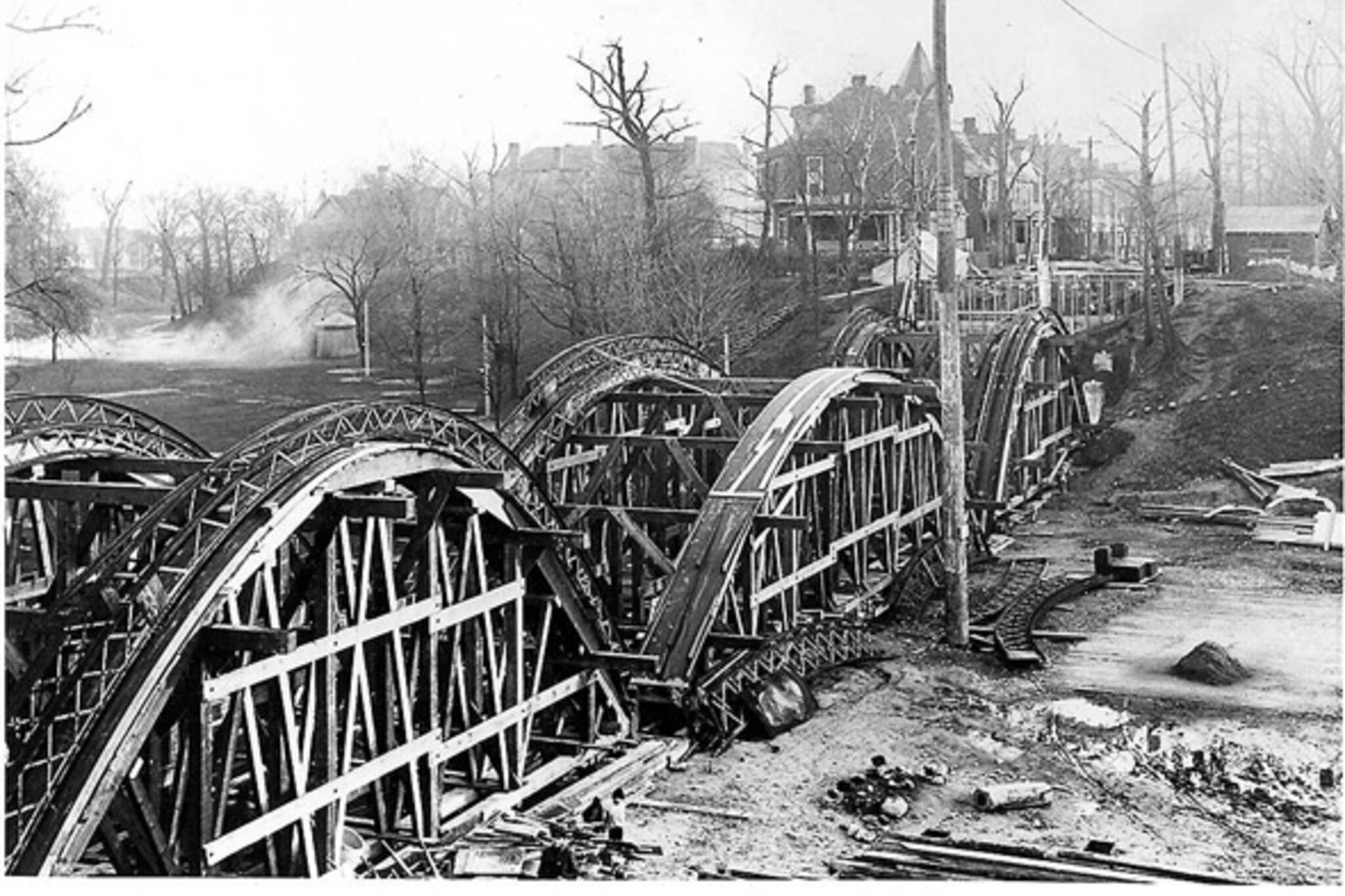
Preparing for the new Crawford Street Bridge in 1914.
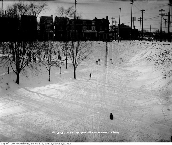
Tobogganing in 1914.
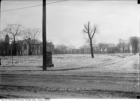
The southeast corner of the park in winter 1914.
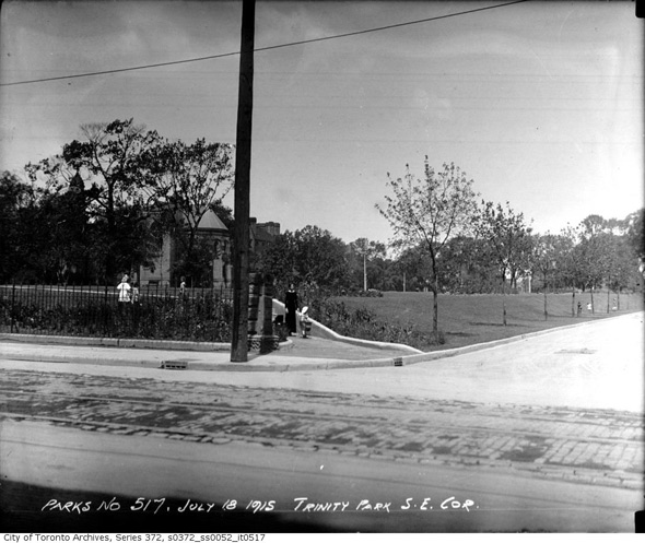
The southeast corner in summer 1915.
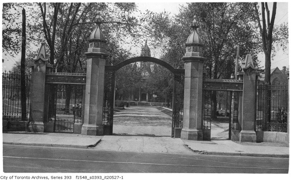
The gates as seen in 1926.
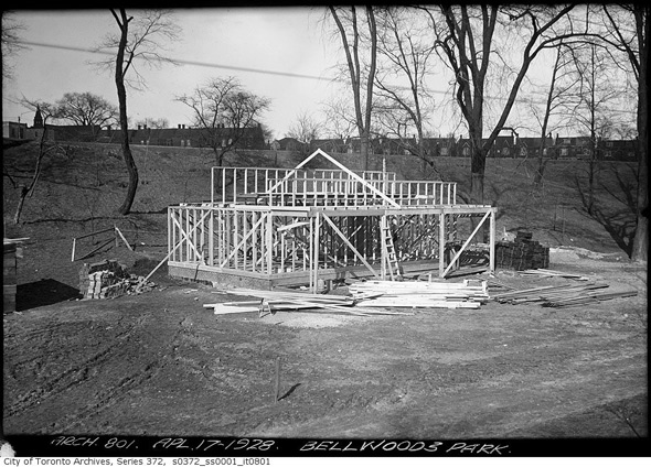
Park shelter in 1928.
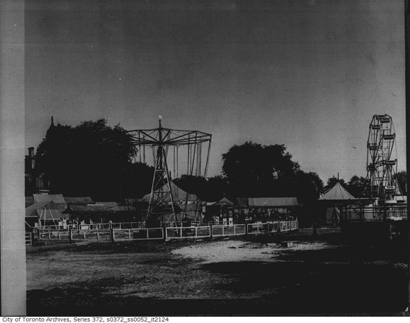
The amusement park in 1945.
Toronto Archives
Latest Videos
Latest Videos
Join the conversation Load comments