
10 key Toronto intersections as they were 30 years ago
The last three decades (ish) have brought profound change to Toronto. Downtown, once dominated by high-rise bank towers, has expanded beyond its old borders, sprouting countless new residential and commercial towers in the process. Forlorn industrial districts, cleaned up and repurposed, have become trendy places to live and shop, and familiar neighbourhoods have been subtly tweaked as stores and businesses start up and shut down.
Everyone knows Toronto has been undergoing profound transformation the last thirty years, but these photos help underscore that fact. Here's a look back at Toronto looked like in the mid to late 1980s, give or take a few years.
Bremner and Simcoe (above)
The downtown skyline from Bremner Blvd. and Simcoe St. circa. 1990. The view today is significantly different: The Crowne Plaza is now an InterContinental, the logo has changed on top of First Canadian Place, oh, and Simcoe Place, Delta Toronto, Bremner, and PwC Tower have taken over the skyline.
Richmond and John streets
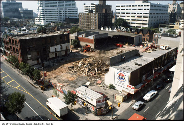
The southwest corner of John and Richmond streets as wreckers clear the site for construction of the Rubik's cube-inspired Riocan Hall. Note the old Amsterdam brewery advert painted on the side of the building near the bottom of the frame. The parking lot near the top left is the future site of the TIFF Bell Lightbox.
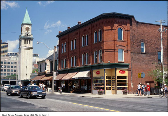
Dundas and Church streets
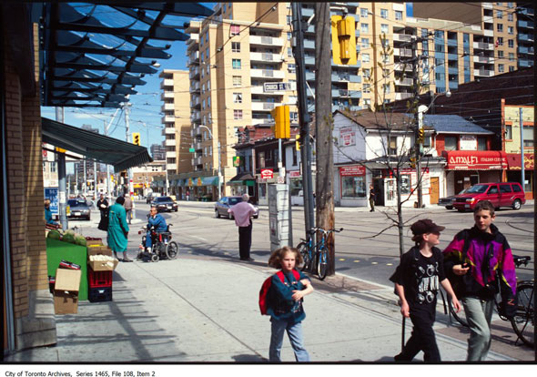
Those ramshackle stores are still at the southeast corner, but the tenants have changed. Amalfi indian restaurant is now Ethiopiques and the corner store has been taken over by Ali Baba's. Those kids are most likely in their mid-30s now, too.
Looking north on Kensington Ave.
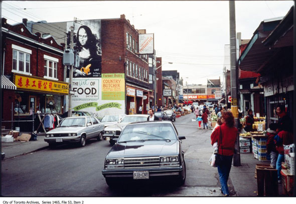
The familiar Mona Lisa mural disguises the subtle changes that have occurred at this intersection over the last three decades: a branch of TD has taken over the former restaurant space, the Asian restaurant with the yellow sign has made way for Essence of Life Organics, even the venerable old European Quality Meat and Sausages has vanished.
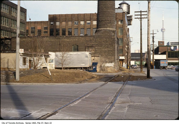
Cherry St. and Lake Shore Blvd.
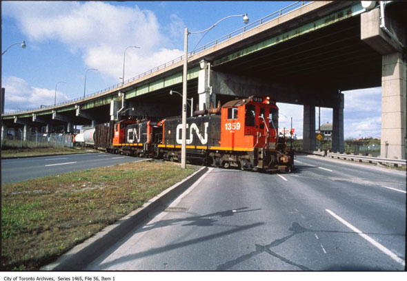
Toronto's downtown railway lands reached peak sprawl in the middle of the middle of the 20th century, but now that many of the former sidings and service tracks have been torn up it's easy to forget that Canadian National freight trains used to pass right through the heart of the city. This track, pictured at Lake Shore Blvd. E. and Cherry St., used to follow Lake Shore to Leslie St., where it turned south into the Port Lands.
Liberty St. and Atlantic Ave.
East on Liberty St. at Atlantic Ave. when Liberty Village was still just the Inglis lands. Historically the area south of King St. west of Niagara St. was heavily industrial. For decades Toronto's central prison was located between Hanna and Strachan avenues among munitions, toy, and home appliance factories. That brick chimney still stands.
Looking south on Spadina near current day Bremner
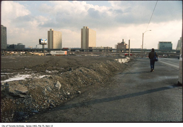
The land on the left had been recently cleared of railway tracks and a roundhouse in anticipation of new development, including the Skydome and later CityPlace. Now, of course, the area has been completely transformed.
Yonge and College streets
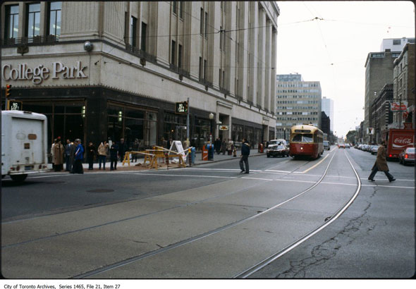
Yonge and College in the last days of the old Presidents' Conference Committee streetcars. Introduced in the late 1930s, the PCCs were the workhorse of the Toronto Transit Commission's surface fleet. Close to 750 of the cream and maroon electric vehicles were in operation during the heyday of Toronto streetcars. For comparison, there are just 246 CLRV and ALRV streetcars on the road today. The last PCCs were retired in January 1996. The view today.
Yonge and Gould streets
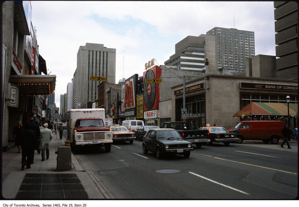
Yonge and Gould when it was the nexus of the Toronto music universe. In this photo, Sam the Record Man and A&A Records, both now defunct, sit side by side. As you will no doubt recall, the Sam sign was the subject of a lengthy preservation battle that culminated in Ryerson paying the City of Toronto to set it up in Yonge-Dundas Square. The site is currently the home of the Ryerson Student Learning Centre.
Yonge and Price streets
Before becoming one of the fanciest liquor stores in the province, the gorgeous Beaux Arts Summerhill CPR Station was Union Station's underachieving little brother. It was only open for 14 years before the railway company pulled the plug and turned the property over for retail use in 1930. In this photo, prior to the LCBO takeover, the south face of the clock tower is missing. The view today.
Chris Bateman is a staff writer at blogTO. Follow him on Twitter at @chrisbateman.
Images: City of Toronto Archives
Latest Videos
Latest Videos
Join the conversation Load comments


