Here's what Toronto's transit network could look like by 2035
The Greater Toronto Area is witnessing its most significant period of transportation investment in generations, and one local has forged a vision of what the regional public transit network could look like a dozen years down the road.
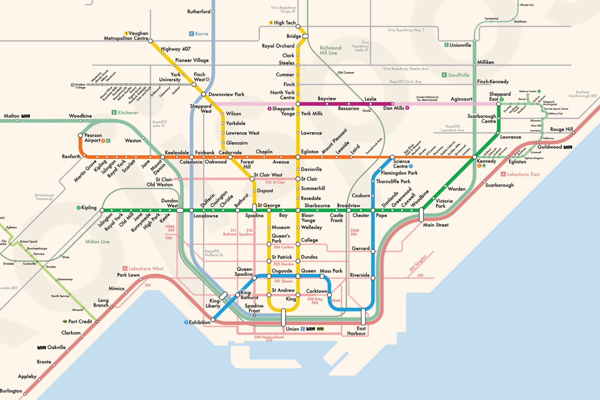
Koji Shiromoto, a self-described data geek who specializes in graphic design and data analysis/visualization, shared a blog post in early November detailing his newest creation — a window into the regional transit network of the not-too-distant future.
I made a diagram that (I hope!) visualizes all the public transit projects that are underway in the GTA.
— Koji Shiromoto (城本浩司) (@kojisposts) November 4, 2023
(There are some edge cases on what counts as "underway", which I discuss here: https://t.co/Q5Un8vqIWS) pic.twitter.com/uzkcMBwSZX
The project expands on Shiromoto's earlier work in visualizing the Toronto subway network of the future in 2022 with an update in 2023.
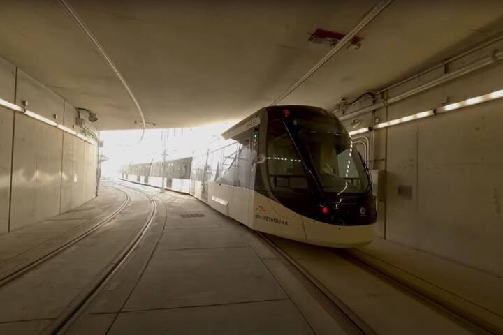
The updated map includes all the upcoming transit lines you've probably heard of by now, like the beleaguered Eglinton Crosstown, its western extension, the Finch West LRT, the Scarborough Subway Extension, the Yonge North Extension and the Ontario Line.
It also features the newest additions to the future transit vision, like the recently unveiled plan to extend the Sheppard Subway in both directions.
Some zoomed-in snapshots: pic.twitter.com/1Io1Y9lAkL
— Koji Shiromoto (城本浩司) (@kojisposts) November 4, 2023
Not included in Shiromoto's earlier maps, transit expansions in 905 cities are now represented as well, like the Hazel McCallion Line under construction along Hurontario in Mississauga, the Hamilton LRT project, and even well beyond the traditional GHTA with the new Kitchener-Waterloo LRT line.
"'Underway' is, of course, a nebulous word," writes Shiromoto, explaining in his blog that "there were a lot of judgment calls on what to include or not."
He notes some liberties were taken in producing the best map possible, like including unfunded future plans that are far enough along that they could possibly come to fruition in the not-too-distant future.
"The Waterfront East LRT and Eglinton East LRT (Line 7) are not funded and could end up not going ahead, but the design work is quite far along and concrete," writes Shiromoto.
A similar decision was made to include the unfunded future portion of Line 5 (Eglinton) linking from the Crosstown West Extension's terminus into Pearson Airport.
Shiromoto explains that this call was made because "the Pearson extension was included in the Business Case and continues to be included in all project maps as 'planned'."
Still emerging plans, like that to extend Line 4, are shown with pale colours, with Shiromoto noting that these projects are "advanced enough in the design stage to demonstrate some level of commitment from the respective governments, but not enough to have a concrete route and list of stations."
The resulting vision looks a far cry from the regional transit network of today, and, if everything goes according to plan (sure, LOL), could be a preview of the map as it will appear in 2035.
Latest Videos
Latest Videos
Join the conversation Load comments