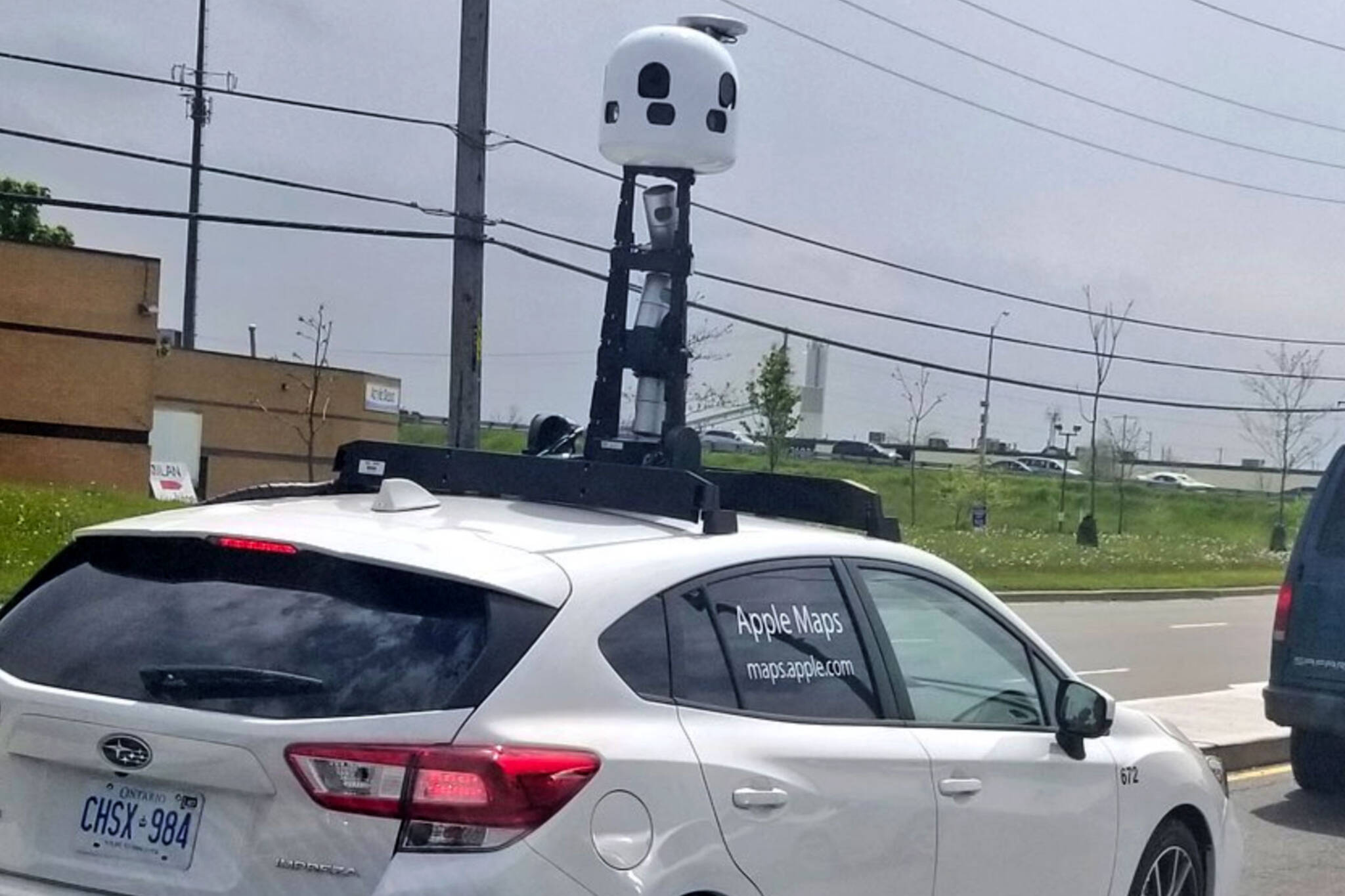
The Apple Maps car is driving around Toronto and people are hating on it
A white Apple Maps car with what looks like a robot antenna has been driving around the city but not everyone is a fan.
Apple Maps Car Spotted Driving in Toronto–Here’s What it Looks Like https://t.co/3sPpjuQS7C pic.twitter.com/OM9Q9u9XbC
— AppMarsh .com (@appmarshcom1) May 28, 2019
Last week, Apple announced that they are driving around Canada this summer to improve their iOS Maps software. This is likely in response to user complaints and competition.
Apple Maps has been lagging behind Google Maps and Waze since its release, critics say.
@AppleSupport take a look! Apple Maps showing Holiday Mountain Resort in the midst of the city of Toronto! Great job! @Google would not do this! @googlemaps pic.twitter.com/nBc9S9d67G
— Ivan Pasic (@IvanPasic) March 18, 2019
The antenna coming out of the car’s roof has 360-degree cameras, which take images of the streets.
Toronto doesn’t need Apple Maps - there’s sooooo much traffic that you can’t get anywhere, anyway🤷♂️
— Steve (@StevoCooks) May 28, 2019
From May to November, Apple cars will be driving around all ten provinces.
The camera is collecting data for their app, but it is possible that the revamped software will look more like Google’s Street View.
An announcement on the Apple website states that privacy is a priority and the update will blur faces and license plates.
No word if there's a way for them to edit out middle fingers.
This announcement suggests that there will be an interactive element to the new software, which could prove fantastic for those looking for a bit more out of the program.
Latest Videos
Latest Videos
Join the conversation Load comments


