What the Junction used to look like in Toronto
The Junction might just be one of the most interesting neighbourhoods in Toronto. At once a place that's undergone profound change (a.k.a. gentrification) over the last decade or so, the former character of the area, particularly north of Dundas West has yet to fade completely. The pocket of streets just north of the sprawling Heinztman Place Condo project (where the eponymous piano manufacturer took root) — Junction Road, Mulock and Cawthra avenues, Old Weston Road — retain a messy measure of industry that's all but been eradicated elsewhere.
That said, even these streets show off the steady transformation of the neighbourhood. While the northern stretch of Mulock might still feel like it's perched on the edge of the world somehow, budding businesses like Junction Craft Brewing and Posterjack already call Cawthra Avenue home.
The presence of the former of these two companies offers up a sweet bit of historical irony given that the area was Toronto's last standing booze-free zone as late as 1997. We've already delved into this anachronistic manifestation of Toronto the Good (thanks, Ben!), but given that the Indie Alehouse has also recently opened near Dundas and Keele, it's worth considering, once again, just how different a place this has become in such a short span of time.
If you go back far enough, what we refer to today as merely the Junction was known as the city of West Toronto Junction, which was also its own federal electoral district. Post-amalgamation with Toronto in 1909, the West Toronto prefix of the former moniker (very) slowly faded into disuse, though it's not entirely uncommon to hear older residents refer to the area in such a manner.
Once the site of a confluence of Native trails — Indian Road, Indian Grove, Indian Trail — the history of the area as a transportation hub has continued through the 20th century and beyond with the presence of what's sometimes referred to as the West Toronto Diamond, the junction of multiple railway lines near the neighbourhood's main intersection.
Although West Toronto was subsumed by a rapidly growing city more than a century ago, standing at the crossroads of these two streets today, it takes little imagination to picture this stretch of Dundas West as the main thoroughfare of a town unto itself. As is the case with Roncesvalles to the south, there's an unmistakable drag-like quality that has stubbornly resisted the forces of redevelopment that chug away more rapidly than ever.
PHOTOS
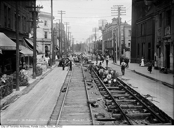
Dundas and Keele looking east, 1912
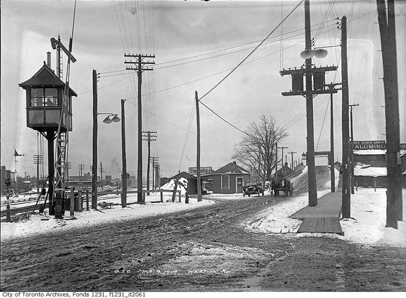
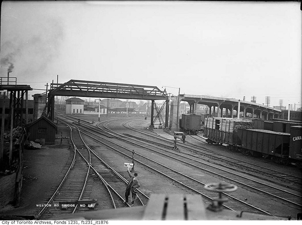
Weston Road Bridge, 1919
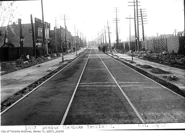
Dundas West looking north from Glenlake, 1922
Dundas West and Edna, 1922
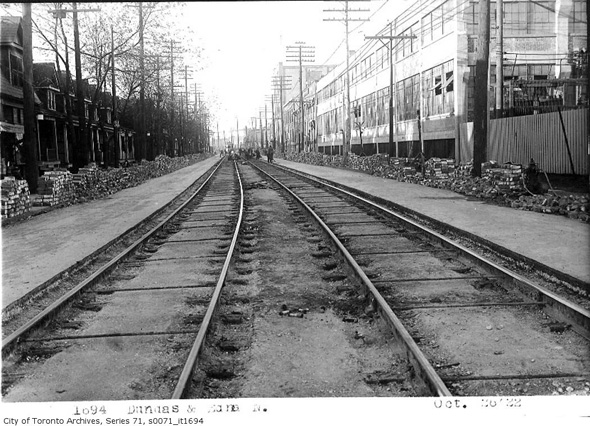
Dundas West looking south from Jerome, 1922
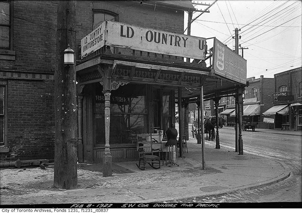
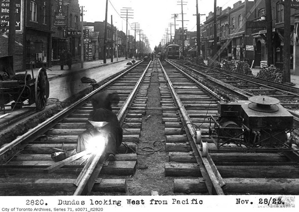
Southwest corner Dundas and Pacific, 1922
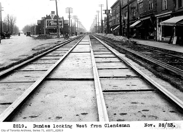
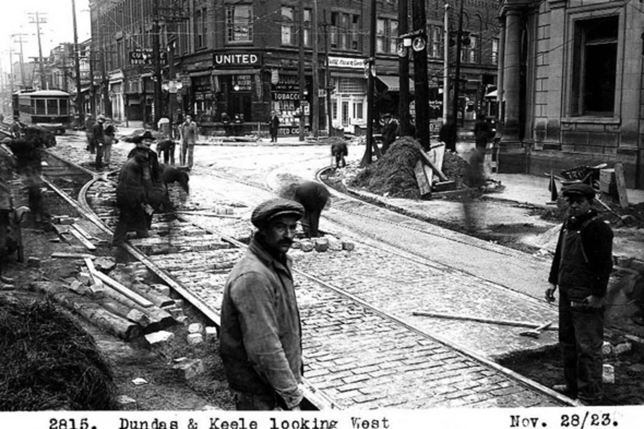
Dundas looking west from Clendenan, 1923
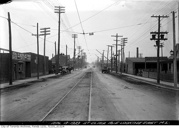
St. Clair looking east from Mulock, 1923
Keele St. looking south from Junction Rd., 1923
Keele looking south from St. Clair, 1923
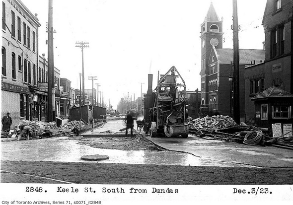
Keele south from Dundas, 1923
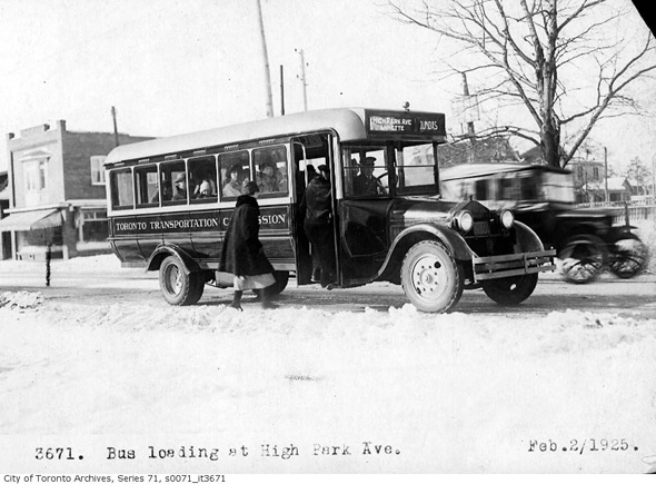
Riding the bus on High Park Avenue, 1925
Weston Road Bridge, 1929
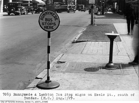
Runnymede bus stop, 1929
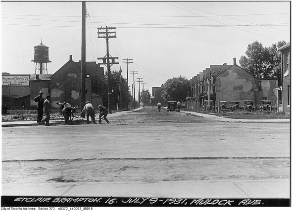
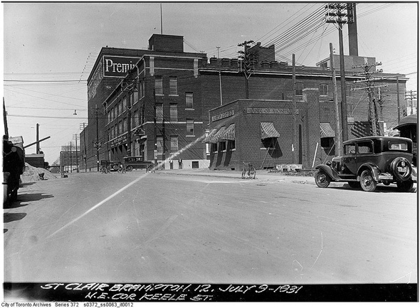
St. Clair and Mulock, 1931
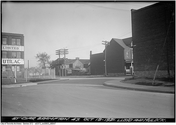
Lloyd and Mulock, 1931
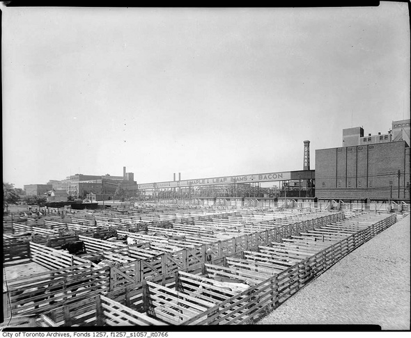
Maple Leaf Bacon plant
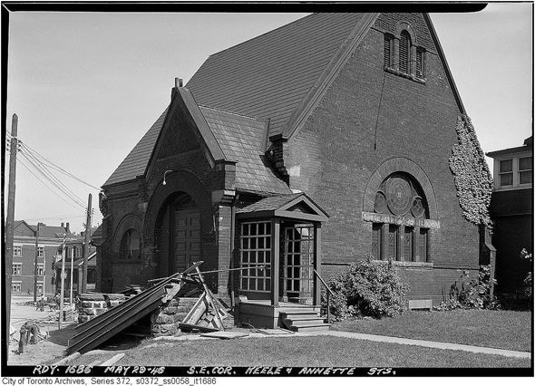
Southeast corner Keele and Annette, 1946
Northeast corner St. Clair and Keele
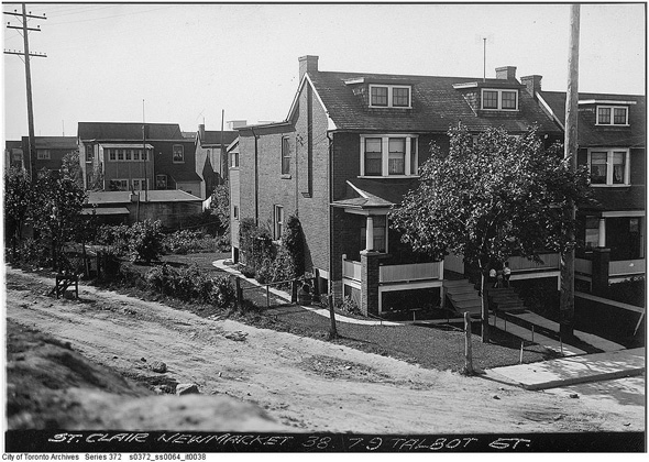
79 Talbot, 1938
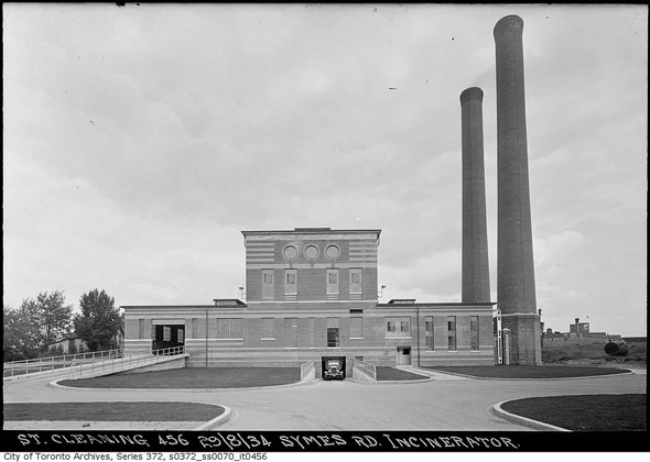
Symes Road Incinerator, 1934
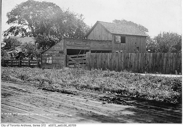
St. Clair and Laughton (date?)
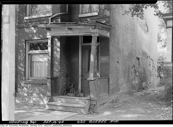
420 Quebec Ave, 1946
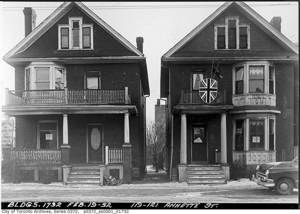
119-121 Annette, 1952
Dundas looking west from Indian Grove, 1932
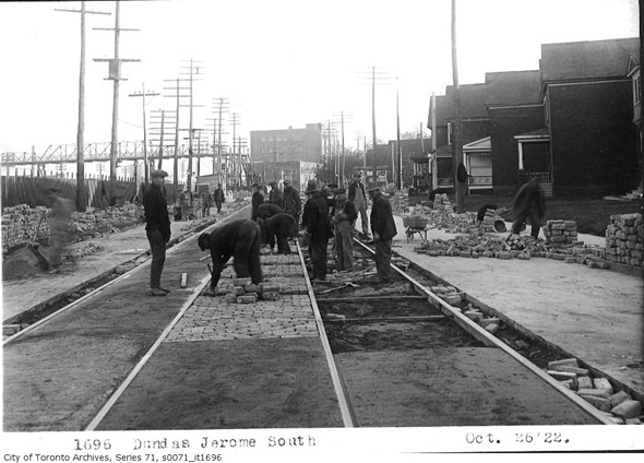
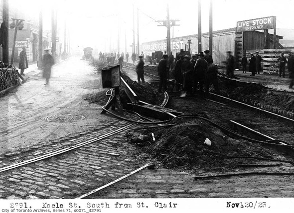
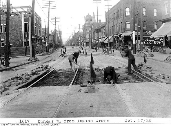
Dundas West track work, 1923
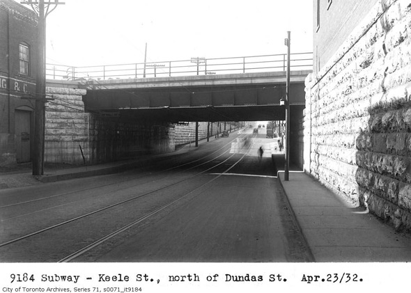
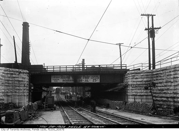
Keele subway, 1932
FURTHER READING
- For then and now views, check out this set of photos from Toronto History on Flickr
- The West Toronto Junction Historical Society has a variety of interesting resources
Photos from the Toronto Archives
Latest Videos
Latest Videos
Join the conversation Load comments


