
That time when Toronto went boom
The Toronto that most of us know today was born during the 20 year period between 1950 and 1970. Prior to the '50s, the city wasn't just a quiet and stiff place — Toronto the good, as it was often called — it was also profoundly less developed. Not only did the city basically end at Wilson / York Mills, but even in more densely populated downtown areas, 10+ storey buildings were scarce.
And then everything changed. Between 1950 and 1970, Metropolitan Toronto was founded, the subway arrived, the positively futuristic-looking New City Hall was built, major expressways like the Gardiner and 401 cut across the city, and the modern skyline was born with the arrival of the Mies van der Rohe-designed TD Centre. The amount of development that took place during this period is almost mind-boggling — and, to be honest, if I hadn't stumbled across a collection of photos documenting it, I'd have great difficultly putting it into perspective.
Boomtown: Metropolitan Toronto is one of those historical treasures that you come across when you spend enough time digging around in libraries or archives. Published in 1969, the now-out-of-print book presents a series of aerial views photographed by the Lockwood Survey Corporation that dramatically captures the development boom that accompanied the birth of Metro Toronto. The text, written by Donald Boyce Kirkup, brims with overly optimistic descriptions of the booming city, but that's okay because the photos are the real calling card here.
I've put together a representative selection of what Boomtown has to offer, but if you're keen on getting a look at the entire collection, a visit to the Reference Library may in your future (a couple other branches have copies, too). It's a rather remarkable historical document, and just the type of book that you can lose an afternoon to poring over its pages.
PHOTOS
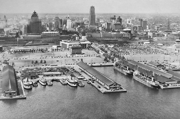
Toronto Skyline, 1949
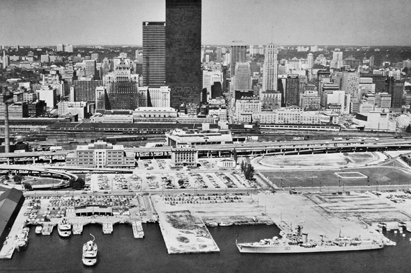
Toronto Skyline, 1969
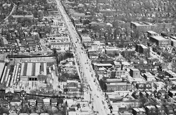
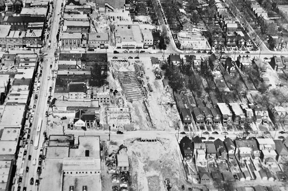
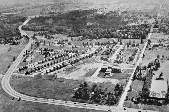
Yonge and Eglinton, 1951
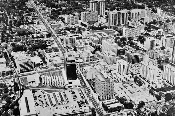
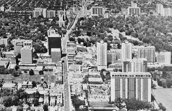
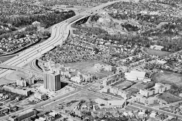
Yonge and Eglinton, Ca. 1969
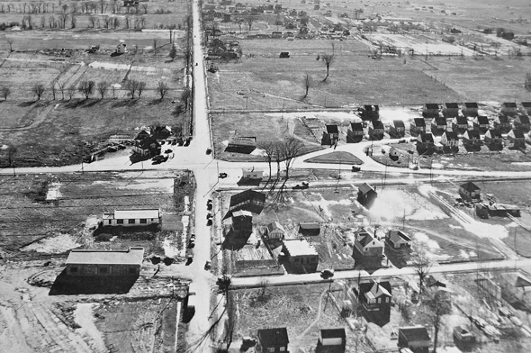
Dufferin and Wilson, 1949
Dufferin and Wilson, Ca. 1969
Looking east on Sheppard towards Bathurst Street, 1949
Similar angle, Ca. 1969
Yonge and St. Clair, 1951
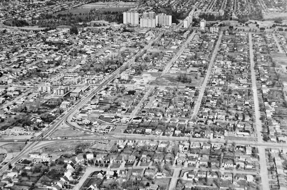
Yonge and St. Clair, 1969
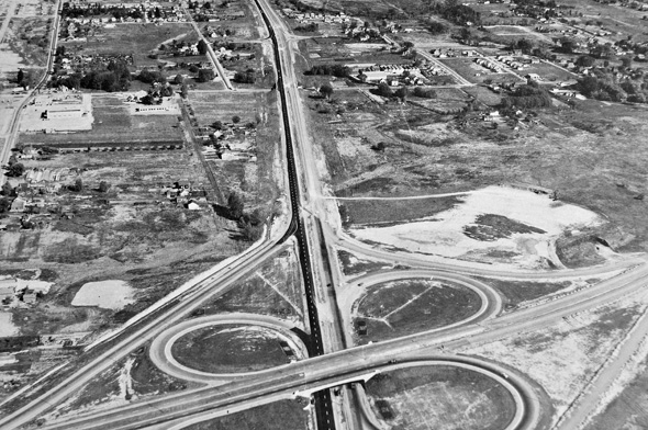
401 / 400 interchange, 1953
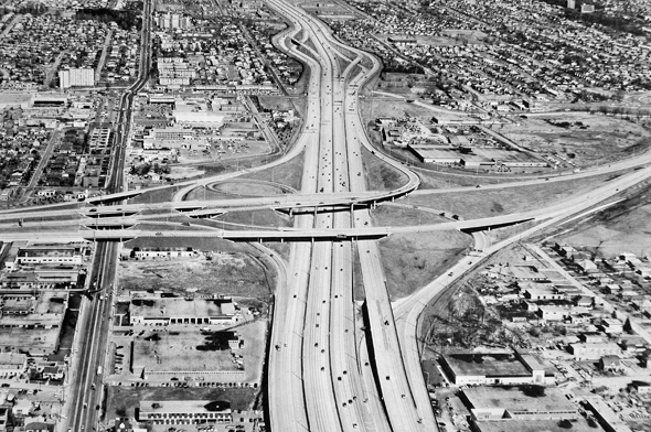
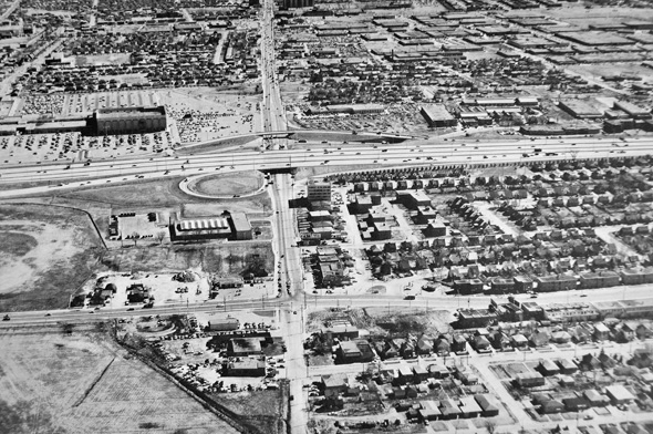
401 / 400 interchange, Ca. 1969
Avenue and Wilson looking towards Hogg's Hollow, 1949
Similar view, 1969
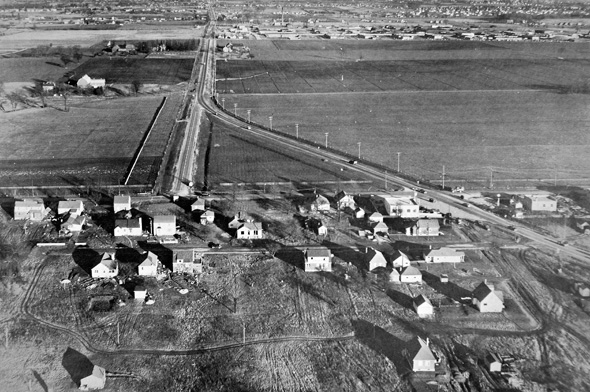
Eglinton and Victoria Park, 1949
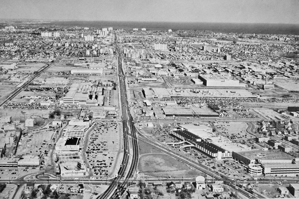
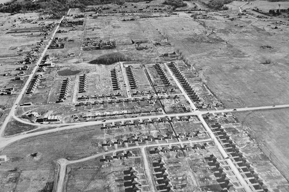
Similar view (now the Golden Mile), Ca. 1969
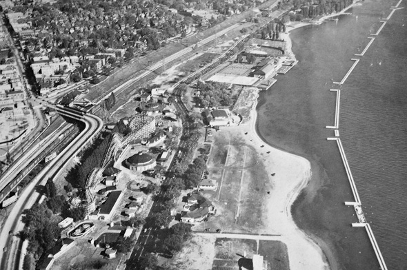
Sunnyside, 1949
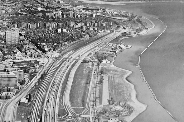
Sunnyside, 1969


