
The history of the Toronto railway lands before South Core and CityPlace
It might be hard to fathom today, but Toronto used to be defined by its massive Railway Lands south of Front St. What today we call South Core and CityPlace were once just a vast expanse of tracks that severed the city from the lakeshore far more than the Gardiner Expressway ever did.
To sketch in rather broad strokes, the history of the Railway Lands dates back to 1858 when Toronto's first Union Station was erected by the Grand Trunk Railway. Prior to this period, Toronto relied on its port and horse-drawn carriages to fuel the economy.
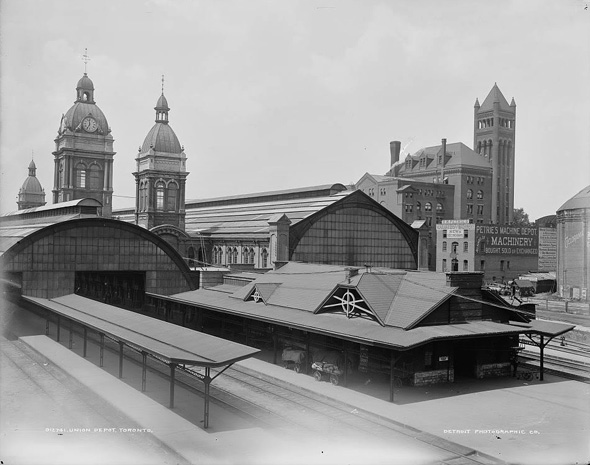
Old Union Station, Ca. 1890. Photo via the Library of Congress.
The first Union would be replaced by a far grander structure in 1873 (now often referred to as Old Union Station), which was unfortunately demolished in the late 1920s after the completion of the station that currently bears this name.
By the 1930s when the City reclaimed some of the land around the waterfront, the Railway Lands had swelled to an enormous size, a process that would continue through the 1940s. Basically all the land south of Front Street to Queen's Quay was owned by rail companies.
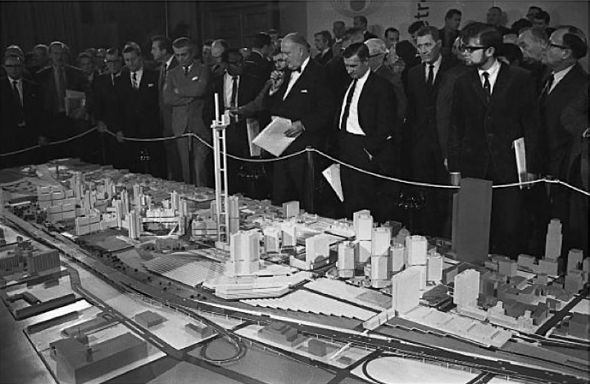
Plans for Metro Centre, 1968 (that's an alternative design for the CN Tower there). Photo via the Toronto Archives.
The first significant plans to revitalize the Railway Lands came in the 1960s, when Metro Centre was proposed, of which the CN Tower was the only facet to come to fruition (though in a much different form than initially proposed).
After the CN Tower was completed there were plans to continue to develop the area, but they were ultimately put on hold until the birth of the SkyDome more than a decade later.
Post-Dome, development again slowed as the city tried to figure out the best use for the remaining lands. Another sports stadium would eventually follow in the form of the Air Canada Centre (now Scotiabank Arena), which finally kickstarted work on what would come to be CityPlace.
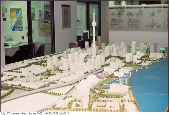
Model for development of the Railway Lands (it doesn't look like this now!). Photo via the Toronto Archives.
The Toronto Archives are littered with urban design photographs of plans, models and presentations devoted to the Railway Lands in the 1980s and 1990s, but the end result of the process is still a matter of some debate.
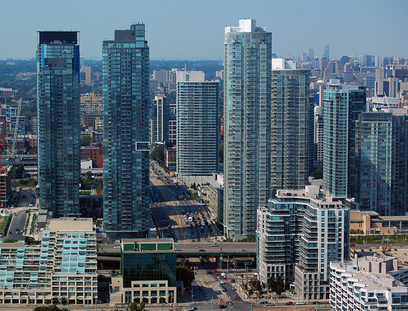
CityPlace was widely criticized in its early years, though it's now slowly becoming more of community. Meanwhile, South Core has shifted the Financial District south and reshaped what we consider downtown.
This is doubly reclaimed land — once from water and once from a sea of rails that turned into an urban wasteland when Toronto transitioned away from an industrial economy. Where once there was wide empty space, now there are skyscrapers everywhere you turn.
This is what Toronto's Railway Lands looked like before the towers.
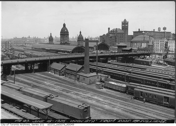
Tracks and rail cars around Old Union Station, 1926. Photo via the Toronto Archives.
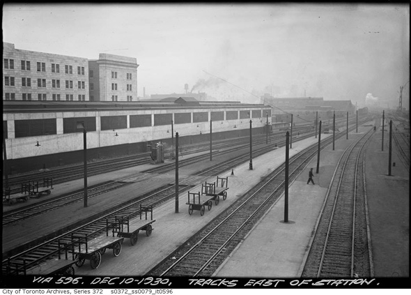
Tracks east of Union Station, 1930. Photo via the Toronto Archives.
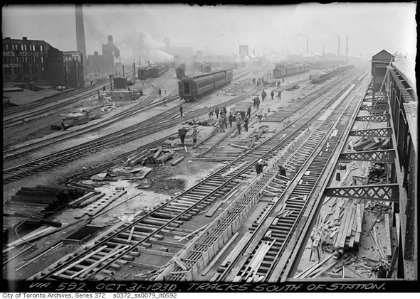
Tracks south of Union Station, alternate view 1930. Photo via the Toronto Archives.
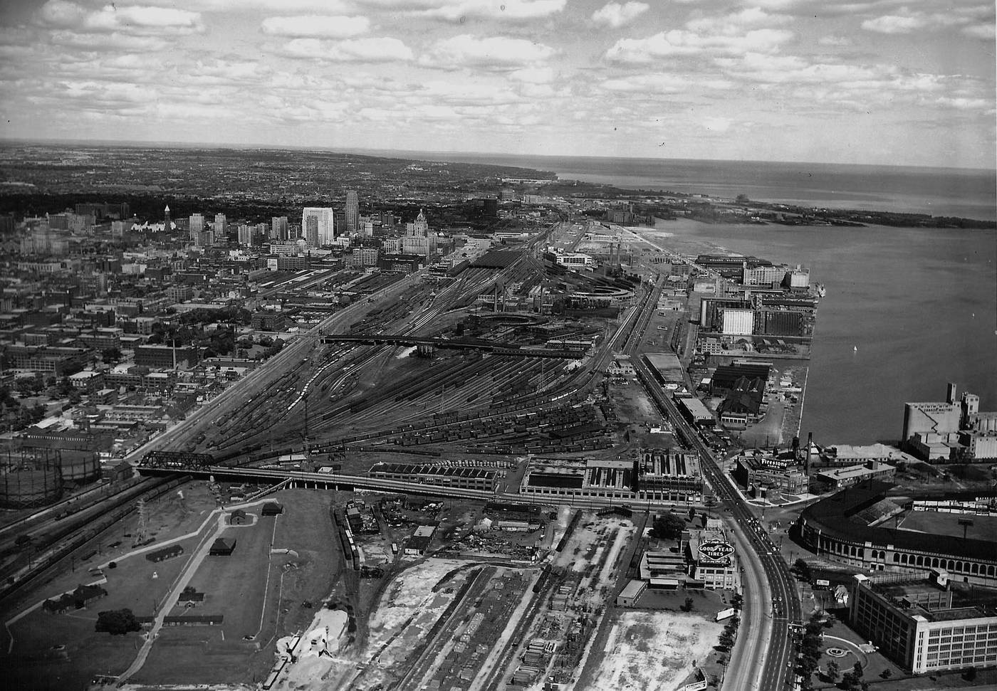 Toronto's vast Railway Lands in the 1940s. Photo via the Toronto Public Library.
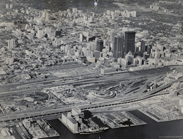
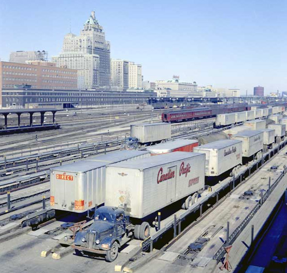
Toronto in 1967, railways and parking lots. Photo via Chuckman's Nostalgia.
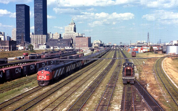
Railway lands, Ca. 1960s. Photo via the Wikimedia Commons.
Railway lands looking really wide, 1960s. Photo via the Wikimedia Commons.
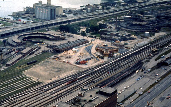
Construction starts on the CN Tower, 1973. Photo via the Toronto Archives.
CN Tower construction, 1973. Photo via Chuckman's Nostalgia.
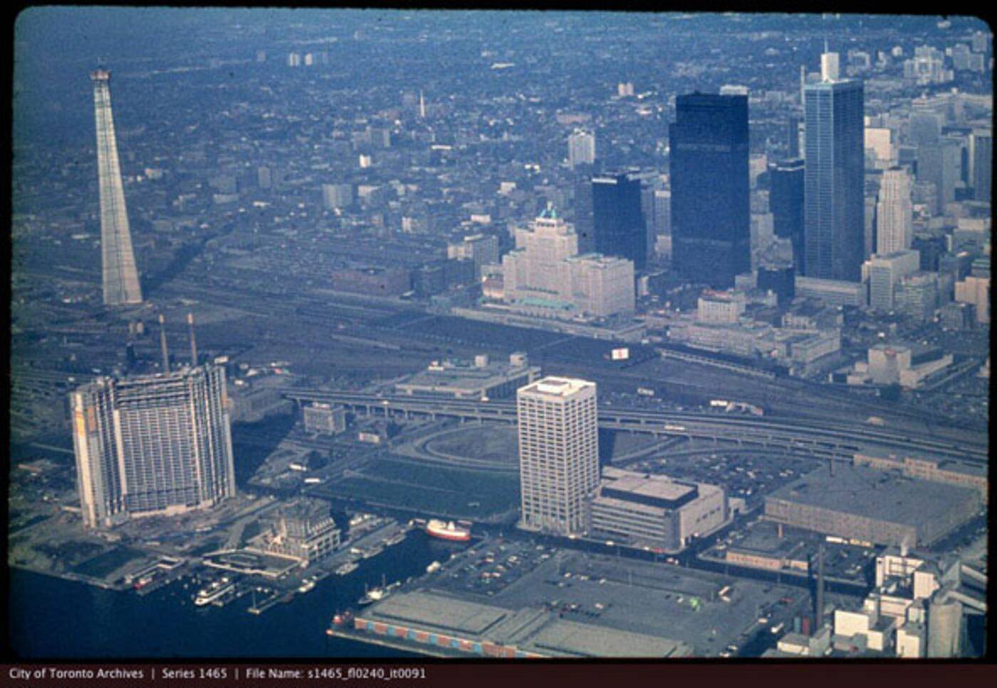
The Tower rises, 1974. Photo via the Toronto Archives.
Looking west across the railway lands, Ca. late 1970s. Photo via the Toronto Archives.
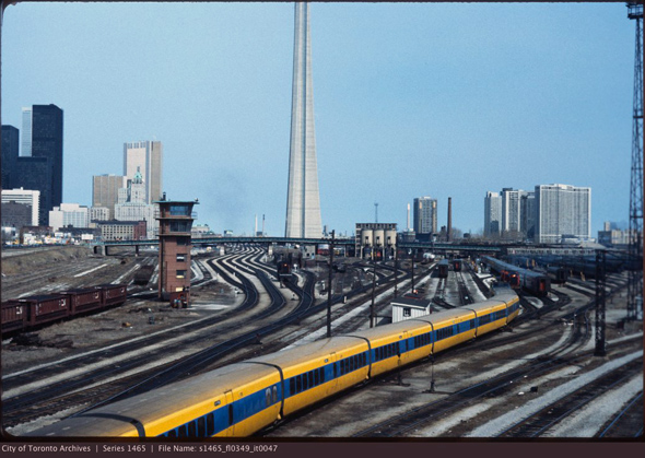
View from the Bathurst Bridge in the early 1980s. Photo via the Toronto Archives.
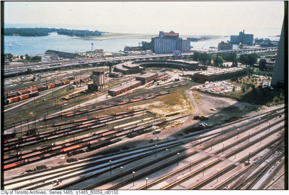
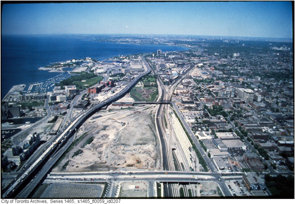
Railway Lands looking down (and east) from the CN Tower, 1980s. Photo via the Toronto Archives.
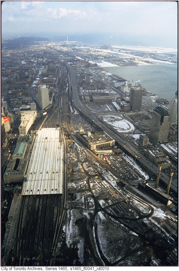
Railway Lands, looking down (and west) from the CN Tower, 1980s. Photo via the Toronto Archives.
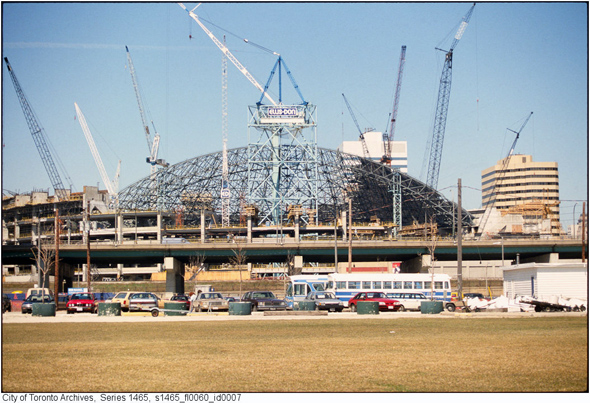
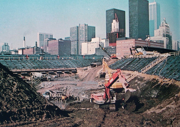
Construction on the SkyDome, late 1980s. Photo via the Toronto Archives.
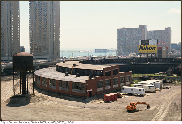
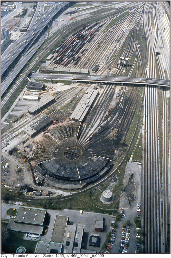
John Street Roundhouse, early 1990s. Photo via the Toronto Archives.
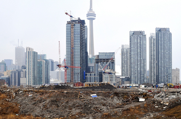
The Railway Lands in 1990s were something of a blank canvas. Photo via the Toronto Archives.
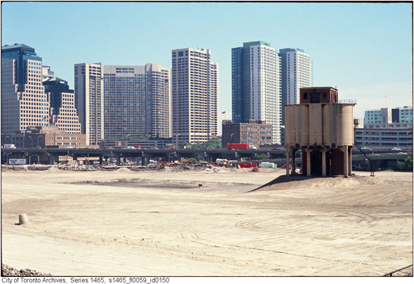
The Railway Lands razed for development, 1990s. Photo via the Toronto Archives.
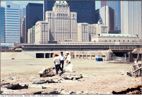
Alternate angle looking towards the future site of the Air Canada Centre. Photo via the Toronto Archives.
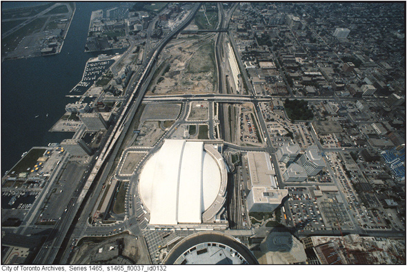
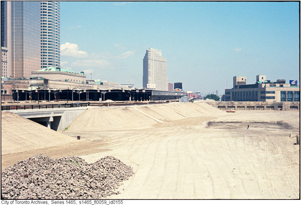
Looking north towards Union Station in the mid 1990s. Photo via the Toronto Archives.
Railway Lands prepared for development, 1990s. Photo via the Toronto Archives.
CityPlace in 2009. Photo by Derek Flack.
View from Bathurst Bridge in 2010. Photo by Derek Flack.
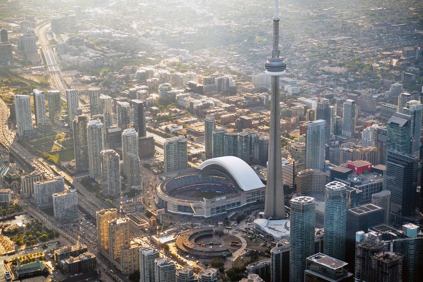
Looking northwest across the former Railway Lands in 2016. Photo by Dan Sedran.
Toronto Archives. Writing by Derek Flack.


