Saturday, May 26, 2012Mostly Cloudy 24°C
City

That time when Toronto widened the streets

Posted by Derek Flack / October 4, 2011

Toronto street widen historyIt may seem strange to think it nowadays, but Toronto — or at least the older parts of the city — wasn't built for cars. Many streets throughout what we now call the core were narrow affairs better equipped to handle carriages and bicycles. Some of Toronto's widest avenues like University and Spadina were once lazy, two-laned paths that would struggle to accommodate a couple of modern-day buses passing one another.

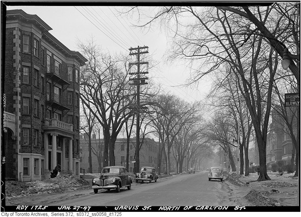
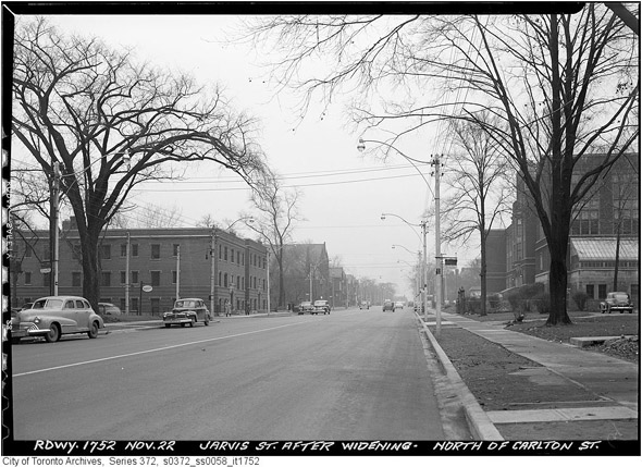
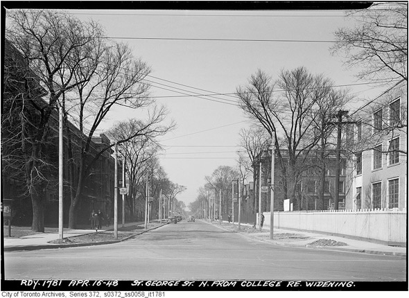
These aren't political statements related to some putative war on the car, but basic facts about the history of this city. So when did things change? Perhaps not surprisingly, Toronto undertook a massive city-wide effort in the years following the second World War to expand the width of its streets to better serve the rising vehicular population. The Archives are littered with photos of formerly tree-lined boulevards that are hollowed out for the purposes of expansion. I used to think the most startling (and in some ways disappointing) instance of this took place on Jarvis Street, which at one time was as grand a street as Toronto had. But in this latest trip into the city's past, I'd now say that the changes in and around U of T are the most dramatic.

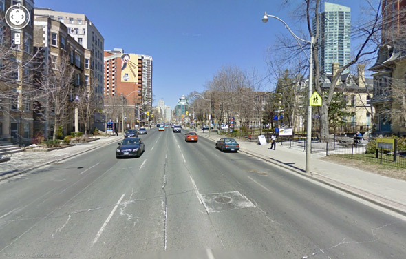
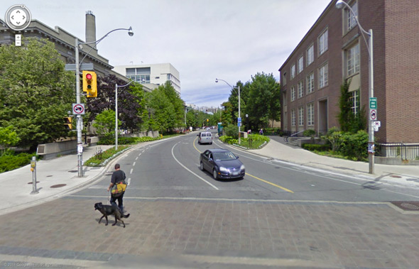
But the point of this isn't mourning. On the contrary, it's fascinating to see how the city was transformed to meet the needs of its growing population and the rise of automobile. Most of the photos below were taken around 1948 and feature before and after views of the streets in question. I've also added a contemporary Google Street View image for additional context. When no immediate "after" photo was available, the "before" photo is directly juxtaposed with the view today.

PHOTOS

Jarvis north of Carlton
201156-jarvis-north-carlton-jan-1947.jpg201156-jarvis-north-carlton-nov-1947.jpg2011103-jarvis-today.jpg

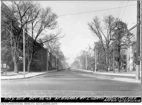
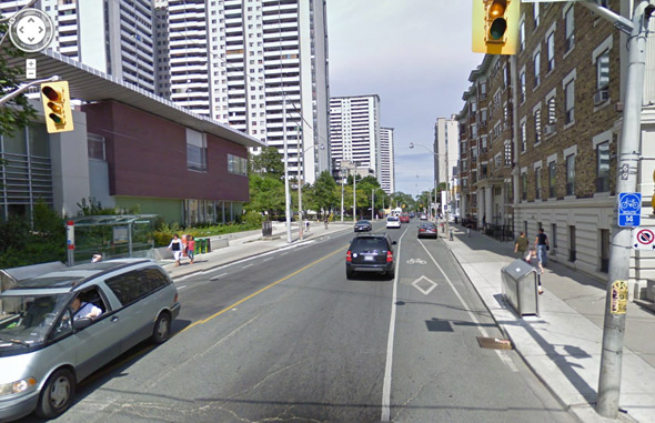
St. George and College
2011103-college-stgeorge-widening-s0372_ss0058_it1781.jpg2011103-stgeorge-widened-college-1949-s0372_ss0058_it2015.jpg2011103-college-stgeorge.jpg

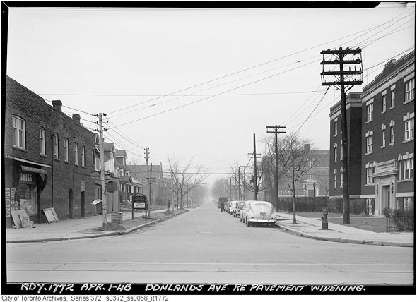
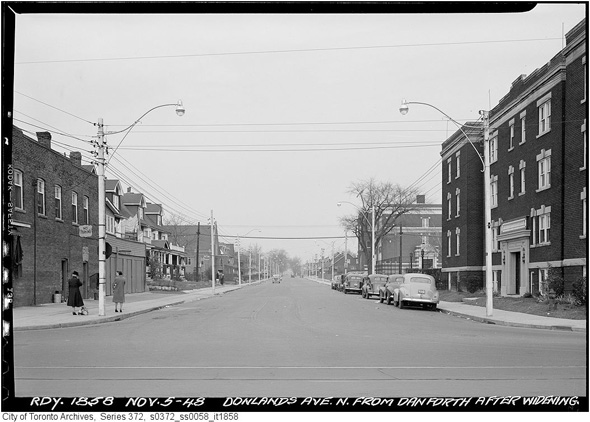
Donlands and Danforth
Donlands2011103-donlands-danforth-widened-1948-s0372_ss0058_it1858.jpg2011103-donlands-danforth.jpg

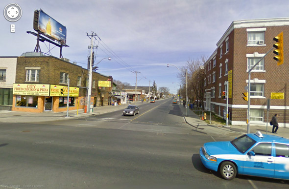
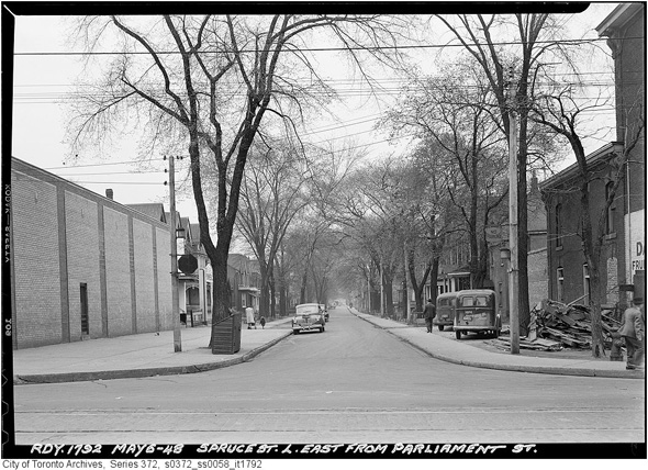
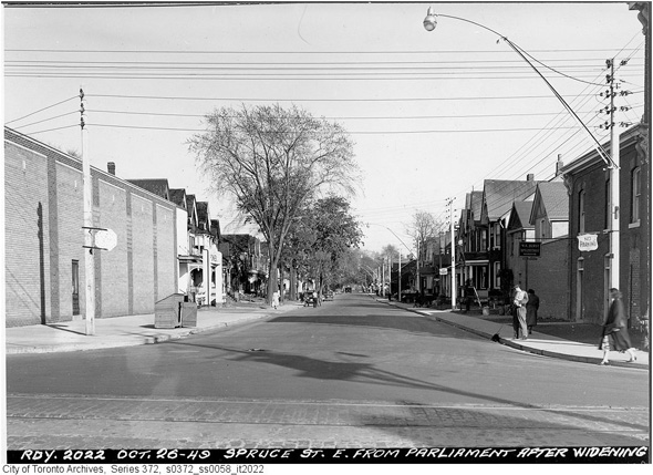
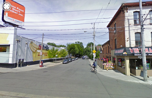
Parliament and Spruce
2011103-spruce-street-parliament-1948-s0372_ss0058_it1792.jpg2011103-spruce-widened-1949-s0372_ss0058_it2022.jpg2011103-parliament-spruce.jpg

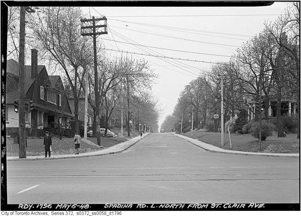
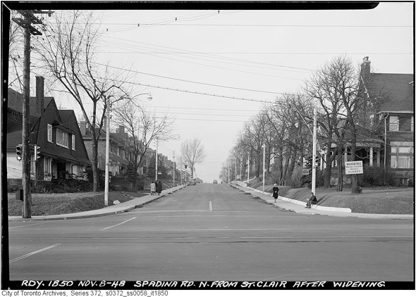
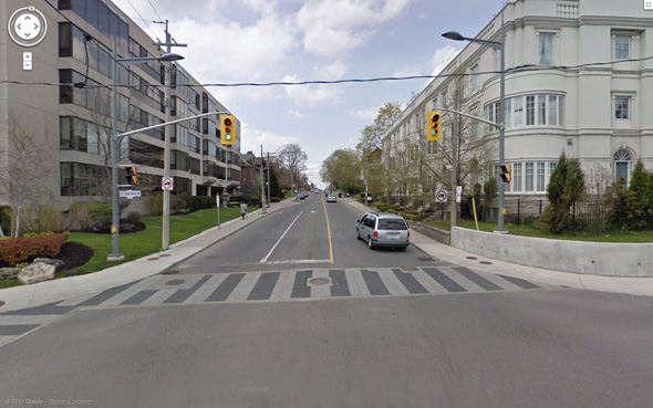
Spadina and St. Clair
2011103-spadina-north-stclair-1948-s0372_ss0058_it1796.jpg2011103-spadian-post-widening-s0372_ss0058_it1850.jpg2011103-spadina-stclair-today.jpg

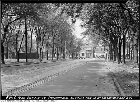
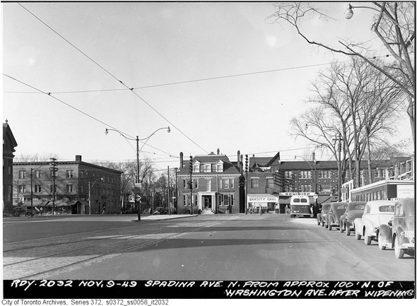
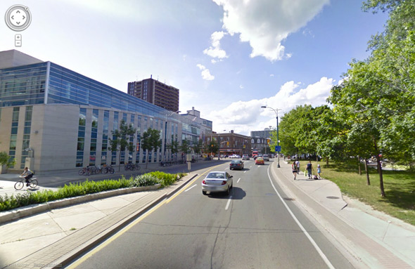
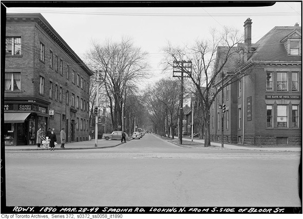
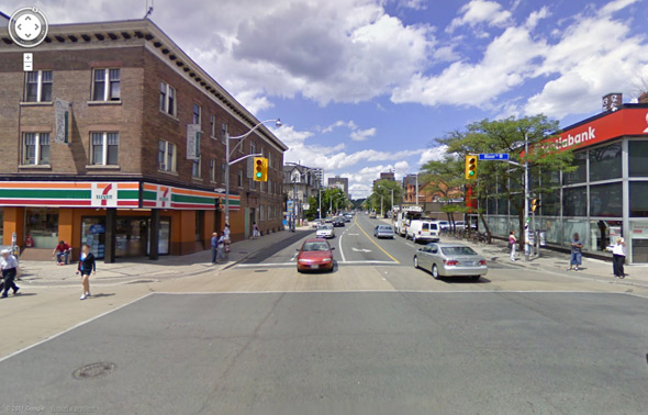
Spadina south of Bloor (looking north)
2011103-spadian-south-bloor-1948-s0372_ss0058_it1838.jpg2011103-spadina-widen-washington-s0372_ss0058_it2032.jpg2011103-spadina-bloor-better.jpg

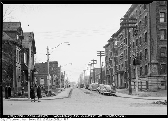
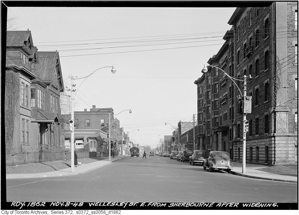
Sherbourne and Wellesley
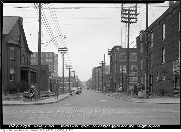
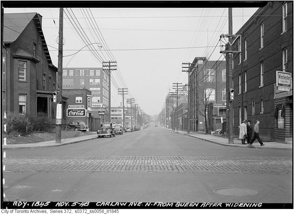
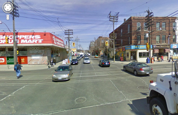
2011103-wellesley-sherbourbne-parliament-1948-s0372_ss0058_it1767.jpg2011103-wellesely-sherbourne-widened-1948-s0372_ss0058_it1862.jpg2011103-wellesley-sherbourne.jpg

Carlaw and Queen
2011103-carlaw-queen-1948-s0372_ss0058_it1776.jpg2011103-carlaw-widened-queen-1948-s0372_ss0058_it1845.jpg2011103-queen-carlaw.jpg

The photos below are pairs rather than trios:

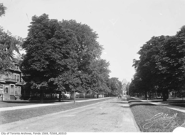
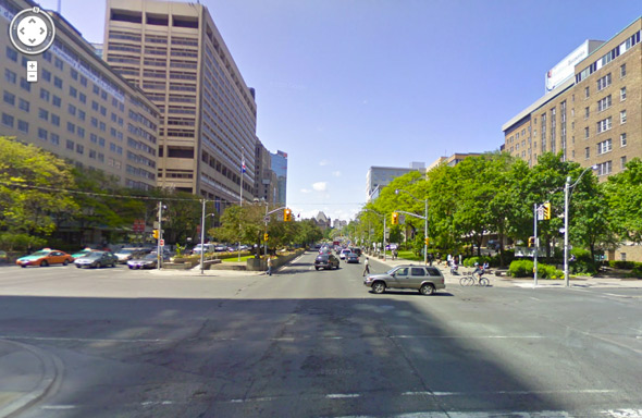
University south of College (original photo ca. 1910)
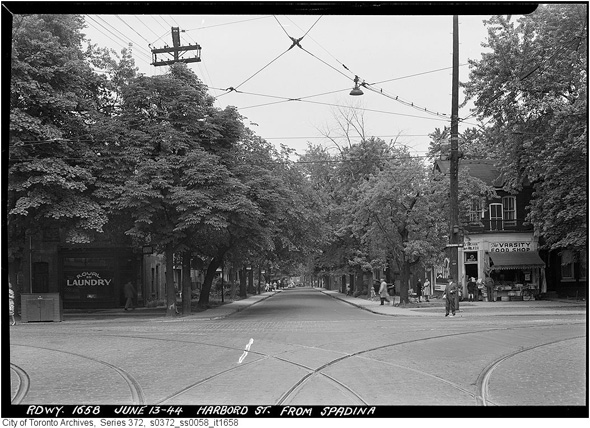
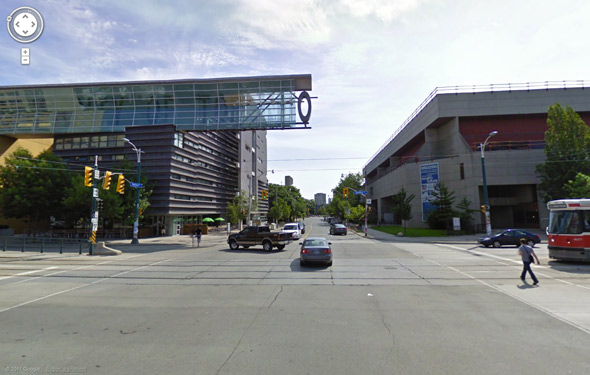
2011103-university-narrow-1900-ca-f1568_it0310.jpg2011103-university-today.jpg

Spadina and Harbord
2011103-harbord-widening-spadina-1944-s0372_ss0058_it1658.jpg2011103-harbord-spadina-better.jpg

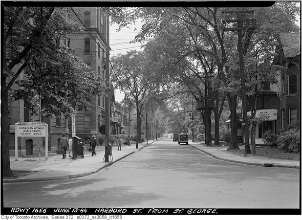
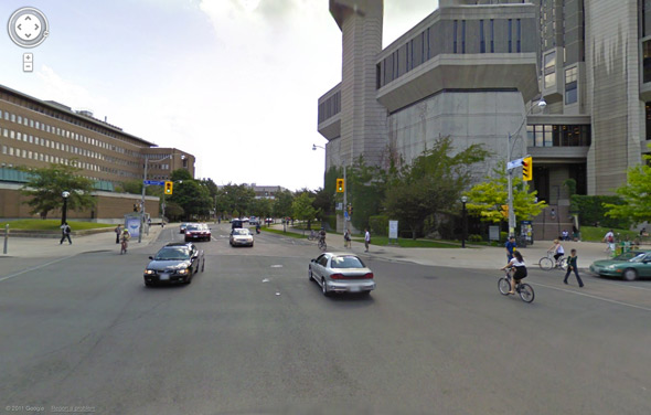
St. George and Harbord (looking west)
2011103-harbord-widening-st-george-1944-s0372_ss0058_it1656.jpg2011103-harbord-stgeorge-today.jpg

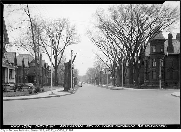
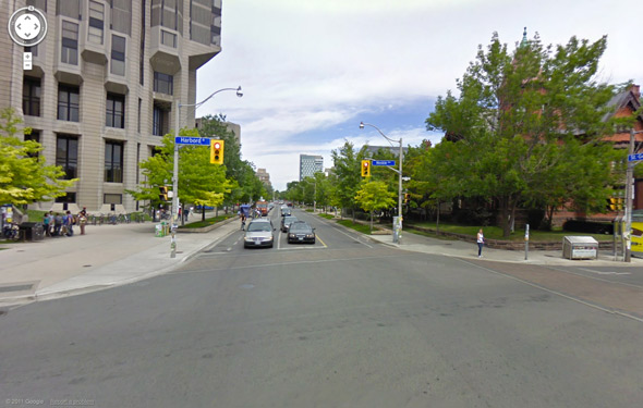
St. George and Harbord (looking north)
2011103-stgeorge-harbord-widening-1948-s0372_ss0058_it1784.jpg2011103-harbord-stgeorge-north-today.jpg

Spadina and Bloor
2011103-spadina-narrow-north-bloor-s0372_ss0058_it1890.jpg2011103-bloor-spadina-today.jpgAll photos from the Toronto Archives, and screenshots from Google Maps

Discussion

14 Comments

James / October 4, 2011 at 10:40 am
user-pic
The changes around the U of T are more dramatic because of the expansion of the university. The university used to be bounded by St George; it expropriated a massive block of land in the mid-to-late fifties to its west to build the academic buildings to the south of Harbord and then a little later Robarts and the newer buildings to the north. Since the expansion also occurred during one of the really poor periods for institutional architecture (and since later buildings, such as the graduate residence and athletic building shown at Harbord and Spadina aren't much of an improvement) the effects of the road widening are dwarfed by the architectural makeover of the sites.
casey / October 4, 2011 at 11:09 am
user-pic
wow! scotia bank has been spadina and bloor for 100 years!!!
DS replying to a comment from casey / October 4, 2011 at 11:28 am
user-pic
What's even cooler is that actually neither of the uses on the corners have really changed, with 7 Eleven being the "modern day equivalent" of the cigar/candy/variety store in the historical picture.
john / October 4, 2011 at 11:52 am
user-pic
how unfortunate.
gadfly / October 4, 2011 at 12:22 pm
user-pic
I think its fabulous!
dichotomous / October 4, 2011 at 04:18 pm
user-pic
Should have kept widening them, who cares if we had to knock down a few buildings. We need to widen all the downtown streets to 10 lanes so everybody can drive like civilized people.
Nick replying to a comment from dichotomous / October 4, 2011 at 04:45 pm
user-pic
@dichotomous and @gadfly: Riiight, then Toronto will be so desirable when it's completely paved over after all its buildings have been razed so you can circulate unimpeded in your private motor vehicles! BlogTO (or Derek), maybe you can run a series on antiquated thinking from the 1950s from the perspective of the automobile manufacturers and city planners of the time. A nice contrasting series would be one where you investigate how some cities have enabled many different (reliable) modes of transportation to allow for citizens to have a choice and to maintain a decent urban environment.
W. K. Lis / October 4, 2011 at 05:06 pm
user-pic
Not just city roads were widened. Upper Middle Road was widened, access controlled, bridged, and turned into the Queen Elizabeth Way. See http://www.thekingshighway.ca/PHOTOS/QEWphotos.htm for more info.
ronobot replying to a comment from casey / October 4, 2011 at 05:21 pm
user-pic
Erm, not quite! I think "1890" refers to the roadway, while the date of the photo is March 28, 1949. 62+ years is still a long time though. I think they have several properties like that, including College & Bathurst and the Scotiabank tower on Bay.
Gadfly replying to a comment from Nick / October 4, 2011 at 05:40 pm
user-pic
And also get your damn street car out of my way too, what a waste of space.
RJ / October 5, 2011 at 08:34 am
user-pic
Sadly the post-war widening of roads all over North America was an exercise to get cars moving faster around corners. Engineers will explain how the wider streets were not only needed for more lanes of traffic but also so cars could travel at higher speeds around curves. Meaning of course car-friendly rather than pedestrian friendly cities.
john replying to a comment from RJ / October 5, 2011 at 09:01 am
user-pic
don't blame the engineers.... they just gave the people what they wanted.
Brian replying to a comment from RJ / October 5, 2011 at 09:20 am
user-pic
Regarding the above comment re: car-friendly vs. pedestrian friendly.

The trend is always toward making concessions for more and more technology. Humans are always forced to give way so technology can move more freely. This has been the history of Western society since the Industrial Revolution. It is system that has as one of it's (possibly) unintended side effects the elimination of humans from all areas of consequence.
Nick replying to a comment from Gadfly / October 5, 2011 at 11:16 am
user-pic
@gadfly, as another commenter pointed out to you on a more recent BlogTO post, you'd not be a happy driver if the 55,000 people who used the King streetcar were in single occupancy vehicles (or if the 1.5 million trips a day on the TTC were made in cars instead). I'm not sure why you're so anti-transit: better transit improves things for car drivers, and that's why we should all contribute to improving it.

Add a Comment

Other Cities: VancouverMontreal