Huge area of Toronto untouched by developers will soon be ripe for redevelopment
Toronto's enormous $1.25 billion Port Lands Flood Protection Project is giving the city a re-naturalized Don River mouth and creating a new artificial island in the process.
The project will entirely reshape the Lower Don Lands area, unlocking former industrial lands for new development opportunities. However, areas of the city to the north will also be primed for transformation by this massive infrastructure undertaking.
According to Waterfront Toronto, the flood protection works will unlock 240 hectares (593 acres) of "prime land for development."
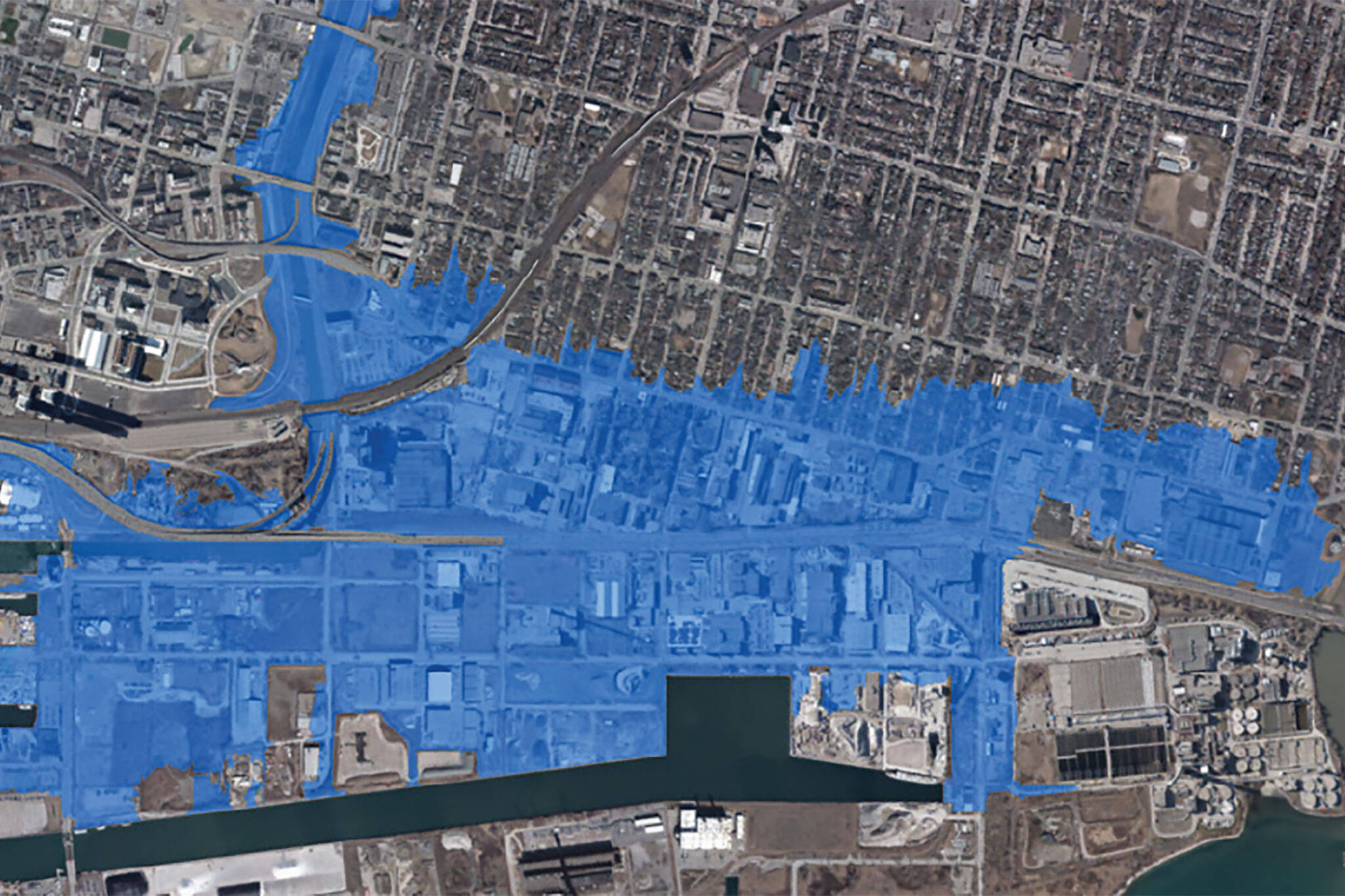
The Don River's current floodplain covers an area that stretches well beyond the Port Lands area, extending north of Lake Shore Boulevard and Eastern Avenue to include residential blocks in the South Riverdale neighbourhood.
Redirection of the river mouth to the new naturalized course being etched through the former industrial wasteland will bypass the waterway's current abrupt right-angle terminal course through the Keating Channel, further aided by flood protection works like landforms that completely re-map floodplains in the area.
Waterfront Toronto's latest five-year strategic plan, released in April, states that once the project is complete, "a large stretch of land that's vulnerable to flooding, and currently cannot be developed, will become a place where we can build new homes, public spaces and parks, allowing the city to expand in a sustainable way."
The land in question is currently largely used for industrial purposes, though the small areas of residential neighbourhoods that will be removed from the current floodplain are set to benefit from the flood protection works in the short term.
Locals in South Riverdale may feel uneasy about the prospect of their quiet neighbourhood being unlocked for higher-density development on main roads, however, homeowners on the area's side streets indeed have much to gain from the flood protection project.
Due to the south end of the neighbourhood's position on the Don River floodplain, flooded basements are a frequent issue for homeowners, and one that will be corrected once the dams are broken, and the river assumes its re-naturalized course.
Waterfront Toronto
Latest Videos
Latest Videos
Join the conversation Load comments


