Toronto expected to see coldest air in years this weekend as temperatures plummet
The worst of Toronto's winter weather woes are far from behind us, if meteorologists are correct, with Friday morning's extremely cold temperatures predicted to persist well into the weekend before even more potential snow.
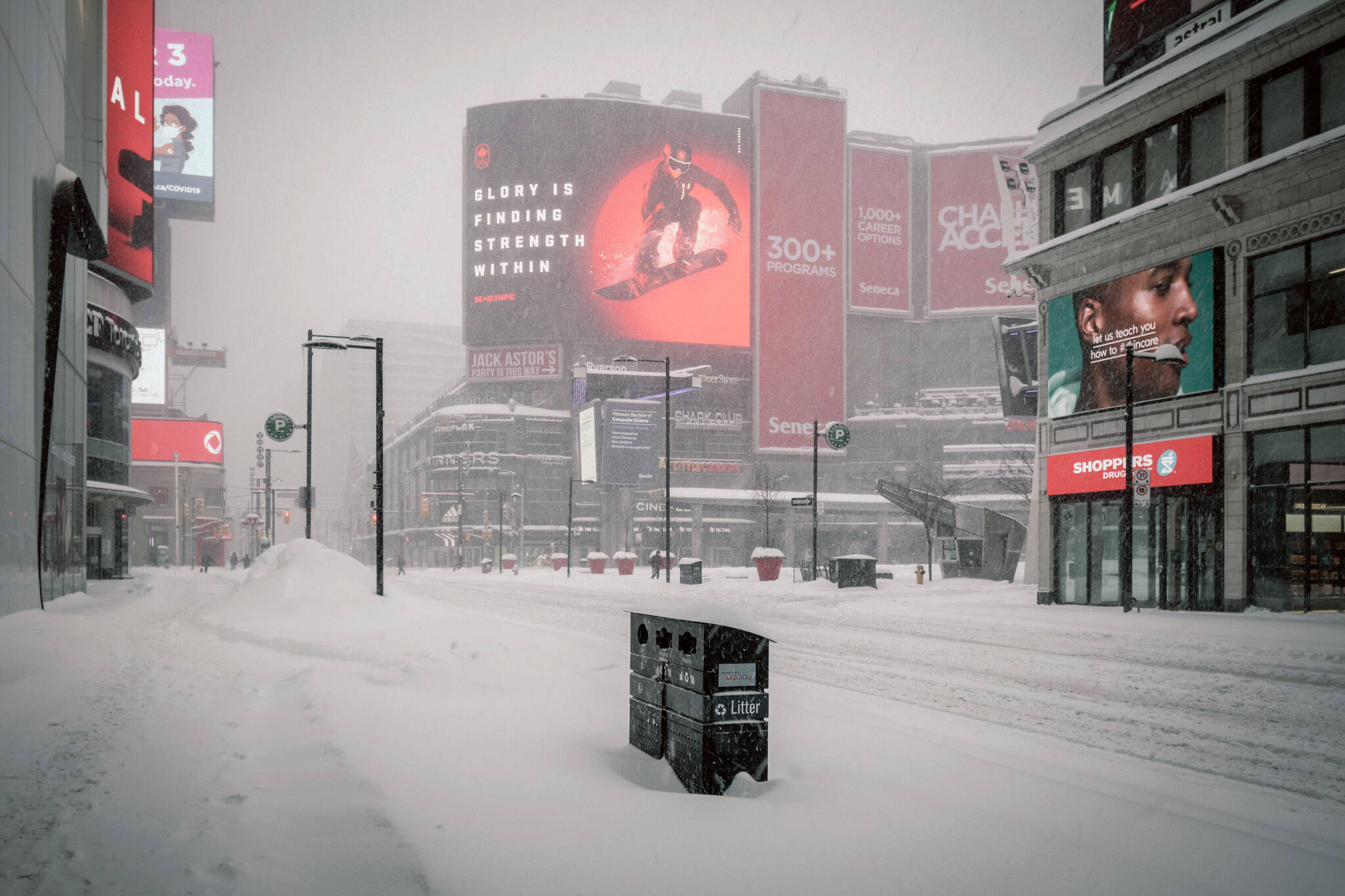
Feeling like -25 C with the windchill in the downtown core, still blanketed with snow from Monday's blizzard and subsequent storm, Toronto is feeling more like Montréal, if not Winnipeg, right now, particularly after a relatively balmy winter season so far.
Sadly for those who are having flashbacks from the record-breaking 'Polar Vortex' weather of 2014, Old Man Winter in his boss form is expected to stick around for a while.
"A deep chill parked over Central Canada will plunge morning lows to levels we haven't seen in years across parts of Ontario and Quebec," reported The Weather Network early Friday morning, warning of "extremely cold temperatures " across both provinces on Friday and Saturday.
Frigid morning - wind chill in the minus 20s! Sunny & very cold again today; Flurries across the Niagara region; Flurries into the GTA this evening/tonite; Mix sun/clouds & not as cold this weekend; Cold next week; A clipper Monday afternoon & night will bring 2-5cm of snow #onwx pic.twitter.com/fdeH18zHDN
— Doug Gillham (@gtaweather1) January 21, 2022
"Lows will dip to or below -20 C across the Greater Toronto Area, with even colder temperatures stretching from cottage country into the heart of Quebec," notes the network.
"Temperatures this cold are downright dangerous to anyone who’s outside too long unprotected. Hypothermia and frostbite can develop in less than an hour with air temperatures between -25 C and -30 C."
Fittingly, Toronto has issued an Extreme Cold Weather Alert for the city to activate vital services and "ensure Toronto residents take necessary precautions to stay safe from the cold."
Temperatures are forecast to rise slightly on Saturday afternoon amid some sunshine and a chance of flurries, only to dip right back down as a cold front rolls across the Great Lakes region, and beyond that... it's not looking great.
Extremely cold temperatures will cover parts of Ontario and Quebec through Saturday morning, potentially bringing the coldest air in years to some communities.https://t.co/UBvXt2nzIt
— The Weather Network (@weathernetwork) January 21, 2022
Meteorologists say that a "persistently cold pattern" should take hold across Ontario over the next week, keeping both daytime and nighttime temperatures below normal seasonal values.
And then there's the possibility of yet more snow for our already-struggling, snow-covered city — though it's hard to say how much yet.
"A clipper system could arrive in southern Ontario early in the week, with a preliminary snowfall forecast for 2-5 cm for much of the region. Another round of lake-effect snow squalls looks to accompany an additional blast of Artic air by mid-week," reports the Weather Network.
"A bigger pattern change is expected for the start of February, as the frigid weather will shift back to western Canada and remain there for the month. While the pattern will definitely be milder than what we are seeing for the second half of January, it is possible that early February will also include some high impact and messy storms."
Latest Videos
Latest Videos
Join the conversation Load comments