New maps on TTC subways show the entire streetcar network
The transition from underground to the harsh outside world may be especially difficult due to all the snow lately, but the TTC is attempting to at least make the transition from subway to streetcar a little easier to understand.
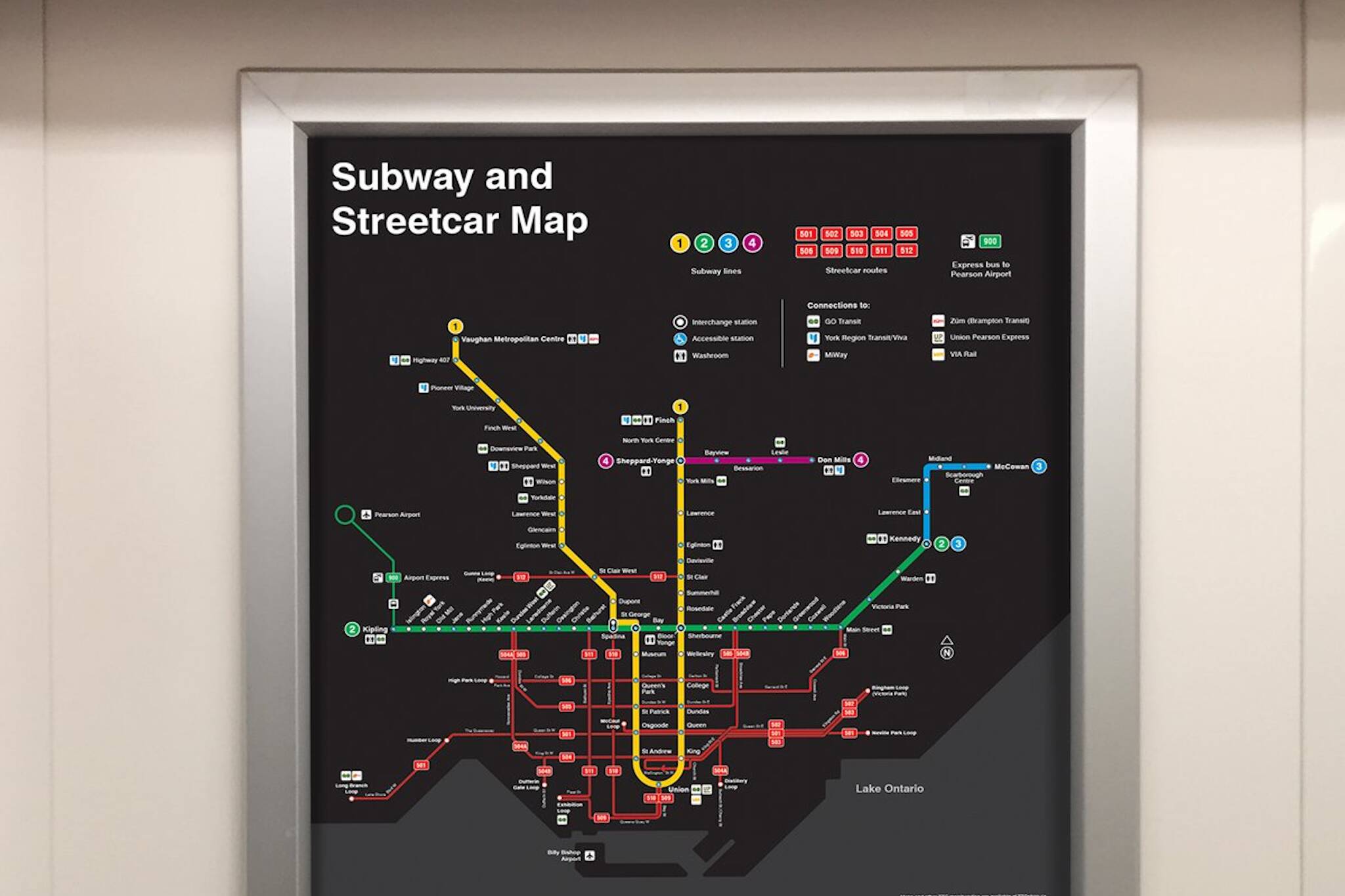
New subway and streetcar maps are being rolled out on Toronto’s subways this week, detailing our city’s entire network. That means not only subways, but streetcars too.
Ultimately collapsing the two rail systems into one map is easier to read than including all bus routes as well, which are outlined on the TTC’s website and in the paper ride guides available on vehicles and in stations.
Starting this week, you may notice new Subway and Streetcar Maps rolling out on subway trains. The new maps show our entire rail network, including streetcars, helping customers to make better connections. Look out for these maps the next time you ride a #TTC train! pic.twitter.com/b2h8JMYDay
— TTC Customer Service (@TTChelps) February 13, 2019
Some are complaining that the maps might not have been the thing that needed fixing about the TTC, but baby steps, Toronto, baby steps.
If you’re looking on the bright side and enjoy the bold, clean design of the new map, it should soon be available to purchase from the TTC online shop.
Latest Videos
Latest Videos
Join the conversation Load comments