
What Lake Shore Boulevard used to look like in Toronto
Lake Shore Boulevard, known mostly for snarled traffic and concrete falling from above, is actually one of Toronto's most interesting — dare I say, even beautiful — streets. Should you doubt such a statement, take a night drive along this perfectly urban corridor and report back. Start at Cherry Street in the east, curl under the Gardiner and then shuttle across the city tucked under the expressway above until you emerge just before Bathurst and eventually see the water to your left, now rolling along a gently winding promenade that delivers you at the Princes' Gates such that you're forced to acknowledge that this boulevard remains aptly named.
It may no longer continually hug the water as it once did, but there remain long stretches that run in close proximity to the shore, offering views of Toronto that are unmatched on any other street in the city. Various infill projects and the arrival of the Gardiner Expressway have re-routed the road over the years at the expense of a residential element throughout its central portion, but it's still the main drag in Mimico, New Toronto and out to Long Branch. When it hits Mississauga the Boulevard tag is replaced with Road, before it dips closer to the water, a tree canopy forms, and the houses get more and more opulent on the way to Oakville.
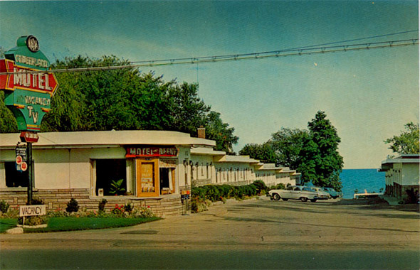
When the Gardiner was built in the early 1960s, Lake Shore changed profoundly. Aside from the more obvious alterations — its effective burial under a highway and the complete reorganization of Sunnyside — the eventual demise of the motel strip that once stretched from the the mouth of the Humber River to beyond Park Lawn Avenue remains one of the most significant.
In its heyday, the area boasted some 20 motels outfitted with neon signs, heavily advertised colour TVs, rotary phones, unheated swimming pools and, of course, sprawling lakefront vistas. A five minute drive from Sunnyside, this was a legitimate tourist hub: close enough to downtown Toronto to make an easy day trip but with the requisite distance to feel like a vacation destination. When the east-lying amusement park was bulldozed, the writing was probably on the wall, even as the majority of these transitional spaces endured through a crime-riddled period in the 1970s and '80s before eventually giving way to the condo boom still chugging along today.
Oh, those old motels along Highway 2. The Beach, Shore Breeze, Rainbow, Casa Loma and Casa Mendoza, The Palace, Cumberland, and Hillcrest (to name only a few) are all gone now, which is less cause for sadness than a sort of inquisitive nostalgia. What was this place by the lake, so bustling with activity when the city itself was notoriously dull?
Running its southerly length across Toronto, Lake Shore has witnessed, more than most streets, the curious play of of centripetal and centrifugal forces that shape the city as we know it today. Who knew, for instance, that the still elegant-looking Palace Pier condos would eventually play anchor to a densely populated high rise strip?
The story of Lake Shore is the story of Toronto, as only makes sense given its crucial location. Let us consider this as we zip under the Gardiner and wonder after the context of our surroundings.
PHOTOS
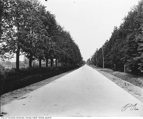
Lake Shore Road near Oakville (looking west), 1925
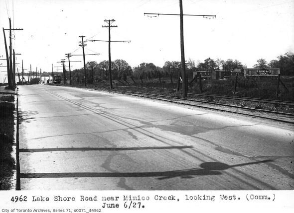
Lake Shore near Mimico Creek (looking west), 1927
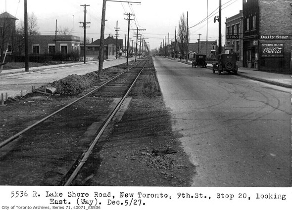
Lake Shore and 9th Street in New Toronto, 1927
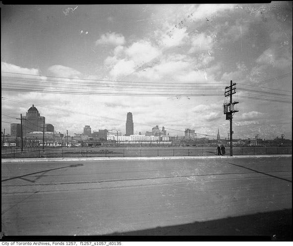
Toronto Skyline from Lake Shore Boulevard, 1930s
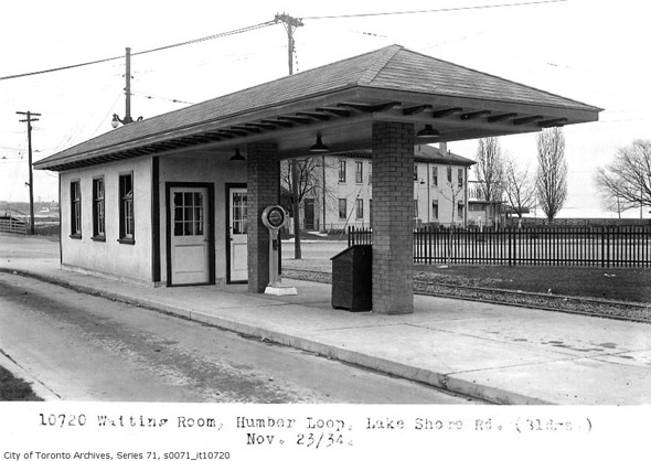
Humber Loop, 1934
Above Sunnyside, 1949
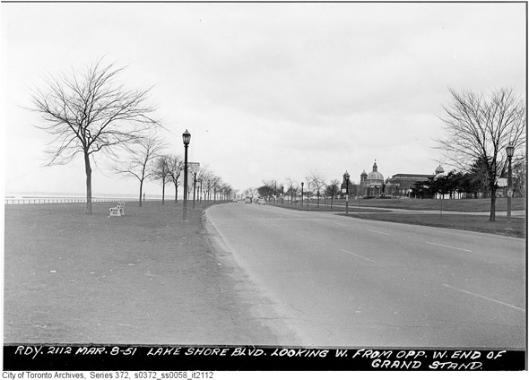
Lake Shore Boulevard west of Strachan, 1951
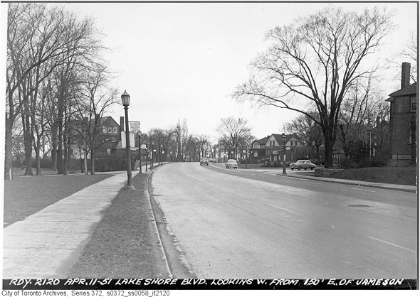
Lake Shore looking west to Jameson, 1951
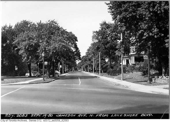
Looking north up Jameson from Lake Shore, 1951
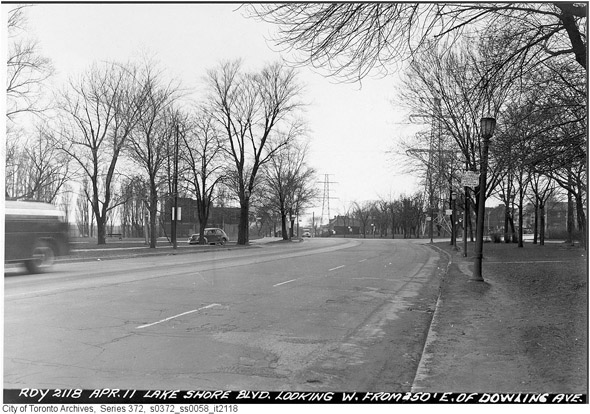
Lake Shore looking towards Dowling Avenue, 1951
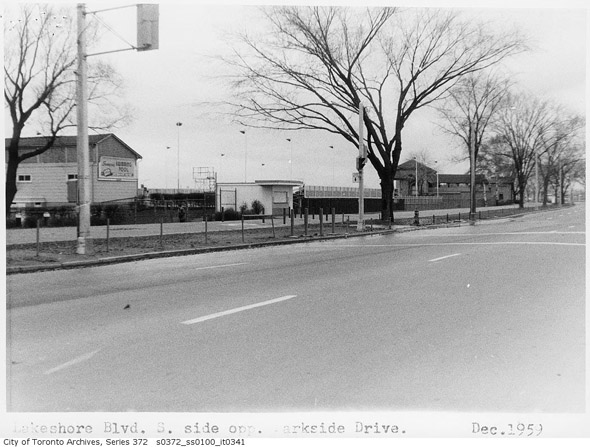
Lake Shore at Parkside, 1959
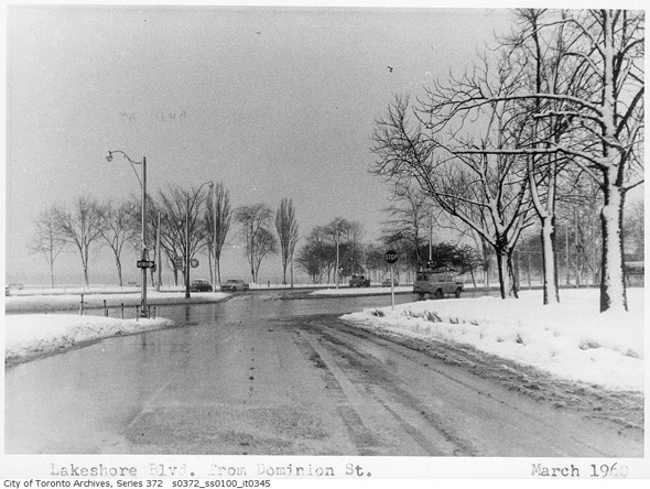
Lake Shore and Dominion, 1960
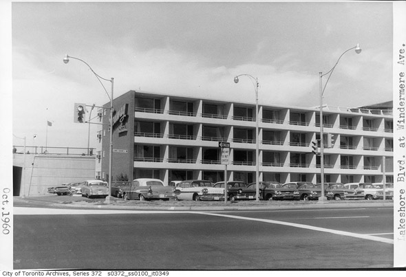
Lake Shore and Windemere, 1960
Lake Shore and Bathurst, 1960
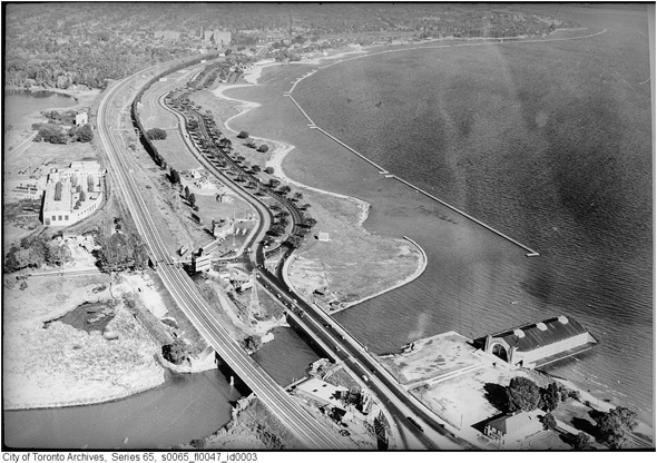
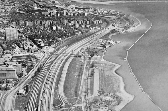
Aerial of Gardiner Expressway being built, early 1960s
Lake Shore near Carlaw, early 1960s
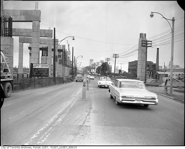
Lake Shore near Cherry Street, early 1960s
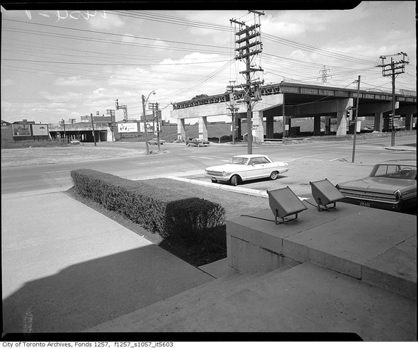
Lake Shore and Jarvis, early 1960s
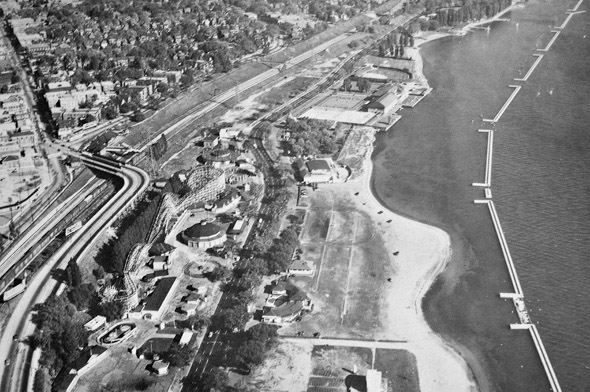
Above the former Sunnyside Amusement Park, 1969
Cumberland Motel, date unknown
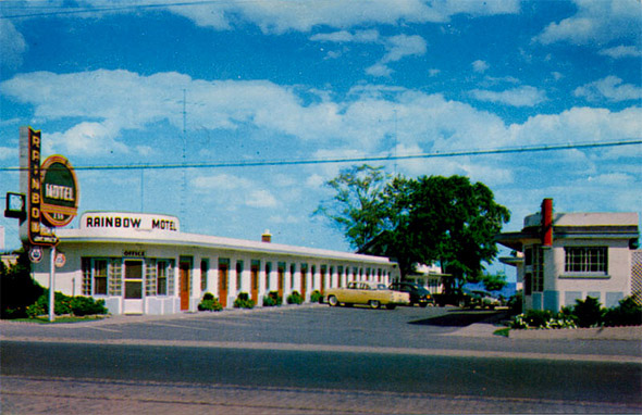
Rainbow Motel, date unkown
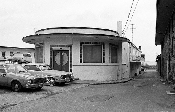
Palace Motel, 1983
Photos from the Toronto Archives (with the exception of the postcards)


