Explore the complex history of Toronto with this map
In 2012, Wendy Smith became curious about the owner of the laneway behind her Harbord Village home. After digging through the provincial property records, Smith came up with a name: "F. W. Jarvis." One of her neighbours, she assumed, because the same person also owned the narrow alleys in the Victorian terrace.
Not quite.
What Smith found out about the mysterious F. W. Jarvis and the history of early Toronto became the inspiration for a Heritage Toronto Award-winning interactive map of the city, The Toronto Park Lot Project.
"It turns out that F. W. Jarvis was sheriff Frederick William Jarvis, who died in the 1870s," Smith says. "He was a cousin of [assistant secretary of Upper Canada] Jarvis and the well-known Jarvis clan [of Jarvis St.] That got me curious ... everything I read game me more questions."
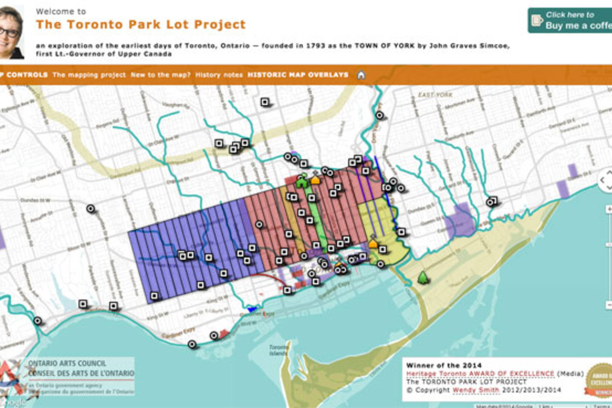
Launched in 2012, Smith's map overlays modern Toronto with insightful historical morsels discovered in the course her research, like the location of lost creeks, the ancient shoreline of Lake Iroqouis, the original 10-block street grid between Adelaide, Front, Jarvis, and Berkeley, and First Nations portage trails.
"It's historical geography," Smith says. "This project was always for me a study guide. I have a couple of books I'm working on ... and as I learned stuff I put it on the map to help me remember it and to put some visual aids to what I was learning ... as I get interested in something, it goes up on the map."
The Park Lot Project gets its name from the 32 narrow fingers of land that were granted to important members of Upper Canada society in the late 1790s. The rural 100-acre plots were only about 200 metres wide, but each one stretched between modern day Queen and Bloor streets, a distance of about 2.1 kms.
The park lots were granted by York founder John Graves Simcoe and his successor, Peter Russell, in an attempt to lure worthies to set up home in the town. For a time, Queen was called Lot Street after the pieces of land, which were eventually subdivided and sold off.
Smith's map allows users to add and remove overlays, making it possible to compare the park lots with the current street grid and important historical landmarks. Those interested in the various lost waterways of Toronto will find a rich source of information, so too will those curious about the origins of street names. It's a great tool to just play with.
If you like it, Smith says, consider donating. Web hosting and other fees tend to add up. Information is welcome, too.
"Sometimes people click the contact button and send me information about their family, their neighbourhood, a little bit of history that they grew up with. I really love those days."
Chris Bateman is a staff writer at blogTO. Follow him on Twitter at @chrisbateman.
Latest Videos
Latest Videos
Join the conversation Load comments


