Toronto just launched its own maps app letting you look back in time to the 1930s
Your computers and mobile devices can play the part of a time machine thanks to a new mapping application from the City of Toronto that allows you to view the city as it appeared in generations past.
The easy accessibility of satellite imagery is taken for granted these days, and you can view everything from far-away cities to secret military installations like Area 51 with just a click or touch of a screen.
Before this era of readily-available aerial views, top-down views of cities were photographed from aircraft for reference by city planners and officials, leaving Toronto with a historic archive of aerial photography, that, until now, has only been accessible in piecemeal, hard-to-navigate batches.
This new City of Toronto-created app is actually the third such platform allowing users to easily scan aerial views of the city with photos going all the way back to 1931.
The new Toronto Maps application is here and it includes decades of imagery, dating back to 1931. Explore different areas of the #CityOfTO like the CN Tower and Rogers Centre and see they’ve changed throughout the years.https://t.co/lcoSMES41w pic.twitter.com/exE5PVi0TB
— City of Toronto (@cityoftoronto) June 19, 2023
The first such platform came in the late teens, when Sidewalk Labs gifted Toronto with a service mapping archival aerial photography. Sidewalk Labs would later pull out of the controversial Quayside community, and the page was ultimately scrubbed from the internet.
A replacement was launched in 2022 by creator and cartographer Jeff Allen, though this platform was limited to views captured in 1954, 1965, 1978, and 2011 sourced from City archives.
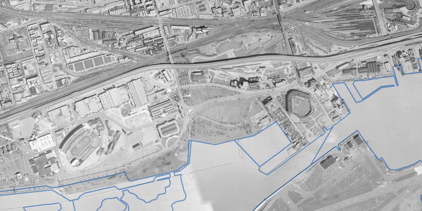
A 1965 aerial shows two of Toronto's lost sports venues in Exhibition Stadium (L) and Maple Leaf Stadium (R).
The version launched by the City of Toronto takes the aerial time machine feature to the next level, offering aerials of the city from 1931, 1939, 1954, 1965, 1978, 2005, 2009, 2011, 2015 through 2018, and 2020 through 2022.
This is seriously great work. It seems to be pretty smooth for me using it on my tablet.
— Keith Marshall (@NeverKieth) June 20, 2023
Any chance of getting official plan designations / zoning added? The old interactive tool for this is less than ideal.
But the historic aerials are only one of the interactive elements in this relaunched mapping tool. You can also customize map layers, draw in your own shaded and coloured areas to create visual assets, and share links for your custom search filters and layers.
City of Toronto
Latest Videos
Latest Videos
Join the conversation Load comments


