The risk of forest fires in Toronto is currently considered extreme amid Ontario blazes
As authorities in more northerly areas of Ontario deal with apocalyptic-looking scenes as they battle multiple out-of-control forest fires, other parts of the province — including even Toronto — have been deemed at "extreme" risk of having blazes of their own.
An interactive map from the Government of Canada's Canadian Wildland Fire Information System shows current fire danger classifications across the country, with the Yukon, Newfoundland and Labrador, most of Manitoba, and other chunks of the country listed as having a low risk of fires.
On the other end of the five-grade spectrum are swaths of B.C., southwestern Northwest Territories, Quebec and, yes, Ontario, which are coloured red and considered to be at extreme risk of forest fires at the time of publication (if not already aflame).
Out-of-control wildfires are causing devastation in Ontario right now https://t.co/imrk1UUKGJ #Ontario
— blogTO (@blogTO) May 31, 2023
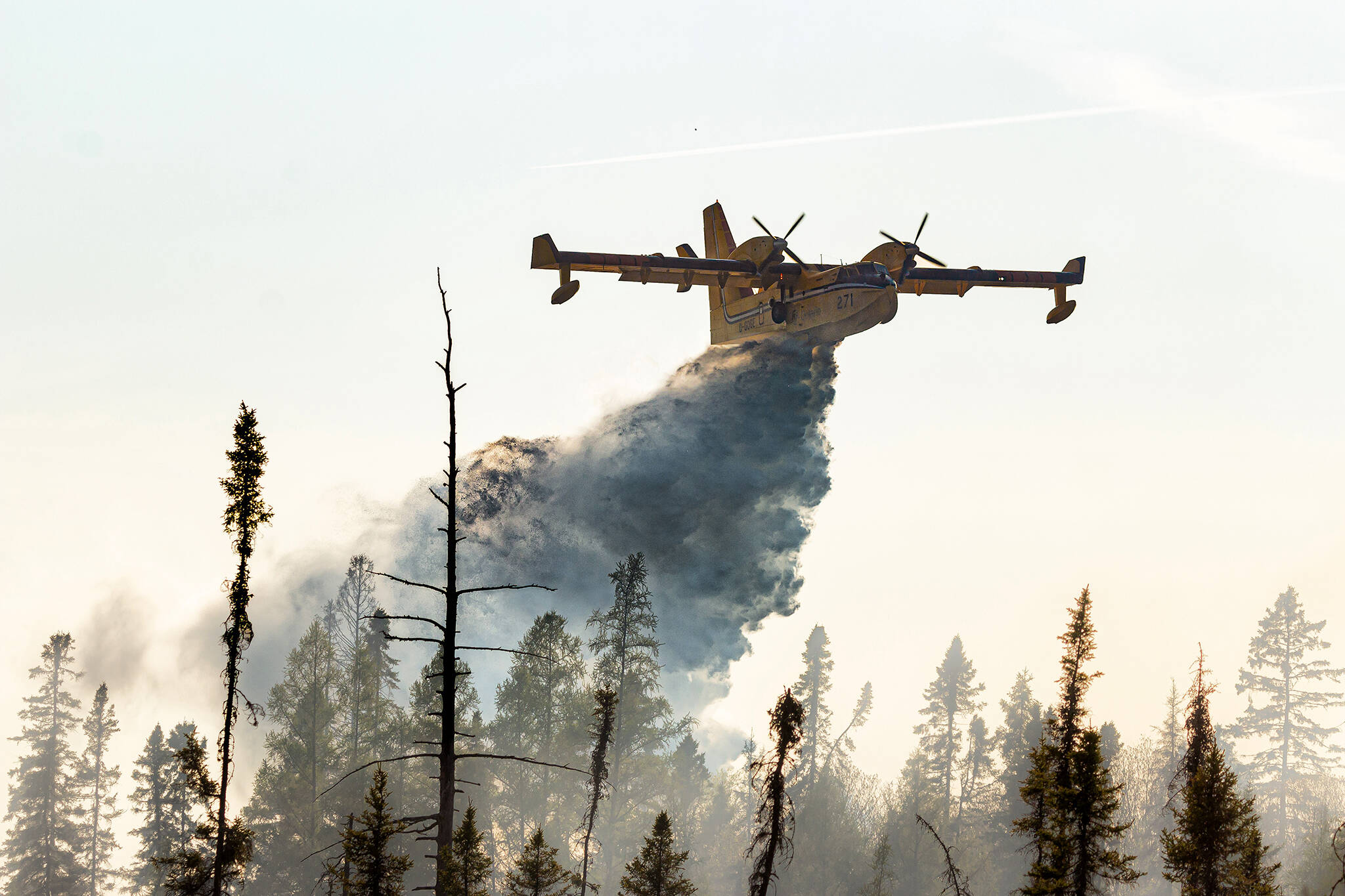
In Ontario, the red zone covers everything from Ottawa north to Quebec, and a chunk of the middle of the province, including Timmins and the Cochrane area, which are already burning.
Dryden, Red Lake, Sioux Lookout, Wawa, Kirkland Lake and Sudbury are also home to some of the province's 12 active forest fires, some of them under control and some of them not.
There is one #fire of note in the Sioux Lookout District. Sioux Lookout 7 is located north of Cat Lake First Nation and has been spreading in a northerly direction away from the community. Currently measuring 9285.1 hectares this fire is not under control. pic.twitter.com/vfay8Y0puB
— Ontario Forest Fires (@ONforestfires) June 1, 2023
While most of the cities and towns directly east and north of Toronto are currently considered at high risk of fire, the north part of the city itself is indeed in the extreme risk category.
This comprises North York and northern Etobicoke and Scarborough, as well as Brampton, parts of Pickering and Ajax, and suburbs up to Richmond Hill, Markham and reaching just north and west of Barrie.
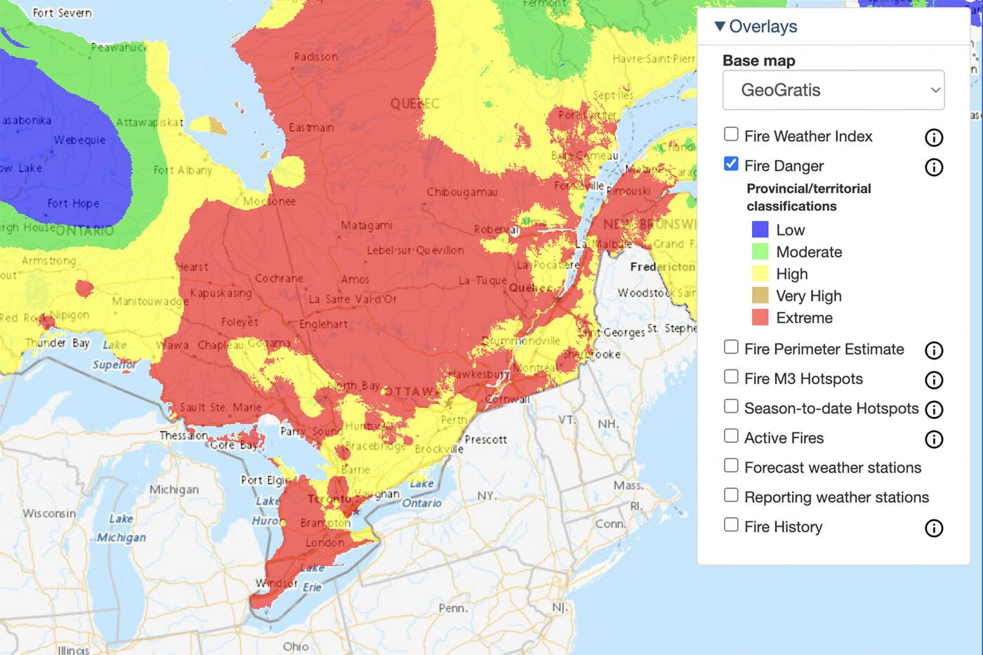
The CWFIS's interactive map showing how high the risk of fire danger is in Ontario on June 1.
Oakville, Kitchener, Burlington and Milton are all high risk, and the entire southern tip of Ontario — including London, Cambridge, Brantford and Windsor — is at extreme risk.
As the government states, the measurement is "a relative index of how easy it is to ignite vegetation, how difficult a fire may be to control, and how much damage a fire may do."
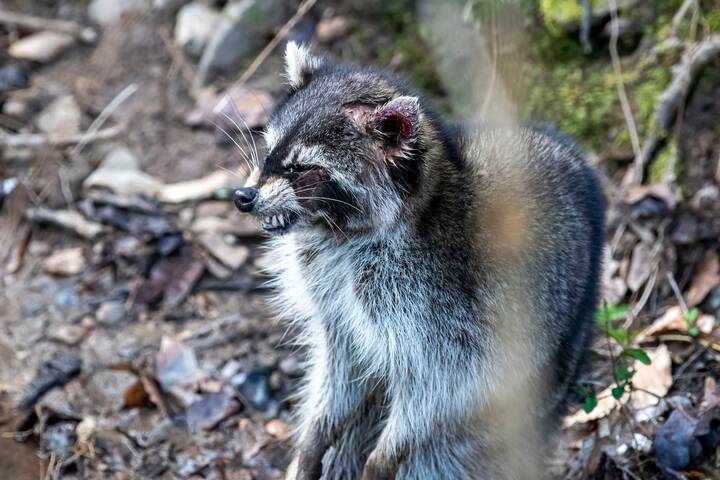
While fires are a natural occurence and are actually often good for the environment when monitored, extreme risk areas have the potential for "fast-spreading, high-intensity crown fire. Very difficult to control. Suppression actions limited to flanks, with only indirect actions possible against the fire's head."
A Restricted Fire Zone is in place for the entire Northwest Region (Zones 1-13) due to an extreme forest fire hazard. Outdoor fires are not permitted. Contact your municipality for burn bylaws or fire bans. More info and the detailed RFZ boundaries at https://t.co/hjyNBmO48D pic.twitter.com/MPvkH2tLZz
— Ontario Forest Fires (@ONforestfires) June 1, 2023
The Fire Weather Index, another measure of fire danger that takes into account temperature, humidity, drought, moisture, and more for potential fire spread, is also high in the majority of the eastern half of Ontario, which has an index of 20-30, the second-worst class of five.
Environment Canada issued both a heat warning and a special air quality statement on Thursday advising residents of high temperatures around 30 C that will feel closer to 35 C with the humidity, paired with deteriorating air quality rated 7 out of 10+, or high risk.
Toronto placed under air quality statement warning of high risk to health https://t.co/yLuE7TmUna #Toronto
— blogTO (@blogTO) June 1, 2023
People in the province are encouraged to stay fire-smart if and when they have campfires this season, which should only be when and where permitted.
Latest Videos
Latest Videos
Join the conversation Load comments