
How to spot a lost river in Toronto
I live at the bottom of a river. Or at least I would if this was 1906. The signs are all over the neighbourhood: Highfield Road, a couple of blocks east of Greenwood and Gerrard, sits at the bottom a wide basin with steep banks at either side. Round here, streets dip and rise unexpectedly; adjacent houses sit at drastically different elevations.
The stream still flows, though it's been buried, contained, and diverted since the Ashbridge Estate, a sprawling farm that used to occupy the land, was subdivided in the early years of the 1900s. Listen to the drains on Woodfield Road just south of Monarch Park and the roar of caged waterway is still clearly audible en route to the Ashbridge's Bay Wastewater Treatment Plant.
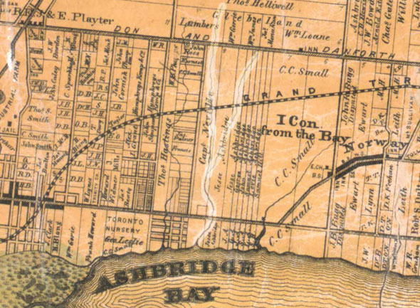
In 1794, the original Ashbridge family, Pennsylvania farmers who were granted a substantial plot of land east of the Town of York, largely stripped their narrow allotment of its native hardwood bush from Danforth Ave. to the bay that now bears their name, planting an orchard, laying fences, and sowing fields.
The family, led by the widowed Sarah Ashbridge, who was already in her sixties when she left America, were highly industrious and remained on the land for five generations. Jesse Ashbridge, a grandson of Sarah, built the family home that still stands on the north side of Queen Street, east of Greenwood.
Before the Ashbridges, the land contained a longhouse and hearth used by local aboriginal people around AD 1100 to 1200. Archaeological digs have turned up some 48,000 artifacts, mostly pottery fragments, across the area.
A small stream with two distinct branches ran sporadically spring along the property's western edge, merging into a single flow just east of Dundas and Greenwood, before winding its way in a shallow depression to a mouth roughly where the TTC yard backs on to Eastern Ave. today.
The dimpled front lawn of Jesse Ashbridge's Regency-style house is further evidence of the lost stream. Here, at its widest extent, the family would paddle down the creek and out into the bay.
As far as records of the Ashbridge Estate and old maps reveal, the little waterway, which was often no more than a frozen trickle in winter, did not have a formal name. A history of the estate that contained several photos, published in 1912 by Wellington Thomas Ashbridge, Jesse Ashbridge's son, referred to it as "the creek."
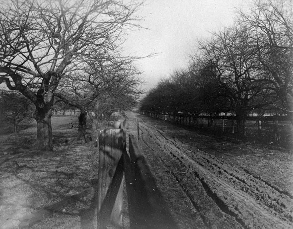
In his words, the photo above "shows in the distance Lake Ontario, while the old farm with its snake fence, the creek valley, and the house with the high elm trees may also be traced by close examination. The dog in the foreground is old "Mike," of well known local memory. This view was taken of what we used to call the "stump field," being on the present site of Morley Ave. [Woodfield Rd.], a little south of the G.T. Railway."
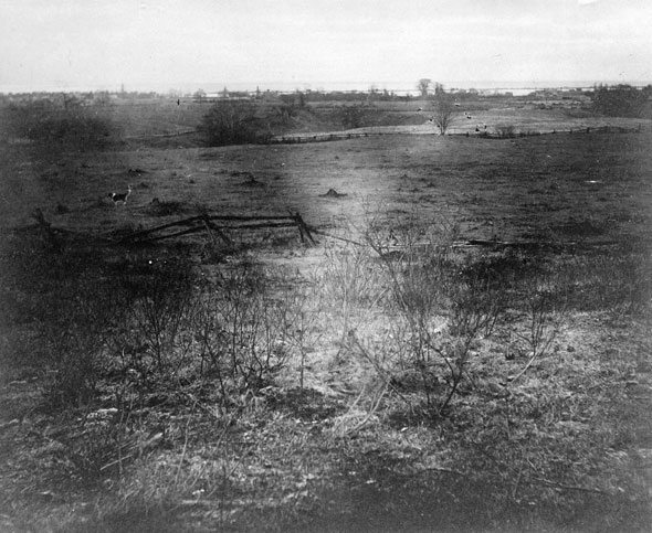
Contrast that with the view today (below) and plenty has changed. The creek valley, visible as a depression in the left side of the frame, has been channeled into a sewer structure and buried. The Ashbridge Estate, which was subdivided out of existence shortly after the first photo was taken, is unrecognizable with the addition of homes and streets.
A little north, in Monarch Park, the land shows the distinctive crumples and depressions of the lost river. It was here, according to early maps, that one branch of the creek flowed on its way south. The other branch started further north, just above the Danforth but seems to have been erased by gravel mining adjacent to Greenwood Ave.
The best evidence for the survival of this lost river whispers on the air during the walk south down Woodfield Road from the park. The creek (or at least what sounds like the creek - it flows night and day year round) splashes in the darkness some metres below a steaming manhole cover in the middle of the road.
The Mid-Toronto Interceptor Sewer, a 13.17-km crosstown sewage highway, was built in the 1970s from the northeast corner of High Park to Ashbridge's Bay. Its 3-metre diameter concrete-lined pipe scoops up the Ashbridge Estate stream when it meets Gerrard St., preventing it from continuing through its old valley to the bay.
The river paddled by some of Toronto's earliest pioneers is now a carriage for its sewage.
MORE IMAGES:
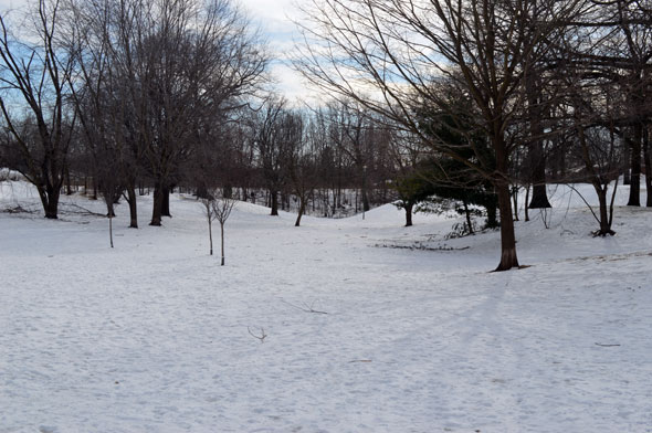
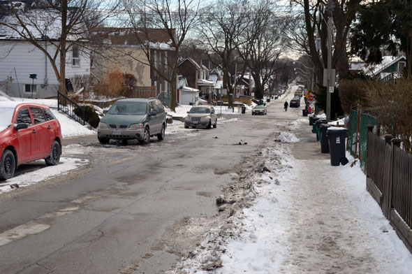
The ground in Monarch Park, where the stream used to flow.
Chris Bateman is a staff writer at blogTO. Follow him on Twitter at @chrisbateman.
Image: Toronto Public Library, Chris Bateman/blogTO


