City
What King West looked like in the 1980s
The King West of the 1980s was a remarkably different place than today. One of those areas that's undergone an almost complete transformation, prior to a condo boom that kicked off in the late 1990s, for over 100 years the street was dominated by Massey Ferguson, one of the world's leading manufacturers of agricultural equipment. The Toronto Works of Massey Ferguson took up much of the area along King West from Bathurst to Sudbury Street as far back as the late 19th century when the company was Toronto's leading employer.
This ain't no Distillery District. Although a few signs of the former industrial character of the area remain, when the area was re-zoned for residential development in 1996, warehouse conversions weren't at the top of the list. And that's why these images, which might not seem particularly remarkable on the surface, are nevertheless fascinating.
Behold King West in the 1980s, before it all changed.
Update (4:40pm):
Local resident and history buff Colby Bayne has been kind enough to provide us with captions for the images.
Lead: Looking east towards Strachan. The two buildings are now King West Place at 901 King St W (Shoppers Drug Mart, CAMH Offices, etc) The closer building is now 905 King St W. Of note, the large plaque is a memorial to the Massey Harris workers lost in WW1 and now located on the east wall of the Massey Harris Building (915 King St W).
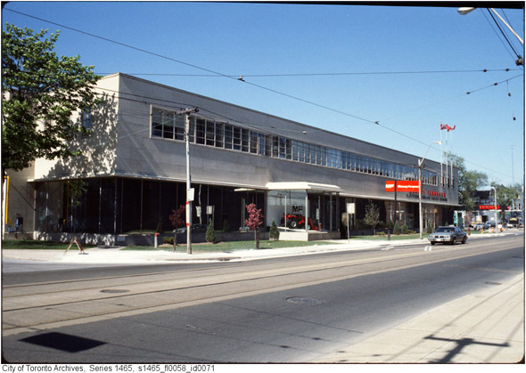
The Massey Ferguson head office, now King West Village Lofts, located on the north side at 954 King St. W (between Crawford and Massey St.)
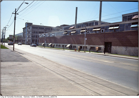
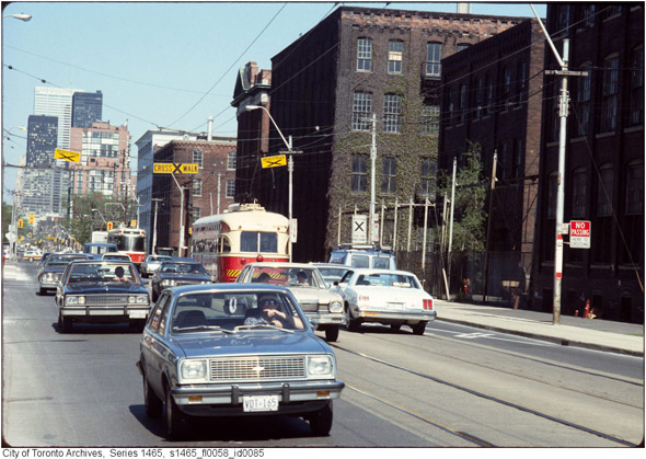
Looking east along King St. W at approximately Sudbury St.
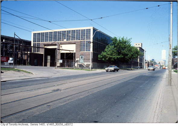
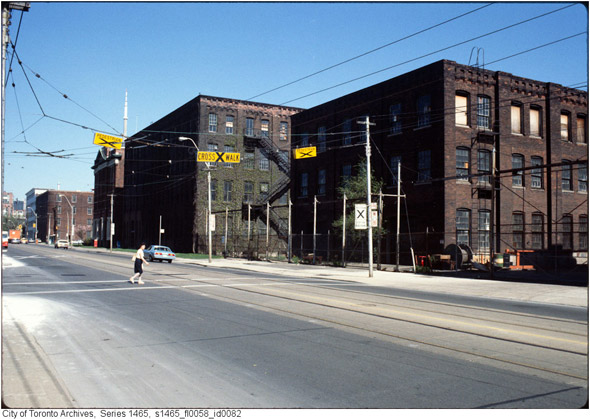
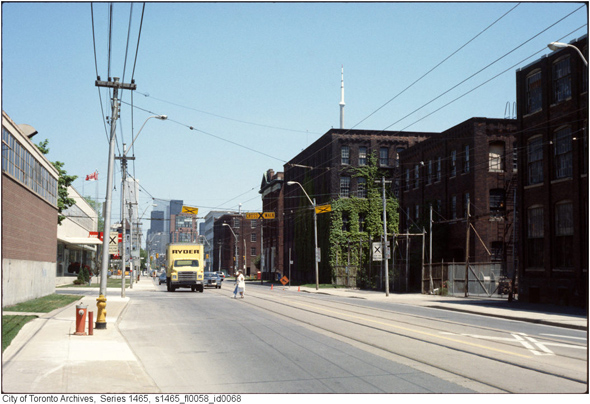
Looking west along King St. W at approximately just east of Shaw.
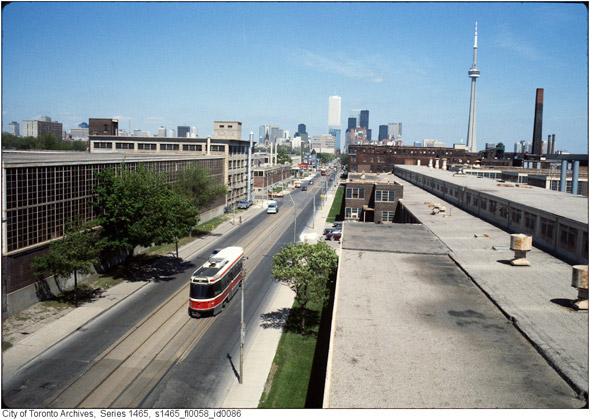
Looking east along King Street from approximately Shaw St. This would be a view from what is now The Electra Lofts at 1029 King St W.
Looking east along King Street at Crawford Street. The two closest buildings are now Massey Harris Park. The 3rd is now the Massey Harris Lofts at 915 King St. W.
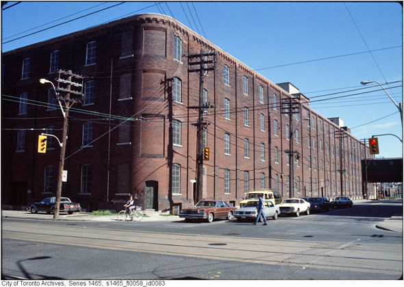
The south east corner of King St. W and Strachan Avenue looking south.
Looking east along King St W from approximately Shaw St.
Looking west along King Street at Crawford Street. The two closest buildings are now Massey Harris Park. The third is now the Massey Harris Lofts at 915 King St. W.
Looking east along King Street at Crawford Street. The 3 closest buildings are now Massey Harris Park. The 4th is now the Massey Harris Lofts at 915 King St. W. The north side buildings are now 1000 and 954 King St W.
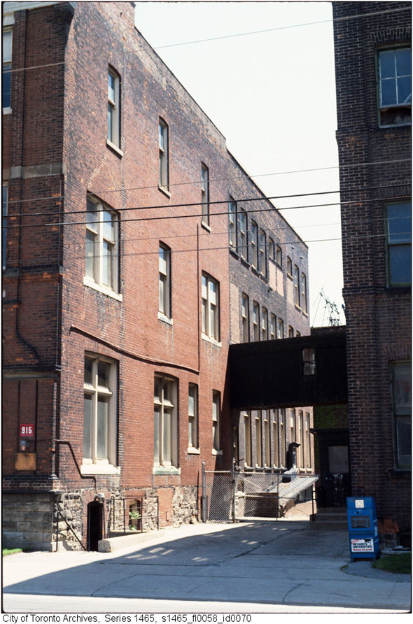
The building to the left is the former Massey Harris head office, now the Massey Harris Lofts at 915 King St W. The building to the right is now part of Massey Harris Park.
Unidentified building interior.
Update (9:20 a.m.)
Here's a Google Street View capture of the street as it (mostly) is today for a little context:
Photos from the Toronto Archives


Discussion
26 Comments
Sort By Oldest First / Newest First
Subscribe
It ain't changed much from these photos.
Wow Derek, you've done it again... such an amazing article.
Can you do a series next on how sidewalks are still made of cement? Some pictures will probably help hammer home the point
When it was free completely free of the asshats that inhabit it today.
Nice post. I used to live in DNA at Shaw/King and never remembered what that stretch used to look like as a kid. No wonder. Definitely forgettable. I always wondered too why the whole Liberty Village Dev. didn't save some of the buildings that used to exist, and now from these pics it's easy to see why.
@AV If you'd like to submit a draft of your proposed article, I'll take a look at it!
When I used to take the TTC downtown to my job at Bay/College, I would have to wait for 2 or 3 streetcars to pass by at 7:30 in the morning, just so I could stand on the bottom stair! I can only imagine how bad the wait times are today.
The area is a microcosm of everything the city has done wrong, from lack of lane widening (yes, that again) to not building the Queen subway when they should have, to blaming everything on the automobile when it's really the dozen or so train tracks that cut the city in half that are the problem (Liberty Village is literally an island!).
What bone-headed city planner authorized the twin bank towers (one being the former head office for Central Guaranty Trust) being built in the late '80s on the corner of Strachan/King? They are so close together that the TTC buses can't even make the corner properly! Single lane Strachan, then dump 50,000 people south of King St. Brilliant, just brilliant.
I pity anyone living in the area today.
New streetcars don't count. They just enable MORE people to sit stranded in walking-pace traffic.
http://torontobefore.blogspot.com/2009/02/zooming-by-massey-ferguson.html
Dumb move IMO knocking down historic buildings...
Why not renovate them? It would have been a lot more appealing than just having more generic looking condos going up...
(looks like a light stone monument with a brass plaque)
also, it's wild how similar the actual street surface looks form then to now.
you can see where most of the buildings fit.
http://www.trainweb.org/oldtimetrains/CPR_Toronto/parkdale_yard.jpg
also, you can see the buildings in MUCH better detail here:
http://www.trainweb.org/oldtimetrains/CPR_Toronto/parkdale_aerial.htm
These shots are indeed King West, east of the underpass.