Toronto's next cool bridge now headed via barge to the waterfront
A component in Toronto's next road bridge is steaming towards the waterfront via barge, soon to be installed over a section of river valley that doesn't even exist yet.
A series of four sleek, futuristic bridges are being built as part of the City's $1.25 billion Port Lands Flood Protection project, making news for their standout designs since first revealed in 2018.
First came the Cherry Street North bridge, arriving last year. This bridge will eventually carry a realigned Cherry Street to the new Villiers Island being formed.
The Commissioners Street bridge was the second bridge to make an appearance back in May.
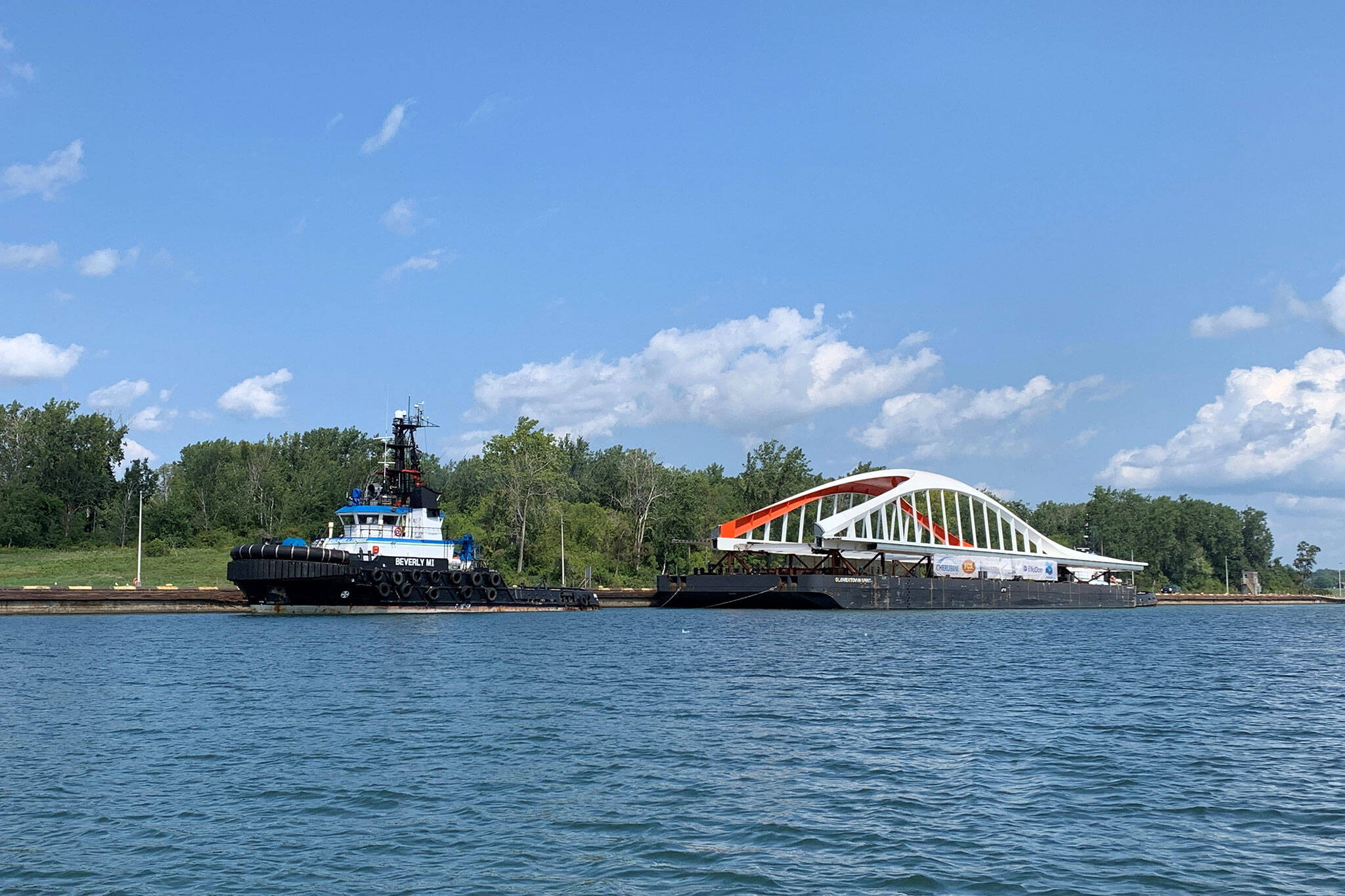
The longest in the group of bridges coming to the Port Lands, the Commissioners bridge required delivery in two separate sections.
The first half of the Commissioners Street bridge was delivered by barge down the St. Lawrence Seaway before making an overland crawl to its final position. Three months later, the second half of the Commissioners Street bridge is cruising towards Toronto.
#BridgeWatchTO: The east half of the Commissioners St. Bridge has reached Lake Ontario!
— Waterfront Toronto (@WaterfrontTO) August 27, 2021
Thanks to Mark Seguljic who sent in these photos of the bridge as it passed through the Snell Lock yesterday. pic.twitter.com/ZrUuvWja09
This western half of the bridge currently floating towards the city weighs a hefty 650 tonnes and measures 83 metres long. When combined with the already-delivered east side, the full bridge will span 152 metres long and weigh 1,210 tonnes.
Waterfront Toronto has been closely tracking the bridge's voyage from Dartmouth, Nova Scotia to the Big Smoke with the #BridgeWatchTO hashtag on Twitter.
The bridge section departed on August 20th and crossed through the Snell Lock yesterday, emerging from the St. Lawrence Seaway and entering Lake Ontario for its final leg.
Friday Photos: Highlights of the journey taken by the west half of the Commissioners St bridge on its way to TO in May. Its other half (the east portion) set sail last night!
— Waterfront Toronto (@WaterfrontTO) August 20, 2021
Think you know the bridges? Test yourself in our IG Stories! https://t.co/gF1fqSeCex#PortLands2024 pic.twitter.com/48RI1HfAOy
Anyone searching for the bridge site on a map might be puzzled to find that the entirety of Commissioners Street runs on level ground.
So why is a bridge being built here at all?
We're looking at what might be the very first case in Toronto history where a bridge comes before the river it crosses. The Port Lands Flood Protection project is etching out a new naturalized Don River Valley mouth.
New bridge infrastructure is needed to access Villiers Island, which will be created the moment the dams are broken and water pours into the re-naturalized valley.
Waterfront Toronto
Latest Videos
Latest Videos
Join the conversation Load comments


