Toronto's artificial river is almost ready and the photos are jaw-dropping
Toronto's $1.3 billion Port Lands Flood Protection Project (PLFP) has reached a pivotal stage, with water now filling the naturalized human-made Don River mouth and birthing a new island in the process.
The project crossed a long-anticipated milestone last week when water began to be pumped into the serpentine river valley carved through the post-industrial Port Lands area, a process that continues to generate excitement days later.
The gradual process of filling the river mouth with water began in earnest on Wednesday — with portions of the trench already partially flooded with rainfall, giving the task a head start.
The water level has risen another 20 cm since Friday. Between two and three metres of water now fills the base of the entire river valley from its north end at the Keating Channel to its southwest outflow at Toronto Harbour.
The water didn’t rise a lot over the weekend – about 20cm since Friday. BUT… pic.twitter.com/p2SSQP2kTZ
— Rocky (@TheRockRipper) February 5, 2024
Both ends of the river valley remain plugged up, and the current filling will give aquatic plants time to take hold before the plugs are removed and water freely flows through the new waterway.
We now have water throughout the full river valley! pic.twitter.com/5jqM6NZqBm
— Rocky (@TheRockRipper) February 5, 2024
While Waterfront Toronto has warned that this process may seem anticlimactic, excitement is clearly building based on social media chatter over the weekend, when many took advantage of the mild weather to go visit the new engineering marvel.
The armour stone looks great! Like big scales underwater. pic.twitter.com/qG8dZtEaoB
— James Gray (@jamesACgray) February 5, 2024
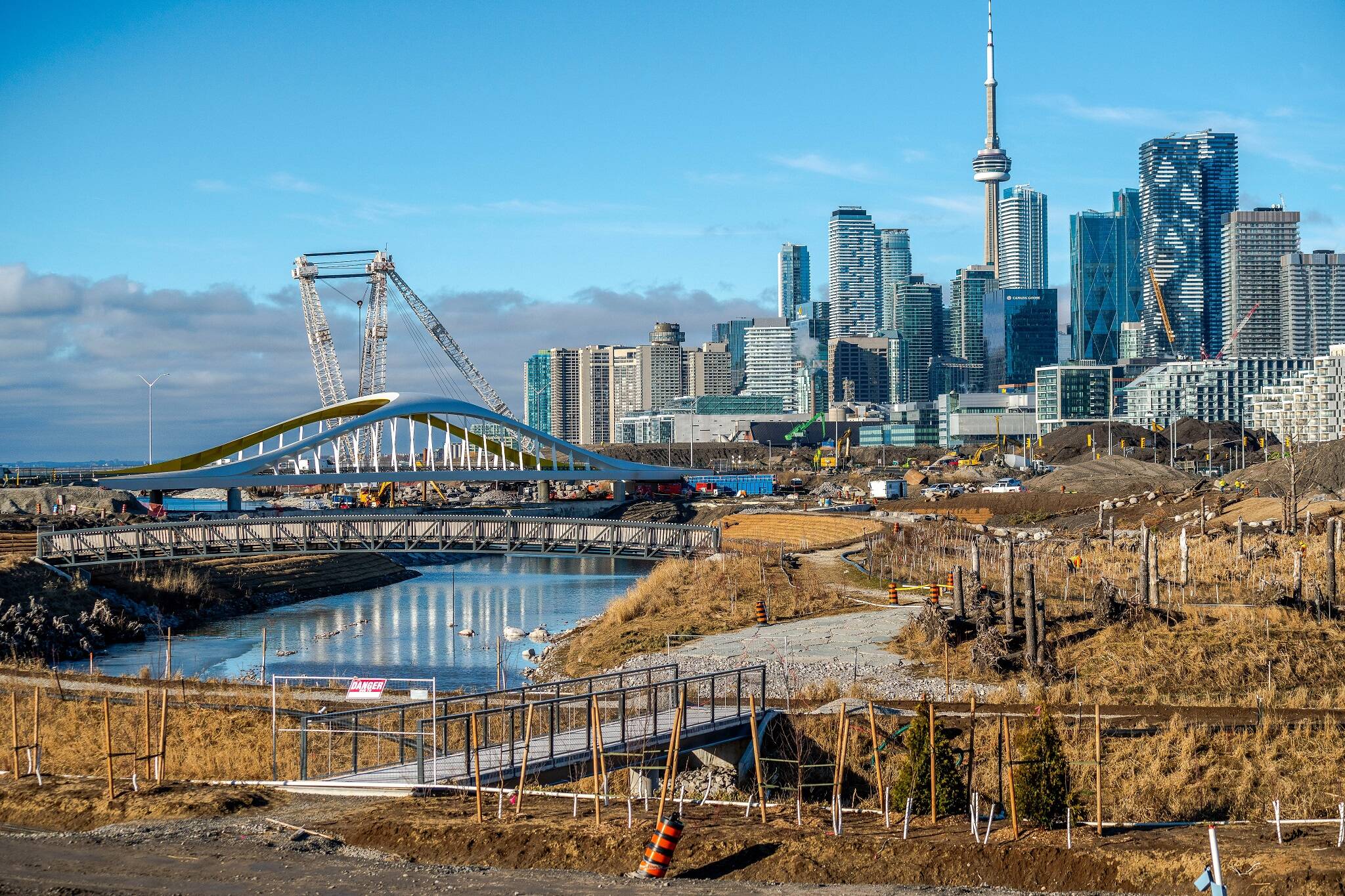
The birth of the waterway's new outflow into Lake Ontario, bypassing the silt-clogged Keating Channel, has, in turn, formed a new artificial island that will serve as the centrepiece of the revitalized Port Lands.
It’s looking wonderful already! Can’t wait until the plantings mature. 🥰
— Robin Richardson she/her 🚲 (@CanadaRobin) February 5, 2024
Known as Villiers Island, this modified landform was largely disconnected from the mainland when water filled the channel over the weekend, with just the soon-to-be-removed plugs and a new network of bridges connecting the island to its surroundings.
Toronto Port Lands river flooding coming along well! pic.twitter.com/42tlG55e5F
— Alex Glista 🇨🇦 (@AlexanderGlista) February 3, 2024
The formerly inhospitable area is now easier to access than ever, all thanks to a new network of bridges and a re-oriented road network. The new Commissioners Street and Cherry Street South bridges spanning the now-flooded waterway offer great vantage points over this astonishing feat of engineering.
For those unable to make the trek down to the Port Lands to witness this moment in history, Waterfront Toronto will be releasing regular updates on the river filling and subsequent plug-pulling for the public to keep tabs on the process.
Latest Videos
Latest Videos
Join the conversation Load comments


