Google Maps in Toronto, the 1858 version
Many of Toronto's most detailed historical maps, the documents that record the city's evolution from a muddy hamlet to a wandering metropolis, are stored in pieces - both physical and digital - in the city archives, sometimes in forms that make them inaccessible to people without special software or the time to visit the facility in person at Spadina and Dupont.
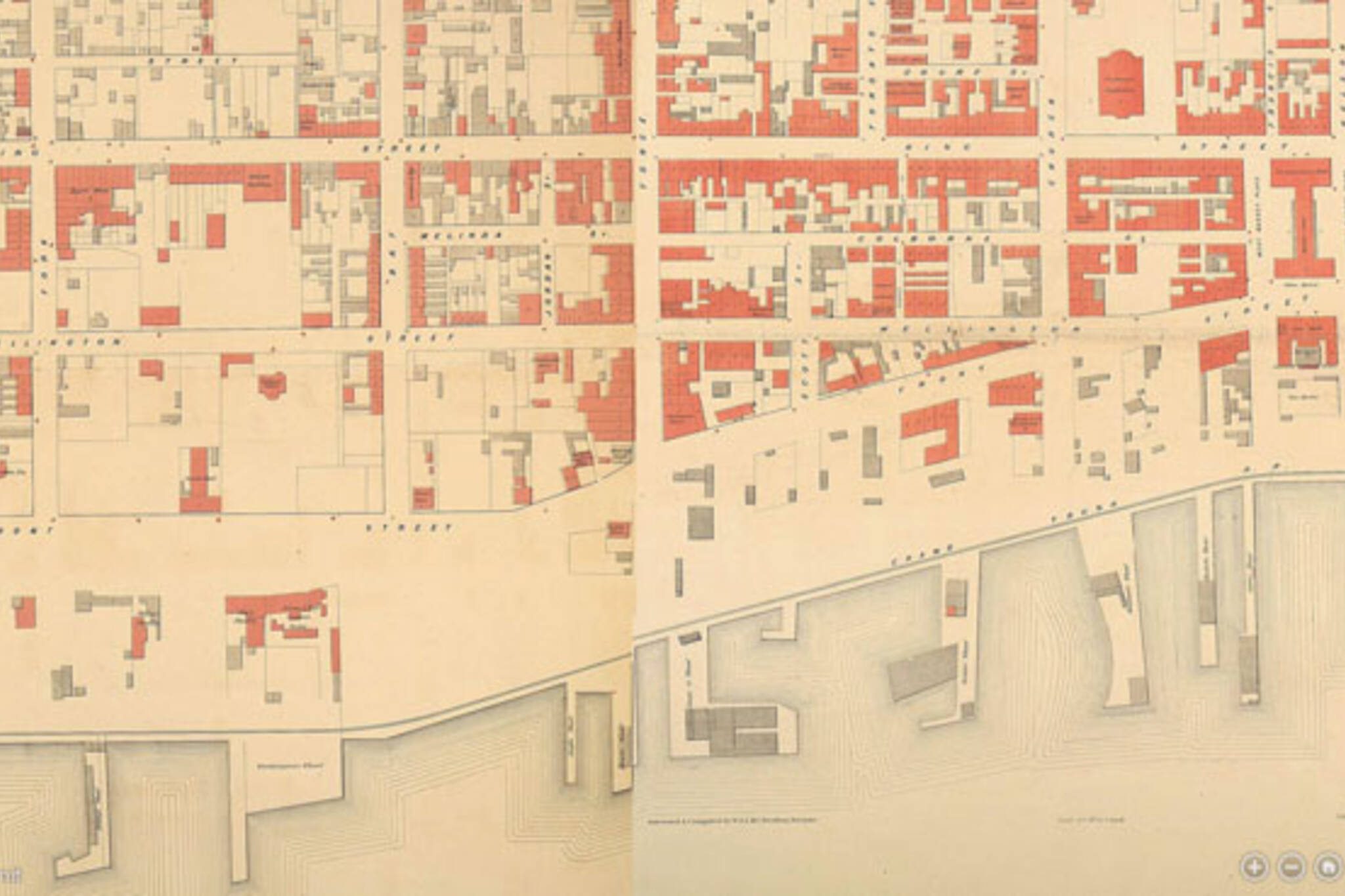
Enter Nathan Ng, Toronto's map hero. His latest project - following on from three comprehensive archives of Toronto maps that collect the earliest sketches by the area's first visitors, plans of Fort York, and detailed insurance plans - brings the separate pieces of a 155-year-old street plan in to the 21st century with the help of some much-needed navigation tools.
"If you had said 'show me Yonge and College,' I'd have no idea which of the plates it is. It's a real pain in the neck," says Ng. "In the modern world, with interfaces like Google Maps and Bing Maps or whatever, you can just scroll and zoom in. So in the back of my mind I thought it would be cool to paste together the 30 plates and put up a little map."
By meticulously stitching together the separate files, sometimes with difficulty, Ng and friend Carrie Martin created a single, giant image with enough detail for virtual aerial exploration of the Toronto of 1858, a drastic step forward for the map's accessibility.
"It actually turned out to be a little more difficult than we thought because a lot of the plates weren't quite oriented the same ... when you actually try and stitch the exact parts together it doesn't match or the angle is slightly different."
Highlights include the scattered lost creeks of old Toronto, the still-disconnected streets that would later be linked to form present day Dundas, University Avenue as "College Park" (giving us the curious lost intersection of College and College,) and a sparse Queen West.
"I like Toronto," continues Ng. "I'm enthusiastic about maps, and this is just one way I like to share the history of Toronto with other people - I hope they find it interesting."
Zoom around and see what you can find. For more background on the project, read here.
Chris Bateman is a staff writer at blogTO. Follow him on Twitter at @chrisbateman.
Image: Toronto Public Library
Latest Videos
Latest Videos
Join the conversation Load comments


