Real time map gives bird's eye view of TTC service
Ever since the TTC made its GPS data available for open source developers, there's been a host of transit apps and real-time maps that have help to reduce the amount of waiting that riders have to do for buses and streetcars. Many of these plot arrival times and show where exactly one's next vehicle is on the streets of Toronto.
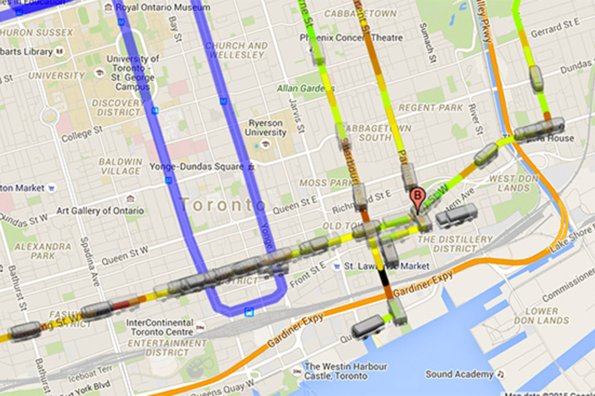
This new map is a bit different in that it offers something of an overview of service conditions in general along a given route you want to take. Using multiple layers on a basic Google map, the TTC Skycam plots out the existing position of buses and streetcars, their position (animated) position over the last 30 minutes, and the relative speed at which they've moved over that same period.
In other words, what this site does particularly well that differs from next vehicle predictors is it gives the rider a sense of possible delays ahead of time and allows him or her to select an alternate route (or at least awareness of how much extra time a trip might make). If there's a downside, it's that the map doesn't yet cover all the TTC surface routes (it's a work in progress).
Creator Daniel Tripp has made an explainer video, which I've embedded below. Perhaps this will help in making your commute just a little less painful.
Latest Videos
Latest Videos
Join the conversation Load comments