Ride the City gets the jump on Google with Toronto launch of interactive cycling maps
Last week's announcement that Google Maps now offers a cycling directions feature was cause for both excitement and disappointment on the part of Toronto's two-wheeled commuters. While the implementation of such a tool initially seemed a timely match for the unseasonably warm and rider-friendly weather, news that it's currently only available in American cities was occasion for a disheartened sigh from cyclists north of the border.
But despite the fact that many have come to rely solely on the mapping prowess of Google, there are a host of other options. Founded in 2008, New York-based upstart Ride the City now offers cycling maps for nine North American cities, including Chicago, Seattle, and, as of last Thursday, Toronto.
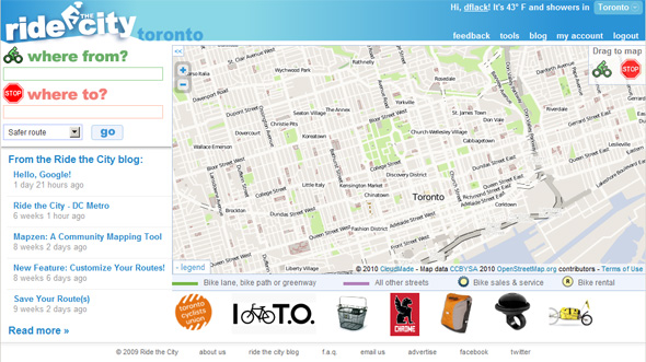
I've spent the last few days testing their Toronto map, and though it's still in beta, I'm pleased to say that it shows considerable promise. While there were plenty of routes I disagreed with, community feedback should ensure that anomalous or less-than-ideal directions are eventually eliminated.
Here's how it works: after a user has punched in his starting and destination points, he can select one of three route-types -- direct, safe and safer. As co-founder Jordan Anderson explains, "the main difference between these three categories involves how far someone's willing to go out of his way for safety."
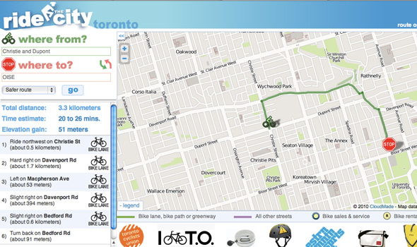
The "safer" routes, as one would figure, put a premium on roads with low traffic and bike lanes at the expense of total trip time/distance. Take, for instance, the above route from Christie and Dupont to OISE (U of T). The "safer option," which takes the rider up to Davenport before heading down Bedford, clearly sacrifices speed for the relative safety of bike lanes.
But what happens if the route suggestion is clearly inaccurate or not as safe as the folks at Ride the City seem to think it is? Well, for now, there's not much that can be done other than to give the route a negative rating. But, in doing so, users can help the company adapt the route suggestions to the needs and opinions of actual riders.
According to Anderson, his company "looks for the person who provided the feedback to suggest an alternate route, or alternate section of the route." And given that "most people do provide this information," the suggestions are bound to improve over time.
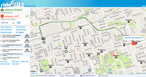
Case in point: I'm not convinced that the above suggestion of using Davenport to get from Christie and Dupont to Bloor and Bedford is optimal. From both a safety and speed standpoint, I tend to think it makes more sense to cross through the Annex to U of T using Barton and other side streets. Not only is such a route less trafficked, but it involves less elevation gain, a factor Anderson says Ride the City tries to take into account when recommending routes.
Should more than a couple people agree with me on this point, Ride the City will consider updating this particular route. So, to a great degree, anecdotal evidence -- often the best kind when it comes to things like bike routes -- will still be taken into account.
Some kinks, however, will need to be worked out sooner rather than later. At the top of this list is the improvement of the application's intersection identification abilities. It sometimes struggles when the user doesn't provide the proper designation of Street, Avenue, Boulevard or Road, resulting in directions to Yonge and Bloor.
Even if this can't immediately be fixed, alternate street suggestions or an error message should come up instead of a completely incorrect route. While it'd be fair to note that the user needs to take responsibility here by punching in the proper info, the point of tools such as this should be to make things as easy as possible.
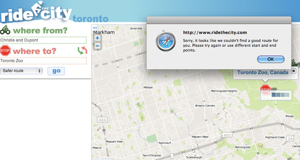
Although I was generally impressed with Ride the City's place-name recognition, a few places further afield also seemed to throw the map for a loop. The Toronto Zoo, for example, shouldn't pose the system any difficulties, but I couldn't get a route suggestion there. And, I also had mixed results entering in TTC stations, which should definitely be in their database.
And lastly, given the importance of rider/user feedback, the "rate this route" option should be far more visible. At present, it's virtually hidden at the bottom of the text directions.
But despite these initial hiccups, the interactive nature of of the application should ensure steady improvement. Who knows? This might just be enough to give Google's cycling maps a run for their money when they finally make it to Canada.
Latest Videos
Latest Videos
Join the conversation Load comments