Mapping Beaches and Beyond
One of the perks of living in a city like Toronto is that, once the warm weather hits, residents have at least a couple beaches to choose from when seeking reprieve from the heat. Health concerns and questionable grey foam aside, nothing quite beats an inoperable air conditioner as much as a quick dip off the city's shores. Of course, in the event that the water's quality is a little too dubious for your liking - or, perhaps everyone's favourite sewage treatment facilities have spewed bacteria onto our sandy shores again - it seems that Google's got you covered.
Starting with version 5.0, the search giant's popular Google Earth application no longer maps just the earth and sky - it's getting its feet wet too, with comprehensive new ocean data as well. But as it turns out, oceans aren't the only bodies of water feeling the love; the Great Lakes - and the shores of Toronto by extension - are all available for exploration as well.
For those unfamiliar with the popular mapping software, Google Earth uses satellite-generated imagery to allow users the ability to travel nearly anywhere of their choosing, both on earth, and amongst the stars. Newly included ocean data means that users can now explore almost every bump and crevice of the planet's major bodies of water - all thanks to collaboration between the NOAA Great Lakes Environmental Research Laboratory (GLERL) and the NOAA National Geophysical Data Center.
Budding Captain Nemo's may delight in the ability to explore some of the oceans' more notable landmarks, but the software's latest update is the sort of feature that, while cool, isn't all that useful for the average user. The great lakes, after all, aren't quite as dramatic beneath the surface as some of the earth's deepest trenches and reefs. Yet, it's the sort of data that will surely come in handy for the likes of sailors, scientists and students.
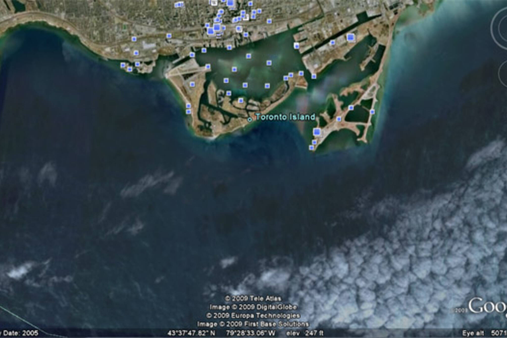
Of course, the software has its quirks; some of the data, for example, is considerably outdated compared to some of its landlocked counterparts. It's a quirk that isn't necessarily Google's fault, but of those who supply the data to the software's engineers. Toronto's coast, pictured in the screenshot above, hasn't been updated since 2005, for example - so forget using Earth to find those glasses you accidently dropped off the island ferry last summer.
Really, it's a neat addition to Google's already vast array of maps, and means that around 22% of the world's fresh water is now available for exploration. But more importantly, when summer arrives, and beach closures hit, it means I'm now only a few clicks away from exploring Toronto's shores.
And without the nasty sunburn, too.
Originally via TechCrunch. What do you think of the ability to explore the depths of The Great Lakes, in addition to the rest of the world's oceans?
Latest Videos
Latest Videos
Join the conversation Load comments