New hexagon maps offer a different view of Toronto
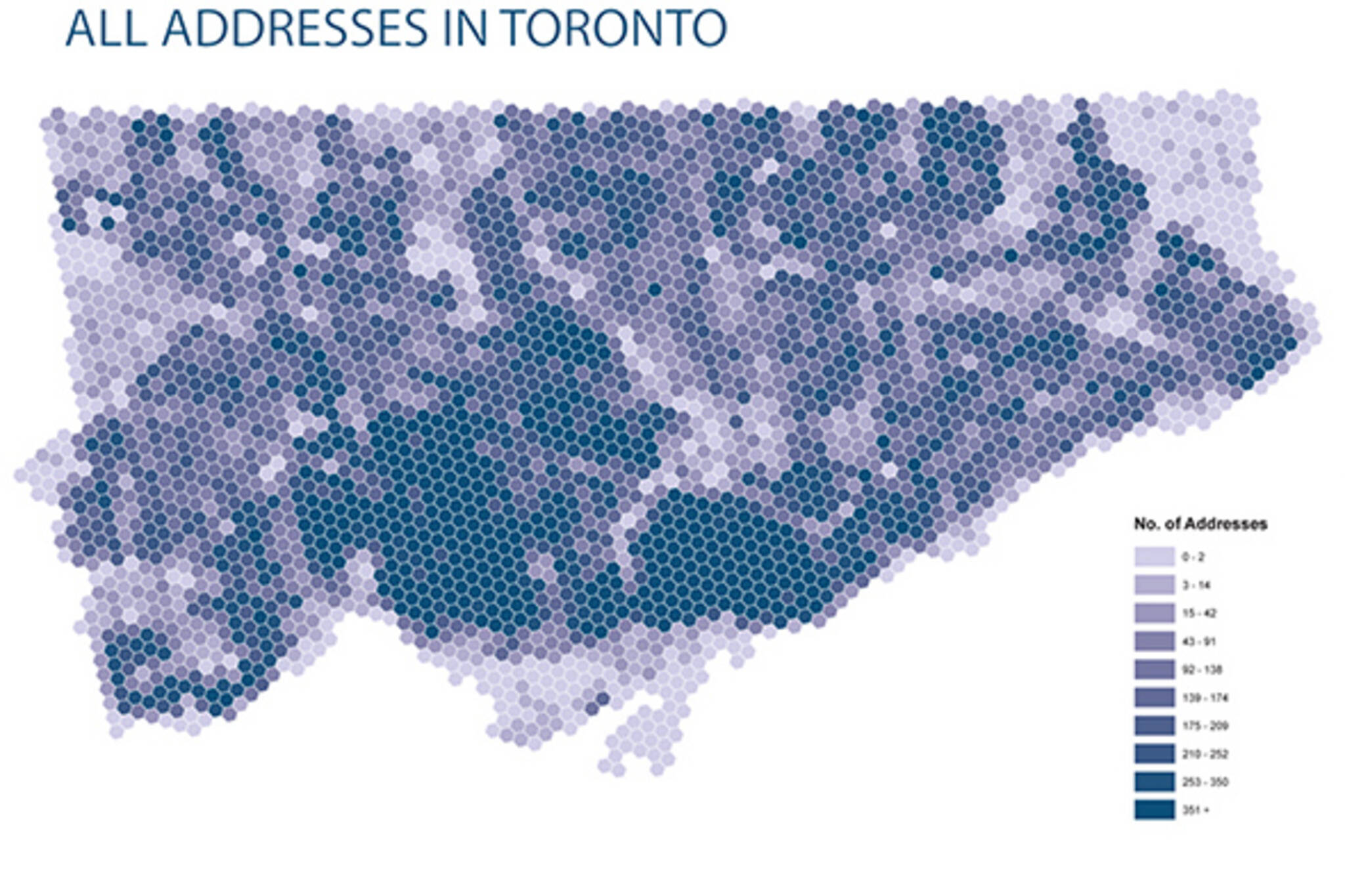
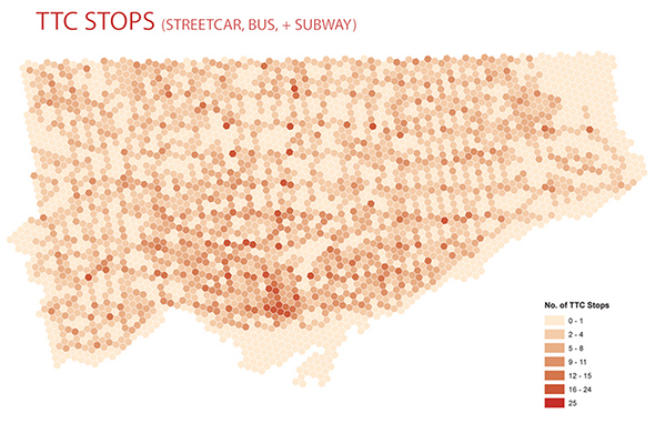
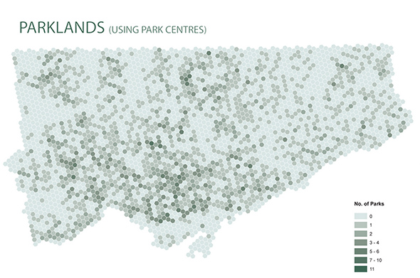
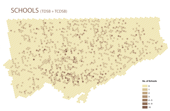
Toronto mapmaking wizard William Davis is back at it with a new series that offers a different way of looking at Toronto than via our typical ward or neighbourhood boundaries. Using hexagonal points to represent geographic distribution, the maps plot urban elements like addresses, TTC stops, schools, and parkland.
They're slick-looking from a design standpoint, but the holistic approach here might also prove a useful way to examine demographics and to plot out statistics without confining information to territories or boundaries. These maps only hint at such a possibility, but they're also fascinating in their own right if only because even the distribution patterns can be surprising.
The northerly hubs of TTC stops at top centre for one, but also the way in which our ravine system reduces the concentration of buildings/addresses across the city). Have a look at the maps, and let us know what interesting bits of information you spot.
Latest Videos
Latest Videos
Join the conversation Load comments