Saturday, May 26, 2012Mostly Cloudy 20°C
City

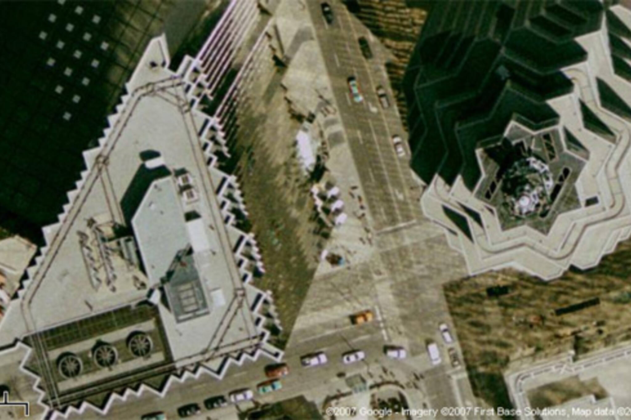
High-res satellite imagery comes to T.O.

Posted by Tatiana / June 15, 2007

20070615_gmfrontandbay.jpg
If you liked Google Maps before, you're gonna love them now! A few days ago Google Maps got a tremendous satellite imagery update which happens to include Toronto. Exciting news for this poster: I've long used the satellite view to scout out cycling shortcuts that bypass busy roads and estimate lane width on unfamiliar streets, and the new stunning resolution of 50 cm per pixel will make that job much easier.

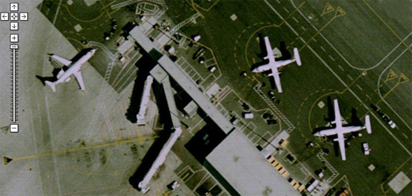
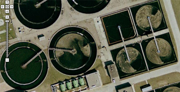
After the jump are some images that demonstrate the awesomeness of the new maps: bits of High Park, Pearson Airport, and mysterious circles near the Humber and the Lakeshore which look suspiciously like an alien-breeding facility.
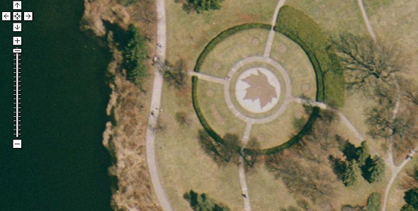
20070615_gmhighpark.jpg

20070615_gmpearson.jpg

20070615_gmalien.jpg

Images: by Google

Discussion

16 Comments

Steve M / June 15, 2007 at 08:29 pm
user-pic
First of all... Finally!!!

I have been waiting for an update and closer images for a long time. The last images were from so long ago they still showed Tent City in the Portlands.

Second, does anyone have any idea when these were taken? Based on the shadows I would guess sometime in the autumn. I would also say it's likely in the morning as well. And perhaps on weekend (no cars in the parking lot at my office). But what year?
Andy / June 15, 2007 at 09:38 pm
user-pic
I'd guess it was fall 2005 in the late morning. The ROM has just the steel structure (which was finished July 2005) and none of the roof, and the trees have no leaves. Varsity stadium doesn't have any of the new seating either.
Stephanie / June 15, 2007 at 09:49 pm
user-pic
Make that late morning on a Sunday - you can see people going to church in several locations, including the one tucked into the Eaton Centre, where you wouldn't often see people at that hour otherwise. I'd guess early spring rather than fall - I didn't notice areas of fallen leaves on the ground. Plus in fall the parking lot of the Royal Conservatory of Music had been closed down.
Rick Mason / June 15, 2007 at 10:02 pm
user-pic
I'm going to guess that it was Sunday, Oct. 16th 2005, based on what every one else has noticed plus what I'm seeing. On my side street we have to switch the side of the street that you park on at the 1st and 16th of each month from spring to fall. And on my street there are an equal number of cars parked on both sides. This only happens when the parking switches.
Steve M / June 15, 2007 at 10:09 pm
user-pic
Good spot on the Sunday Church goers...

Jerrold / June 15, 2007 at 10:23 pm
user-pic
blogTO's Morning Brew Crossroads puzzles are going to be even more fun now!!! :)
Steve M / June 15, 2007 at 10:43 pm
user-pic
Now that I think about it, it's hard to say what day of the week this was taken on. I am sure that some part might have been on a Sunday given the empty parking lots and the church goers but, I just looked at my Mother-in-law's place in North York and it was definitely taken on a Tuesday because the recycling bins and garbage are out on the side walk.

Neat when you think about it. The image is presented as an organic whole but is really a collage of Toronto over a period of time (a few days? a week? a month?). It would be cool if Google would post the dates the pictures were taken.
Piero / June 15, 2007 at 11:07 pm
user-pic
It's even a better experience on google earth!
Peter / June 16, 2007 at 08:25 am
user-pic
For those that don't know about this already, it is possible to zoom in even closer than the +- scale allows you to. On the Google satellite images click on the "link to this page", which appears just above the image on the right. A long link will show up in the address bar. Near the end of the link you will find "z=19". 19 is the "zoom factor" change this to 20 and zoom you will. In some areas (not Toronto) you can zoom in as far as 23.
ryan c / June 16, 2007 at 10:52 am
user-pic
If we ever get Google Streetview, I'll freak out.
Kari / June 16, 2007 at 11:09 am
user-pic
This is effin' awesome. Thanks for letting me know!
Phil / June 16, 2007 at 11:20 am
user-pic
Also on high-res: Fort Saskatchewan, Alberta, population 14,686 (but not Edmonton) and Nanaimo BC, pop 79000 (but not Vancouver).
iaresee / June 16, 2007 at 11:51 pm
user-pic
cool.

i think the circles near humber and lakeshore are sewage treatment pits. they sift the solids out and send the clean water back into the lake.
miles / June 17, 2007 at 09:57 am
user-pic
Cafes and restaurants have their patios out, isn't there a date when they're allowed to start doing that?
Tom Slade / June 17, 2007 at 01:34 pm
user-pic
Very cool. I was using Google Maps a few days ago and thought the side perspective of the buildings was a new thing, thanks for the explanation.
Jayme / June 17, 2007 at 03:46 pm
user-pic
I don't think the satellite images could have been taken in Fall of 2005 because in the images, the Trinity Square Labyrinth is still cut in the grass (instead of the current brick labyrinth).

The brick labyrinth was constructed during the summer of 2005 and opened that September.

Fall of 2004, perhaps?

Add a Comment

Other Cities: VancouverMontreal