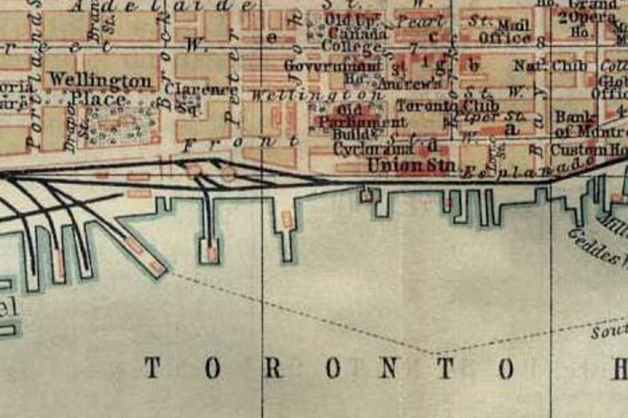
What Toronto Looked Like 100 Years Ago
I'll admit that I am a map nerd (and not the only one at blogTO). All maps - transit maps, geological maps, those maps that show man-made light across the globe, all give me a little shiver. Google Earth changed my life and I can look at an old atlas for hours (and, somehow, I have a girlfriend).
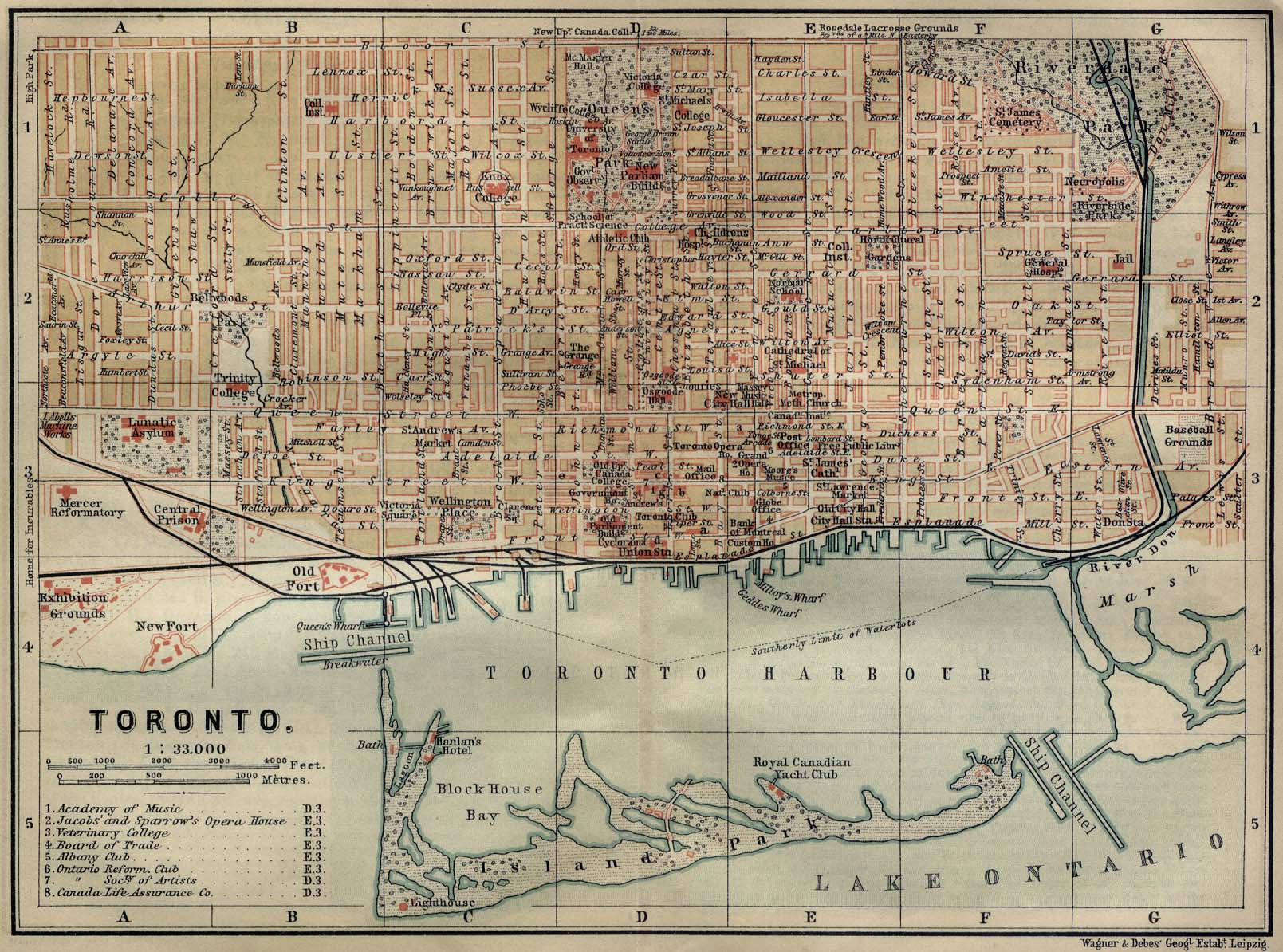
You can image my happiness when I came across the above image from The Infonaut Blog - a map of what Toronto looked like over a century ago from the University of Texas maps archive. If you're anything like me, you'll be spending way too much time looking at this glimpse into how our city evolved (and how "lunatic asylum" was once an acceptable term).
Turns out I live close to what was our Central Prison and down the road from the "Home for the Incurables" - seriously fascinating!
Check out the enlarged map here.
Latest Videos
Latest Videos
Join the conversation Load comments


